Sehakhala
Sehakhala is a village and a gram panchayat in Chanditala I community development block in Srirampore subdivision of Hooghly district in the state of West Bengal, India. It is under Chanditala police station.[1]
Sheakhala Shiyakhala,Shihakhala | |
|---|---|
Village | |
 Sheakhala Location in West Bengal, India  Sheakhala Sheakhala (India) | |
| Coordinates: 22.7677229°N 88.1743169°E | |
| Country | |
| State | West Bengal |
| District | Hooghly |
| Founded by | Narayan Sen |
| Government | |
| • Body | Gram panchayat |
| Population (2011) | |
| • Total | 6,434 |
| Languages | |
| • Official | Bengali, English |
| Time zone | UTC+5:30 (IST) |
| Telephone code | 03212 |
| ISO 3166 code | IN-WB |
| Vehicle registration | WB |
| Lok Sabha constituency | Serampore |
| Vidhan Sabha constituency | Chanditala |
| Website | wb |
Geography
Sehakhala is located at 22.7677229°N 88.1743169°E.
Gram panchayat
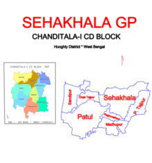
Villages in Shiakhala gram panchayat are: Chak Tajpur, Madhupur, Paschim Tajpur, Patul, Raghunathpur, Sandhipur and Sehakhala.[2]
Demographics
As per 2011 Census of India Sehakhala had a total population of 6,434 of which 3,253 (51%) were males and 3,181 (49%) were females. Population below 6 years was 542. The total number of literates in Sehakhela was 4,955 (84.10% of the population over 6 years).[3]
Transport
Railway
The nearest Railway station, Baruipara railway station, is on the Howrah-Bardhaman chord line, which is a part of the Kolkata Suburban Railway system.[4][5]
Road
State Highway 15 (Ahilyabai Holkar Road) and 31 Number Road crossing point is located in the village. 31 Number Road is the main artery of the town and it is also connected with National Highway 19 (Bora), State Highway 13 (Milki Badamtala) and State Highway 6/ G.T. Road (Nabagram).[5]
Bus
Private Bus
- 26 Bonhooghly – Champadanga
- 31 Serampore - Jangipara
Bus Routes without Numbers
- Howrah Station - Bandar (Dhanyaghori)
Education
- Sheakhala Benimadhab High School
- Sheakhala Benimadhab Girls High School
References
- "Mouza Information". Land & Land Reforms Department, Government of West Bengal. Archived from the original on 22 December 2016.
- "Sehakhala". Indian Village Directory. Retrieved 12 October 2018.
- "C.D. Block Wise Primary Census Abstract Data(PCA)". 2011 census: West Bengal – District-wise CD Blocks. Registrar General and Census Commissioner, India. Retrieved 7 October 2018.
- "36811 Howrah Bardhaman Local (via Chord)". indiarailinfo. Retrieved 6 October 2018.
- Google maps
Cities, towns and locations in Srirampore subdivision | |||||||||||
|---|---|---|---|---|---|---|---|---|---|---|---|
| Cities, municipal, census towns and Villages |
| ||||||||||