Manirampur
Manirampur is a census town in Chanditala I CD Block in Srirampore subdivision of Hooghly district in the state of West Bengal, India.[1]
Manirampur | |
|---|---|
Census Town | |
 Raksha kali Temple, Monirampur | |
 Manirampur Location in West Bengal, India  Manirampur Manirampur (India) | |
| Coordinates: 22.7456608°N 88.2288799°E | |
| Country | |
| State | West Bengal |
| District | Hooghly |
| Nearest City | Serampore |
| Population (2011) | |
| • Total | 7,428 |
| Languages | |
| • Official | Bengali, English |
| Time zone | UTC+5:30 (IST) |
| PIN | 712306 |
| Vehicle registration | WB |
| Lok Sabha constituency | Serampore |
| Vidhan Sabha constituency | Chanditala |
| Website | wb |
Geography

 |
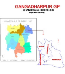
| Cities and towns in Chanditala I, Chanditala II and Jangipara CD Blocks in Srirampore subdivision in Hooghly district M: municipal city/ town, CT: census town, R: rural/ urban centre, Owing to space constraints in the small map, the actual locations in a larger map may vary slightly |
Location
Manirampur is located at: 22°44′44″N 88°13′44″E [2]
Gangadharpur, Manirampur, Masat, Jangalpara, Dudhkalmi, Nababpur, Bhagabatipur, Kumirmora and Ramanathpur form a cluster of census towns in Chanditala I CD Block.[3]
Urbanisation
Srirampore subdivision is the most urbanized of the subdivisions in Hooghly district. 73.13% of the population in the subdivision is urban and 26.88% is rural. The subdivision has 6 municipalities and 34 census towns. The municipalities are: Uttarpara Kotrung Municipality, Konnagar Municipality, Serampore Municipality, Baidyabati Municipality, Rishra Municipality and Dankuni Municipality. Amongst the CD Blocks in the subdivision, Uttarapara Serampore (census towns shown in a separate map) had 76% urban population, Chanditala I 42%, Chanditala II 69% and Jangipara 7% (census towns shown in the map above).[4][5]All places marked in the map are linked in the larger full screen map.
Gram panchayat

Villages and census towns in Gangadharpur gram panchayat are: Bankrishnapur, Gangadharpur, Malipukur and Manirampur.[6]
Market: Ganngadharpur Bazar, Hajaghata, Manirampur.
Demographics
As per 2011 Census of India Manirampur had a total population of 7,428 of which 3,706 (50%) were males and 3,722 (50%) were females. Population below 6 years was 679. The total number of literates in Manirampur was 5,381 (79.73% of the population over 6 years). [5]
Dankuni Urban Agglomeration
As per the 2011 census, Dankuni Urban Agglomeration includes: Dankuni (M), Purba Tajpur (CT), Kharsarai (CT), Begampur (CT), Chikrand (CT), Pairagachha (CT), Barijhati (CT), Garalgachha (CT), Krishnapur (CT), Baruipara (CT), Borai (CT), Nawapara (CT), Basai (CT), Gangadharpur (CT), Manirampur (CT), Janai (CT), Kapashanria (CT), Jaykrishnapur (CT), Tisa (CT), Baksa (CT), Panchghara (CT) and Naiti (CT).[7]
Transport
Baruipara railway station is the nearest railway station on Howrah-Bardhaman chord line, which is a part of the Kolkata Suburban Railway system.[8][9]
References
- "Hugli district census handbook" (PDF). Retrieved 27 February 2016.
- "banglarbhumi.gov.in". WEST BENGAL ->HUGLI(হুগলী) ->CHANDITALA - I(চণ্ডীতলা-১) Mouza Information. Archived from the original on 22 December 2016. Retrieved 11 April 2016.
- "Census of India 2011, West Bengal: District Census Handbook, Hooghly" (PDF). Map of Chanditala I CD Block, page 649. Directorate of Census Operations, West Bengal. Retrieved 4 October 2018.
- "District Statistical Handbook 2014 Hooghly". Table 2.2, 2.4(a). Department of Statistics and Programme Implementation, Government of West Bengal. Archived from the original on 21 January 2019. Retrieved 3 October 2018.
- "C.D. Block Wise Primary Census Abstract Data(PCA)". 2011 census: West Bengal – District-wise CD Blocks. Registrar General and Census Commissioner, India. Retrieved 3 October 2018.
- "Bankrishnapur". Indian Village Directory. Retrieved 12 October 2018.
- "Constituents of urban Agglomerations Having Population 1 Lakh & above" (PDF). Provisional Population Totals, Census of India 2011. Retrieved 20 October 2018.
- "36811 Howrah Bardhaman Local (via Chord)". indiarailinfo. Retrieved 6 October 2018.
- Google maps
Cities, towns and locations in Srirampore subdivision | |||||||||||
|---|---|---|---|---|---|---|---|---|---|---|---|
| Cities, municipal, census towns and Villages |
| ||||||||||