Saint-Maur, Cher
Saint-Maur is a commune in the Cher department in the Centre-Val de Loire region of France.
Saint-Maur | |
|---|---|
.jpg) The church in Saint-Maur | |
Location of Saint-Maur 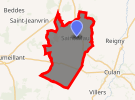
| |
 Saint-Maur  Saint-Maur | |
| Coordinates: 46°34′51″N 2°17′58″E | |
| Country | France |
| Region | Centre-Val de Loire |
| Department | Cher |
| Arrondissement | Saint-Amand-Montrond |
| Canton | Châteaumeillant |
| Government | |
| • Mayor (2008–2014) | Patrick Couzadet |
| Area 1 | 25.62 km2 (9.89 sq mi) |
| Population (2017-01-01)[1] | 295 |
| • Density | 12/km2 (30/sq mi) |
| Time zone | UTC+01:00 (CET) |
| • Summer (DST) | UTC+02:00 (CEST) |
| INSEE/Postal code | 18225 /18270 |
| Elevation | 224–321 m (735–1,053 ft) (avg. 273 m or 896 ft) |
| 1 French Land Register data, which excludes lakes, ponds, glaciers > 1 km2 (0.386 sq mi or 247 acres) and river estuaries. | |
Geography
A farming area comprising the village and four hamlets situated by the banks of the small river Portefeuille, about 38 miles (61 km) south of Bourges at the junction of the D62 with the D65 and the D127 roads.
Population
| Historical population | ||
|---|---|---|
| Year | Pop. | ±% |
| 1962 | 384 | — |
| 1968 | 445 | +15.9% |
| 1975 | 396 | −11.0% |
| 1982 | 329 | −16.9% |
| 1990 | 287 | −12.8% |
| 1999 | 295 | +2.8% |
| 2008 | 274 | −7.1% |
Sights
- The church of St. Maur, dating from the thirteenth century.
- Two fifteenth-century castles, Mazères and Grande Besse.
- A dolmen, known as the "Pierre des Fées" (fairy stone).
See also
References
- "Populations légales 2017". INSEE. Retrieved 6 January 2020.
External links
| Wikimedia Commons has media related to Saint-Maur (Cher). |
- Annuaire Mairie website (in French)
| Authority control |
|---|
This article is issued from Wikipedia. The text is licensed under Creative Commons - Attribution - Sharealike. Additional terms may apply for the media files.