Graçay
Graçay is a commune in the Cher department in the Centre-Val de Loire region of France.
Graçay | |
|---|---|
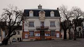 Town hall | |
.svg.png) Coat of arms | |
Location of Graçay 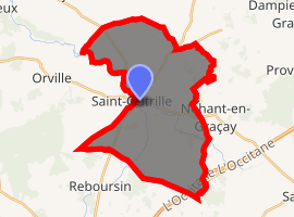
| |
 Graçay  Graçay | |
| Coordinates: 47°08′37″N 1°50′51″E | |
| Country | France |
| Region | Centre-Val de Loire |
| Department | Cher |
| Arrondissement | Vierzon |
| Canton | Vierzon-2 |
| Intercommunality | CC Vierzon-Sologne-Berry et Villages de la Forêt |
| Government | |
| • Mayor (2008–2014) | Jean-Pierre Charles |
| Area 1 | 31.82 km2 (12.29 sq mi) |
| Population (2017-01-01)[1] | 1,447 |
| • Density | 45/km2 (120/sq mi) |
| Time zone | UTC+01:00 (CET) |
| • Summer (DST) | UTC+02:00 (CEST) |
| INSEE/Postal code | 18103 /18310 |
| Elevation | 97–164 m (318–538 ft) (avg. 111 m or 364 ft) |
| 1 French Land Register data, which excludes lakes, ponds, glaciers > 1 km2 (0.386 sq mi or 247 acres) and river estuaries. | |
Geography
It is a farming area comprising the small town and several hamlets, on the right bank of the Fouzon river, situated some 12 miles (19 km) southwest of Vierzon at the junction of the D68, D19, D83 and D922 roads. Junction 9 of the A20 autoroute lies within the territory of the commune
Population
| Historical population | ||
|---|---|---|
| Year | Pop. | ±% |
| 1962 | 1,889 | — |
| 1968 | 2,043 | +8.2% |
| 1975 | 2,019 | −1.2% |
| 1982 | 1,844 | −8.7% |
| 1990 | 1,559 | −15.5% |
| 1999 | 1,562 | +0.2% |
| 2008 | 1,557 | −0.3% |
Sights
- The church of St. Martin, dating from the twelfth century.
- The church of Notre-Dame, dating from the nineteenth century.
- A dolmen known as the “Pierre Levée" or "Grosse Pierre" .
- Remains of medieval ramparts.
- The sixteenth-century chateau of Coulon.
See also
References
- "Populations légales 2017". INSEE. Retrieved 6 January 2020.
External links
| Wikimedia Commons has media related to Graçay. |
- Official town website (in French)
| Authority control |
|
|---|
This article is issued from Wikipedia. The text is licensed under Creative Commons - Attribution - Sharealike. Additional terms may apply for the media files.