Moulins-sur-Yèvre
Moulins-sur-Yèvre is a commune in the Cher department in the Centre-Val de Loire region of France.
Moulins-sur-Yèvre | |
|---|---|
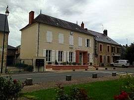 Mairie of Moulins-sur-Yèvre | |
Location of Moulins-sur-Yèvre 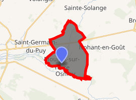
| |
 Moulins-sur-Yèvre  Moulins-sur-Yèvre | |
| Coordinates: 47°05′01″N 2°31′05″E | |
| Country | France |
| Region | Centre-Val de Loire |
| Department | Cher |
| Arrondissement | Bourges |
| Canton | Avord |
| Intercommunality | CC Terres du Haut Berry |
| Government | |
| • Mayor (2008–2014) | Jean-Paul Berger |
| Area 1 | 15.33 km2 (5.92 sq mi) |
| Population (2017-01-01)[1] | 852 |
| • Density | 56/km2 (140/sq mi) |
| Time zone | UTC+01:00 (CET) |
| • Summer (DST) | UTC+02:00 (CEST) |
| INSEE/Postal code | 18158 /18390 |
| Elevation | 132–172 m (433–564 ft) (avg. 140 m or 460 ft) |
| 1 French Land Register data, which excludes lakes, ponds, glaciers > 1 km2 (0.386 sq mi or 247 acres) and river estuaries. | |
Geography
A farming area comprising the village and several hamlets situated by the banks of the river Yèvre, some 6 miles (9.7 km) east of Bourges, at the junction of the D46 with the N151 and the D156 roads.
Population
| Historical population | ||
|---|---|---|
| Year | Pop. | ±% |
| 1962 | 407 | — |
| 1968 | 445 | +9.3% |
| 1975 | 421 | −5.4% |
| 1982 | 369 | −12.4% |
| 1990 | 382 | +3.5% |
| 1999 | 466 | +22.0% |
| 2008 | 601 | +29.0% |
Sights
- The church of St. Austrégésile, dating from the twelfth century.
- The chateau of Moulins.
- The fifteenth-century chateau of Maubranches.
- The chapel of Notre-Dame at Liesse, rebuilt in 1872.
See also
References
- "Populations légales 2017". INSEE. Retrieved 6 January 2020.
External links
| Wikimedia Commons has media related to Moulins-sur-Yèvre. |
- Postcard photos of the commune (in French)
| Authority control |
|
|---|
This article is issued from Wikipedia. The text is licensed under Creative Commons - Attribution - Sharealike. Additional terms may apply for the media files.