Arçay, Cher
Arçay is a commune in the Cher department in the Centre-Val de Loire region of France.
Arçay | |
|---|---|
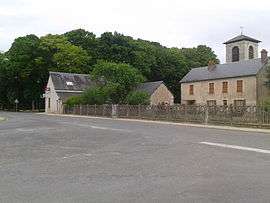 The main square in Arçay | |
Location of Arçay 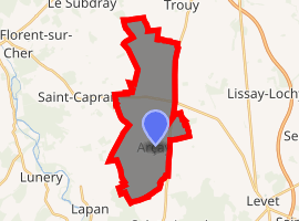
| |
 Arçay  Arçay | |
| Coordinates: 46°56′57″N 2°20′28″E | |
| Country | France |
| Region | Centre-Val de Loire |
| Department | Cher |
| Arrondissement | Bourges |
| Canton | Trouy |
| Intercommunality | Bourges Plus |
| Government | |
| • Mayor (2014-2020) | Robert Huchins |
| Area 1 | 18.32 km2 (7.07 sq mi) |
| Population (2017-01-01)[1] | 510 |
| • Density | 28/km2 (72/sq mi) |
| Time zone | UTC+01:00 (CET) |
| • Summer (DST) | UTC+02:00 (CEST) |
| INSEE/Postal code | 18008 /18340 |
| Elevation | 145–174 m (476–571 ft) |
| 1 French Land Register data, which excludes lakes, ponds, glaciers > 1 km2 (0.386 sq mi or 247 acres) and river estuaries. | |
Geography
A farming area comprising the village and several hamlets situated some 12 miles (19 km) south of Bourges at the junction of the D88, D28 and the D73 roads.
Population
| Historical population | ||
|---|---|---|
| Year | Pop. | ±% |
| 2004 | 420 | — |
| 2006 | 458 | +9.0% |
| 2007 | 476 | +3.9% |
| 2008 | 495 | +4.0% |
| 2009 | 513 | +3.6% |
| 2010 | 533 | +3.9% |
| 2011 | 539 | +1.1% |
| 2012 | 529 | −1.9% |
| 2013 | 520 | −1.7% |
| 2014 | 510 | −1.9% |
| 2015 | 516 | +1.2% |
| 2016 | 515 | −0.2% |
The inhabitants are called Arcéens or Arcéennes.
Places of interest
- The church of St.Sulpice, dating from the nineteenth century.
- The nineteenth-century château Belair.
See also
References
- "Populations légales 2017". INSEE. Retrieved 6 January 2020.
External links
| Wikimedia Commons has media related to Arçay (Cher). |
- Arçay on the Quid website (in French)
This article is issued from Wikipedia. The text is licensed under Creative Commons - Attribution - Sharealike. Additional terms may apply for the media files.