Léré, Cher
Léré is a commune in the Cher department in the Centre-Val de Loire region of France.
Léré | |
|---|---|
 The collegiate church of Saint-Martin, in Léré | |
.svg.png) Coat of arms | |
Location of Léré 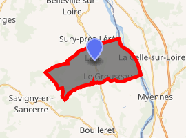
| |
 Léré  Léré | |
| Coordinates: 47°28′15″N 2°52′26″E | |
| Country | France |
| Region | Centre-Val de Loire |
| Department | Cher |
| Arrondissement | Bourges |
| Canton | Sancerre |
| Intercommunality | CC Pays Fort Sancerrois Val de Loire |
| Government | |
| • Mayor (2008–2014) | Patrice de Lamerville |
| Area 1 | 15.98 km2 (6.17 sq mi) |
| Population (2017-01-01)[1] | 1,098 |
| • Density | 69/km2 (180/sq mi) |
| Time zone | UTC+01:00 (CET) |
| • Summer (DST) | UTC+02:00 (CEST) |
| INSEE/Postal code | 18125 /18240 |
| Elevation | 132–198 m (433–650 ft) |
| 1 French Land Register data, which excludes lakes, ponds, glaciers > 1 km2 (0.386 sq mi or 247 acres) and river estuaries. | |
Geography
A farming area comprising a very small town and several hamlets situated by the banks of the Loire lateral canal in the valley of the river Loire, some 35 miles (56 km) northeast of Bourges, at the junction of the D951, D751 and the D42 roads.
Population
| Historical population | ||
|---|---|---|
| Year | Pop. | ±% |
| 1962 | 923 | — |
| 1968 | 923 | +0.0% |
| 1975 | 880 | −4.7% |
| 1982 | 925 | +5.1% |
| 1990 | 1,161 | +25.5% |
| 1999 | 1,296 | +11.6% |
| 2008 | 1,217 | −6.1% |
Sights
- The church of St. Martin, dating from the fourteenth century.
- A fifteenth-century manorhouse.
- The chateau of Villate, dating from the fifteenth century.
See also
References
- "Populations légales 2017". INSEE. Retrieved 6 January 2020.
| Wikimedia Commons has media related to Léré (Cher). |
| Authority control |
|---|
This article is issued from Wikipedia. The text is licensed under Creative Commons - Attribution - Sharealike. Additional terms may apply for the media files.