Menetou-Râtel
Menetou-Râtel is a commune in the Cher department in the Centre-Val de Loire region of France.
Menetou-Râtel | |
|---|---|
Location of Menetou-Râtel 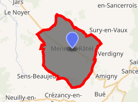
| |
 Menetou-Râtel  Menetou-Râtel | |
| Coordinates: 47°21′07″N 2°45′24″E | |
| Country | France |
| Region | Centre-Val de Loire |
| Department | Cher |
| Arrondissement | Bourges |
| Canton | Sancerre |
| Intercommunality | CC Pays Fort Sancerrois Val de Loire |
| Government | |
| • Mayor (2008–2014) | Michel Desreaux |
| Area 1 | 28.01 km2 (10.81 sq mi) |
| Population (2017-01-01)[1] | 484 |
| • Density | 17/km2 (45/sq mi) |
| Time zone | UTC+01:00 (CET) |
| • Summer (DST) | UTC+02:00 (CEST) |
| INSEE/Postal code | 18144 /18300 |
| Elevation | 242–377 m (794–1,237 ft) (avg. 311 m or 1,020 ft) |
| 1 French Land Register data, which excludes lakes, ponds, glaciers > 1 km2 (0.386 sq mi or 247 acres) and river estuaries. | |
Geography
A winegrowing and farming area comprising the village and several hamlets situated some 26 miles (42 km) northeast of Bourges, at the junction of the D85, D86 and the D923 roads. The commune is one of only a few that can grow grapes for Sancerre AOC wine.
Population
| Historical population | ||
|---|---|---|
| Year | Pop. | ±% |
| 1962 | 547 | — |
| 1968 | 594 | +8.6% |
| 1975 | 526 | −11.4% |
| 1982 | 506 | −3.8% |
| 1990 | 483 | −4.5% |
| 1999 | 480 | −0.6% |
| 2008 | 488 | +1.7% |
Sights
See also
References
- "Populations légales 2017". INSEE. Retrieved 6 January 2020.
External links
| Wikimedia Commons has media related to Menetou-Râtel. |
- Menetou-Râtel on the Quid website (in French)
| Authority control |
|
|---|
This article is issued from Wikipedia. The text is licensed under Creative Commons - Attribution - Sharealike. Additional terms may apply for the media files.