Jalognes
Jalognes is a commune in the Cher department in the Centre-Val de Loire region of France.
Jalognes | |
|---|---|
Location of Jalognes 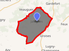
| |
 Jalognes  Jalognes | |
| Coordinates: 47°14′12″N 2°47′11″E | |
| Country | France |
| Region | Centre-Val de Loire |
| Department | Cher |
| Arrondissement | Bourges |
| Canton | Sancerre |
| Intercommunality | CC Pays Fort Sancerrois Val de Loire |
| Government | |
| • Mayor (2008–2014) | Patrick Léger |
| Area 1 | 28.09 km2 (10.85 sq mi) |
| Population (2017-01-01)[1] | 292 |
| • Density | 10/km2 (27/sq mi) |
| Time zone | UTC+01:00 (CET) |
| • Summer (DST) | UTC+02:00 (CEST) |
| INSEE/Postal code | 18116 /18300 |
| Elevation | 172–239 m (564–784 ft) (avg. 202 m or 663 ft) |
| 1 French Land Register data, which excludes lakes, ponds, glaciers > 1 km2 (0.386 sq mi or 247 acres) and river estuaries. | |
Geography
A farming area, comprising the village and four hamlets situated by the banks of the river Bennelle, some 23 miles (37 km) northeast of Bourges, at the junction of the D10, D49 and the D52 roads. The river Chantraine flows through the commune's southern territory.
Population
| Historical population | ||
|---|---|---|
| Year | Pop. | ±% |
| 1962 | 388 | — |
| 1968 | 423 | +9.0% |
| 1975 | 354 | −16.3% |
| 1982 | 295 | −16.7% |
| 1990 | 271 | −8.1% |
| 1999 | 285 | +5.2% |
| 2008 | 296 | +3.9% |
Sights
See also
References
- "Populations légales 2017". INSEE. Retrieved 6 January 2020.
External links
| Wikimedia Commons has media related to Jalognes. |
- Website about Jalognes (in French)
- Webpage about the history of Jalognes (in French)
| Authority control |
|
|---|
This article is issued from Wikipedia. The text is licensed under Creative Commons - Attribution - Sharealike. Additional terms may apply for the media files.