Saint-Martin-d'Auxigny
Saint-Martin-d'Auxigny is a commune in the Cher department in the Centre-Val de Loire region of France.
Saint-Martin-d’Auxigny | |
|---|---|
 Coat of arms | |
Location of Saint-Martin-d’Auxigny 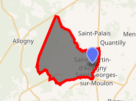
| |
 Saint-Martin-d’Auxigny  Saint-Martin-d’Auxigny | |
| Coordinates: 47°12′16″N 2°25′03″E | |
| Country | France |
| Region | Centre-Val de Loire |
| Department | Cher |
| Arrondissement | Bourges |
| Canton | Saint-Martin-d'Auxigny |
| Intercommunality | CC Terres du Haut Berry |
| Government | |
| • Mayor (2008–2014) | Fabrice Chollet |
| Area 1 | 24.08 km2 (9.30 sq mi) |
| Population (2017-01-01)[1] | 2,397 |
| • Density | 100/km2 (260/sq mi) |
| Time zone | UTC+01:00 (CET) |
| • Summer (DST) | UTC+02:00 (CEST) |
| INSEE/Postal code | 18223 /18110 |
| Elevation | 152–301 m (499–988 ft) (avg. 249 m or 817 ft) |
| 1 French Land Register data, which excludes lakes, ponds, glaciers > 1 km2 (0.386 sq mi or 247 acres) and river estuaries. | |
Geography
An area of lakes and streams, forestry and farming comprising a large village and several hamlets situated about 9 miles (14 km) north of Bourges, at the junction of the D940 with the D56 and the D68 roads.
Population
| Historical population | ||
|---|---|---|
| Year | Pop. | ±% |
| 1962 | 1,625 | — |
| 1968 | 1,659 | +2.1% |
| 1975 | 1,635 | −1.4% |
| 1982 | 1,705 | +4.3% |
| 1990 | 1,909 | +12.0% |
| 1999 | 2,018 | +5.7% |
| 2008 | 2,104 | +4.3% |
Sights
- The church of St. Martin, dating from the nineteenth century.
- The ruins of the fifteenth-century chapel at the site of the Château de la Salle le Roi.
- The thirteenth-century chapel of the old priory in the forest at Bléron.
See also
External links
| Wikimedia Commons has media related to Saint-Martin-d'Auxigny. |
- Official commune website (in French)
- Saint-Martin-d'Auxigny on the Quid website (in French)
| Authority control |
|
|---|
This article is issued from Wikipedia. The text is licensed under Creative Commons - Attribution - Sharealike. Additional terms may apply for the media files.