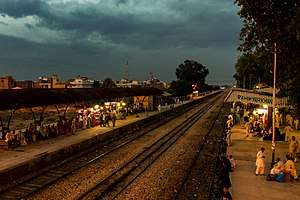
Rahim Yar Khan District
Rahim Yar Khan District (Urdu: ضلع رحیم یار خان) is a district in the Bahawalpur Division of Punjab province, Pakistan and the city of Rahim Yar Khan is its capital. The city itself is administratively subdivided into nine Union Councils.
Rahim Yar Khan District ضلع رحیم یار خان | |
|---|---|
 | |
 Rahim Yar Khan district is highlighted in map of Punjab | |
| Coordinates: 28°25′12″N 70°18′00″E | |
| Country | Pakistan |
| Province | Punjab |
| Headquarters | Rahim Yar Khan |
| Tehsils | 4 |
| Area | |
| • Total | 11,880 km2 (4,590 sq mi) |
| Population (2017)[1] | |
| • Total | 4,814,006 |
| • Density | 410/km2 (1,000/sq mi) |
| • Gender ratio | 105.2 male / 100 female |
| Time zone | UTC+5 (PST) |
Geography
The district lies between 27°40'-29°16' north latitudes and 60°45'-70°01' east longitudes. The riverain area of the district lies close to eastern bank of the river Indus and Panjnad. The Rahim Yar Khan District is bounded on the north by Muzaffargarh District, on the east by Bahawalpur District, on the south by Jaisalmer district (India) and Ghotki District of Sindh province, and on the west by Rajanpur District.
This district is divided into three main physical features: (a) Riverside area, b) canal-irrigated area, and (c) desert area which is called Cholistan. The Riverside area of the district lies close on the southern side of the Indus river mainly falling in the river bed. The canal-irrigated area lies on the south and is separated by main Minchan Bund. The approximate height of the irrigated area is 150 to 200 meters (490 to 655 ft) above sea level. The third part of the area, called Cholistan, lies in the south of the irrigated tract up to the Indo-Pak border. The surface of the desert consists of a succession of sand dunes rising at places to a height of 150 meters (492 ft) and covered with the vegetation peculiar to sandy tracts.
Demography
According to the 1998 census of Pakistan, the total population of Rahim Yar Khan district was 3,141,053 of which 19.16% were urban[1] an intercensal percentage increase of 70.6 since March, 1981 when it was 1,841,451. The average annual growth rate was 3.2 percent during this period. The total area of the district is 11,880 square kilometres which gives population density of 264 persons per square kilometre as against 155 persons observed in 1981 indicating a fast growth rate of the district.
The urban population was 616,582 or 19.6 percent of the total population of the district which grew at an average rate of 4.3 percent during 1981-98 and had decreased from 4.7 percent observed during 1972-81. There are three Municipal Committees and five Town Committees in the district.
The population of the district is predominantly Muslims i.e. 96.7 percent. The next higher percentage is of Hindu (Jati) with 1.8 percent, followed by Scheduled Castes 0.6 percent. While other minorities like Christians, Ahmadi etc. are very small in number. The proportion of population of Muslims is higher in urban than rural areas.
According to the 1998 census, the most widely spoken first language[2] in the district was Saraiki, spoken by 62.6% of the population. 27.3% identified their language as Punjabi, 2.9% – as Urdu and 2.9% – as Sindhi.[3]:36 The local dialect (see Riasti) belongs to the southern dialect group of Saraiki.[4] Other languages spoken are Bagri/Choolistani and Haryanvi.
History
It has been renamed customarily amid last 5000 years, first available (on record) name was AROR or ALOR, and then it became City of Pattan, Phul Wada, Noshehra and now Rahim Yar Khan. The ancient tower of Pattan Minarah is standing just 13 km away from city center in the south in its original form. Rahim Yar Khan has had the status of a separate district since 1943. The district derives its name from its headquarters, the city of Rahim Yar Khan, which was known as "Naushehra" until 1881. To avoid confusion with the similarly named city of Nowshera, the ruler of Bahawalpur, Nawab Sadiq Khan IV, renamed it after his first son, Rahim Yar Khan.[3]:1
Education
The literacy rate in the district is 38% total for the 10th grade level school, locally known as 'graduating the Matric Examination'.[5]
Notable people
- Ahmed Raza, first class cricketer.
- Asim Saleem Bajwa, Pakistani three star general who was the director-general of the Inter-Services Public Relations.
- Makhdoom Altaf Ahmed, former Provincial Minister (Punjab) Finance & Excise and Taxation.
- Makhdoom Shahbuddin, Former Federal Minister of Pakistan for Textiles.
- Makhdoom Ahmed Mehmood elected to the Punjab and National Assemblies.
- Makhdoom Khusro Bakhtiar politician who currently serves as the Federal Minister of National Food Security and Research, since 19 November 2019. He has also been the Federal Minister for Planning, Development and Reforms.
- Makhdoom Hashim Jawan Bakht politician who is the current Finance Minister of Punjab.
- Muniba Mazari, motivational speaker.
- Rais Muhammad Iqbal, former Provincial Minister (Punjab) for Mines and Mineral Affairs.
- AVM (Rtd) Mushtaq Laghari, former ambassador to UAE.
See also
- Shaikh Zayed International Airport
- Shaikh Zayed Medical College
- Bhong Masjid
- Patan minara
- Khanpur
- Mian Wali Qureshian
- Sadiqabad
- Liaqatpur
- Khan Bela
- Kot Sabzal
References
- Rahim Yar Khan District At A Glance on pbs.gov.pk website Retrieved 12 March 2018
- defined as the language for communication between parents and children
- 1998 District Census report of Rahim Yar Khan. Census publication. 126. Islamabad: Population Census Organization, Statistics Division, Government of Pakistan. 2000.
- Wagha, Muhammad Ahsan (1997). The development of Siraiki language in Pakistan (Ph.D.). School of Oriental and African Studies. pp. 229–31. (requires registration).
- Pakistan Social and Living Standards Measurement Survey (2014-2015) Pakistan Bureau of Statistics, Government of Pakistan website, Published March 2016, Retrieved 12 March 2018
Neighbourhoods of Rahim Yar Khan | ||
|---|---|---|
Administrations: Rahim Yar Khan District | ||
| Tehsils |  | |
| Cities |
| |
| Towns and councils |
| |
| Villages |
| |
Provincial capital: Lahore | ||
| Bahawalpur | .png) | |
| Dera Ghazi Khan | ||
| Faisalabad | ||
| Gujranwala | ||
| Lahore | ||
| Multan | ||
| Rawalpindi | ||
| Sargodha | ||
| Sahiwal | ||
| Sheikhupura | ||
See also: Districts of Punjab, India | ||