Gujranwala District
Gujranwala District (Punjabi and Urdu: ضِلع گُوجرانوالا), is a district in Punjab, Pakistan.
Gujranwala گُوجرانوالا | |
|---|---|
| Gujranwala | |
 Map of Punjab with Gujranwala District highlighted | |
| Coordinates: 32°10′N 73°50′E | |
| Country | Pakistan |
| Province | Punjab |
| Division | Gujranwala Division |
| Headquarters | Gujranwala |
| Area | |
| • Total | 3,622 km2 (1,398 sq mi) |
| Population (2017)[2] | |
| • Total | 5,014,196 |
| • Density | 1,400/km2 (3,600/sq mi) |
| Time zone | UTC+5 (PKT) |
| Number of Tehsils | 5 |
| Languages (1981) | 97.6% Punjabi[3] |
.jpg)
History
Gujranwala belongs to the Majha region of ancient Punjab. The village of Asarur has been identified as the location of Taki, an ancient town, visited by the Chinese pilgrim Hiuen Tsiang contains immense ruins of Buddhist origin. After the time of Tsiang little is known about Gujranwala till the Islamic conquests, by this time, however, Taki had fallen into oblivion while Lahore had become the capital of Punjab. The contemporary village of Asarur has been identified as the site of the ancient city. From the beginning of the 7th century Rajput kingdoms dominated Eastern portions of Pakistan and northern India. The district flourished during Mughal rule, from the days of Akbar to those of Aurangzeb, wells were scattered over the whole country, and villages lay thickly dotted about the southern plateau, now a barren waste of grass land and scrub jungle. Their remains may still be found in the wildest and most solitary reaches of the Bar.[4] The Punjab region became predominantly Muslim due to missionary Sufi saints whose dargahs dot the landscape of Punjab region.
Eminabad and Hafizabad were the chief towns (the latter now part of a separate district), while the country was divided into six well-tilled parganas. But before the end of the Islamic period the tract was mysteriously depopulated. The tribes at present occupying the District are all immigrants of recent date, and before their advent the whole region seems for a time to have been almost entirely abandoned. The only plausible conjecture to account for this sudden and disastrous change is that it resulted from the constant wars by which the Punjab was convulsed during the last years of Mughal Imperial rule.[4]
After the decline of the Mughal Empire following Aurangzebs death in 1707, the Afsharids in 1739 under their powerful Turko-Iranian conqueror Nadir Shah destroyed what remained of the once powerful Mughal Empire. Between 1747-1772 the Durrani Afghans (Pashtuns) of Ahmad Shah Abdali and the Sikh Misls vied for control of the region following the power vacuum left by the Mughals. Eventually the Sikh Sukerchakia Misl of Charat Singh won out and occupied the area of Gujranwala making it his new capital.
During the rise of Sikhs, the agricultural lands of Gujranwala were seized from Punjabi Muslims by Punjabi Sikhs under Charat Singh and his son Maha Singh who occupied and settled fellow Sikhs in the lands. Punjabi Muslim Chathas (Jats) and Bhattis (Rajputs) maintained a sturdy independence. In the end, however, the Sukerchakia misl succeeded in bringing both under its power.[4] Maha Singh’s son Ranjit Singh, founder of the Sikh Empire, was born in Gujranwala.
In 1849, the district was occupied by the British East India Company who annexed the entirety of the Sikh empire after defeating them in the Second Anglo-Sikh War. A cantonment was established at Wazirabad, which was abolished in 1855. The District formed a part originally of the extensive District of Wazirabad, which comprised the whole upper portion of the Rechna Doab.[5]
In 1852 this unwieldy territory was divided between Gujranwala and Sialkot District. The District, as then constituted, stretched across the entire plateau, from the Chenab to the Ravi; but in 1853 the south-eastern fringe, consisting of 303 villages, was transferred to Lahore District, and three years later a second batch of 324 villages was handed over to the same District. There was no outbreak during the Indian Rebellion of 1857 and the Hindus and Sikh rallied to the side of Government with the greatest enthusiasm while Muslims rallied for the Mughals.[5] According to the 1901 census the District had a population of 890,577 and contained 8 towns and 1,331 villages. Its population according to the 1881 census was 616,892 rising to 690,169 in 1891. The population increased by 29 per cent between 1891 and 1901 - the increase being greatest in the Hafizabad and Khangah Dogran tahsils, owing to the extension of canal-irrigation and the colonisation of the Bar.[5] At the time the district was divided into four tehsils, namely: Gujranwala, Wazirabad, Hafizabad and Khangah Dogran (the headquarters of each being at the place from which it is named).[5] The chief towns during British rule were the municipalities of Gujranwala, the headquarters of the District, Wazirabad, Rasulnagar, Ali Pur Chattha, Eminabad, Qila Didar Singh, and the notified area of Sodhra.[5] During the British era, the district of Gujranwala was part of Lahore Division.[6]
Demography
According to the 1998 census, the population of the district was 3,400,940, of which 51% were urban.[7]:23 The population now stands at 4,308,905.[8]
The most commonly used language of the district is Punjabi, which according to the 1998 census is the first language[9] of 97% of the population, while Urdu accounts for 1.9%.[7]:27
Religion and ethnic groups
Majority of population is Muslim with a small Christian minority.
Major tribes are Gujjars , Jats, Rajputs, Awans and Sayids.
Administration

Gujranwala is in fact a City district. The district is divided into following tehsils:
- Gujranwala City
- Gujranwala Saddar
- Wazirabad Tehsil
- Kamonki
- Naushehra Virkan
Furthermore, there are following towns under these tehsils:
- Khiali Shahpure Town
- Aroop Town
- Nandipur Town
- Qila Didar Singh Town
- Wazirabad Town
- Kamonki Town
- Naushehra Virkan Town
First four towns lie in Gujranwala City and Saddar tehsils while the last three towns are under their respective tehsils, i.e. Tehsil Wazirabad, Kamonki and Naushehra Virkan respectively.
Gujranwala is the district headquarters while Gujranwala, Wazirabad, Kamonki and Naushehra Virkan are tehsil headquarters.
Transport links
Road
Rail

The main Peshawar-Karachi railway line passes through Gujranwala district. The district is linked with Sialkot, Hafizabad and Gujrat districts through railway network.[10]
Economy
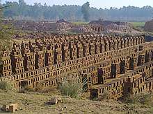
Gallery
See also
References
- "Gujranwala | Punjab Portal". Retrieved 15 December 2016.
- "DISTRICT WISE CENSUS RESULTS CENSUS 2017" (PDF). www.pbscensus.gov.pk. Archived from the original (PDF) on 29 August 2017. Retrieved 3 September 2017.
- Stephen P. Cohen (2004). The Idea of Pakistan. Brookings Institution Press. p. 202. ISBN 0815797613.
- Gujrānwāla District Imperial Gazetteer of India, v. 12, p. 355
- Gujrānwāla District Imperial Gazetteer of India, v. 12, p. 356
- Gujrānwāla District - Imperial Gazetteer of India, v. 12, p. 353
- 1998 District Census report of Gujranwala. Census publication. 37. Islamabad: Population Census Organization, Statistics Division, Government of Pakistan. 1999.
- "Statistics - Official website of Gujranwala Police". Archived from the original on 13 April 2008. Retrieved 11 February 2008.
- "Mother tongue": defined as the language of communication between parents and children and recorded of each individual.
- "Archived copy". Archived from the original on 22 April 2008. Retrieved 19 March 2009.CS1 maint: archived copy as title (link)
External links
| Wikivoyage has a travel guide for Gujranwala. |
Places adjacent to Gujranwala District | ||||||||||
|---|---|---|---|---|---|---|---|---|---|---|
| ||||||||||
Provincial capital: Lahore | ||
| Bahawalpur | .png) | |
| Dera Ghazi Khan | ||
| Faisalabad | ||
| Gujranwala | ||
| Lahore | ||
| Multan | ||
| Rawalpindi | ||
| Sargodha | ||
| Sahiwal | ||
| Sheikhupura | ||
See also: Districts of Punjab, India | ||