Bahawalnagar District
{{Infobox settlement
| name = Bahawalnagar
| official_name =
| native_name = بہاولنگر
| native_name_lang =
| settlement_type = District
| image_skyline =
| imagesize =
| image_alt =
| image_caption =
| image_map = Pakistan - Punjab - Bahawalnagar.svg
| mapsize = 200px
| map_alt =
| map_caption = Location of Bahawalnagar District (highlighted in red) within Punjab.
| coordinates =
| subdivision_type = Country
| subdivision_name = Pakistan
| subdivision_type1 = Province
| subdivision_name1 = Punjab
| subdivision_type2 =
| subdivision_name2 =
| founder =
| seat_type = Headquarters
| seat = Bahawalnagar
| government_footnotes =
| leader_party =
| unit_pref = Metric
| area_footnotes =
| area_total_km2 = 8878
| population_footnotes = [1]
| population_as_of = 2017
| population_total = 2,981,919
| population_density_km2 = auto
| timezone1 = PKT
| utc_offset1 = +5
| established_title = Established
| established_date =
| leader_title = District Coordination Officer
| leader_name =
| leader_title1 = Members of National Assembly
| leader_name1 = [[Mr. Muhammad Abdul Ghafar Wattoo]] (NA-166 Bahawalnagar-I)
[[Mr. Alam Dad Lalika]] (NA-167 Bahawalnagar-I)
[[Mr.Ihsan ul Haq Bajwa]] (NA-168 Bahawalnagar-I)
[[Mr. Noor Ul Hassan Tanvir]] (NA-169 Bahawalnagar-I)
| blank_name_sec1 = No. of Tehsils
| blank_info_sec1 = 5
| blank1_name_sec1 = Tehsils
| blank1_info_sec1 = Bahawalnagar
Chishtian
Fort Abbas
Haroonabad
Minchinabad
| demographics1_title1 = Main language(s)
| demographics1_info1 = Punjabi and Urdu
| website =
}}
Bahawalnagar District (Urdu: ضِلع بہاولنگر), is a district of Punjab province in Pakistan. Before the independence of Pakistan, Bahawalnagar was part of Bahawalpur state governed by the Nawab of Bahawalpur. The city of Bahawalnagar is the capital of the district. Its population according to the 2017 census is 2,982,000 people.[2]
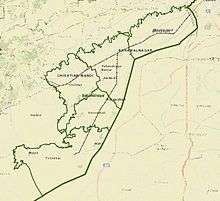
District boundaries
The boundaries of Bahawalnagar in the east and south touches the Indian territory while Bahawalpur district lies on its west and river Sutlej flows on its northern side. District Bahawalnagar spreads over an area of 8878 square kilometers.[3]
Administration
The district of Bahawalnagar is spread over an area of 8,878 square kilometres comprising five tehsils and 118 Union Councils:[4]
| Tehsil name | No of Unions |
|---|---|
| Bahawalnagar | 31 |
| Chishtian | 29 |
| Fort Abbas | 16 |
| Haroonabad | 22 |
| Minchinabad | 20 |
| Total | 118 |
Languages
According to the national census of 1998, the predominant first language[5] in the district was Punjabi, spoken by 94.6% of the population, followed by Urdu at 3.7% and Saraiki at 1.2%.[6]:42
Population and literacy rate
The population of Bahawalnagar, according to the 1998 Census of Pakistan, is 2,061,447.[7]
The sub-campus of Islamia University is located here. Presently this sub campus is offering limited subjects for postgraduate education and graduation while there is only one post-graduation degree college for boys with an area nearly equal to 75 acres, formed in 1945, and one for girls.
History
Nawab Bahawal Khan-1[8] as second nawab of Bahawalpur ascended the throne in 1746 A.D.
Muhammad Mubarik after ruling successfully for years died issueless in 1772 A.D. He was succeeded by nephew Sahibzada Jafar Khan alias Nawab Muhammad Bahawal Khan-II[9] in 1772.
Shrine of Tajuddin Chishti
Shaikh Khawaja Tajuddin Chishti also known as Taj Sarwar Chishti was a Sufi saint of Chishti Order. He was a grandson Shaikh Farid-ud-din Ganjshakar of Pakpattan and his descendants founded the village of Chishtian around 1265 CE (574 Hijri, Islamic calendar). Many native tribes in Punjab region accepted Islam due to his missionary Daawah. Shaikh Khawaja Tajuddin Chishti faced hostility from tribes that opposed his Muslim missionary Daawah and he was martyred in a battle and was buried in Chishtian. Shrine of Sufi saint Shaikh Khawaja Tajuddin Chishti, located at the city of Chishtian. The dargah of Shaikh Taj-ud-din Chishti is called Roza Taj Sarwar.[10]
See also
References
- "DISTRICT WISE CENSUS RESULTS CENSUS 2017" (PDF). Pbscensus.gov.pk. Archived from the original (PDF) on 29 August 2017. Retrieved 3 September 2017.
- "Archived copy" (PDF). Archived from the original (PDF) on 7 November 2017. Retrieved 26 November 2017.CS1 maint: archived copy as title (link)
- "Bahawalnagar | Punjab Portal". Punjab.gov.pk. Archived from the original on 14 October 2012. Retrieved 31 January 2017.
- Unions in Bahawalnagar Government of Pakistan Archived 2012-02-09 at the Wayback Machine. Nrb.gov.pk. Retrieved on 2011-12-04.
- defined as the language for communication between parents and children
- 1998 District Census report of Bahawalnagar. Census publication. 110. Islamabad: Population Census Organization, Statistics Division, Government of Pakistan. 2000.
- Population Archived 13 May 2006 at the Wayback Machine
- "CDA". Cholistan.gov.pk. Retrieved 31 January 2017.
- "Archived copy". Archived from the original on 8 February 2013. Retrieved 27 November 2012.CS1 maint: archived copy as title (link)
- "Shrine of Tajuddin Chishti, Bahawalnagar - Mera Watan". Merawatan.pk. Retrieved 6 March 2019.
| Wikivoyage has a travel guide for Punjab (Pakistan). |
Provincial capital: Lahore | ||
| Bahawalpur | .png) | |
| Dera Ghazi Khan | ||
| Faisalabad | ||
| Gujranwala | ||
| Lahore | ||
| Multan | ||
| Rawalpindi | ||
| Sargodha | ||
| Sahiwal | ||
| Sheikhupura | ||
See also: Districts of Punjab, India | ||