Muzaffargarh District
Muzaffargarh District (Urdu: ضِلع مُظفّرگڑھ) is a district of the Punjab province of Pakistan. Its capital is Muzaffargarh city. It lies on the bank of the Chenab River.
Muzaffargarh District ضِلع مُظفّرگڑھ | |
|---|---|
 District Government logo | |
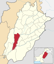 Map of Punjab with Muzaffargarh District highlighted | |
| Coordinates: 30°4′10″N 71°11′39″E | |
| Country | |
| Province | |
| Headquarters | Muzaffargarh |
| Government | |
| • Type | District Government |
| • Deputy commissioner | Muhammad Saif Anwar Jappa[1] |
| • Chairman | Sardar Hafiz Muhammad Umar Khan Gopang |
| • District Police Officer | Sadiq Ali doger[2] |
| Population (2017)[3] | |
| • Total | 4,322,009 |
| Time zone | UTC+5 (PST) |
| Number of Tehsils | 4 |
Administration
The district is administratively divided into the following four tehsils (subdivisions), which contain a total of 93 Union Councils:[4]
| Tehsil | No. of Unions |
|---|---|
| Alipur | 14 |
| Jatoi | 16 |
| Kot Addu | 28 |
| Muzaffargarh | 35 |
| Total | 93 |
Demographics
The major ethnic group are the Saraiki-speaking Jatt people forming the majority, with Saraiki-speaking Gujjar, Baloch, Rajputs and Pathans groups in minority.[5] According to the 1998 census, the major first language, defined as the language for communication between parents and children, of the district is Saraiki, spoken by 86.3% of its inhabitants. Punjabi is spoken by 7.4%, and Urdu – by 4.9%.[6]
The population is mostly Muslim, with a Sunni majority and a Shia minority. There are also Christians and Hindus in the city.
History
In 997 CE, Sultan Mahmud Ghaznavi, took over the Ghaznavid dynasty empire established by his father, Sultan Sebuktegin, In 1005 he conquered the Shahis in Kabul in 1005, and followed it by the conquests of Punjab region. The Delhi Sultanate and later Mughal Empire ruled the region. The Punjab region became predominantly Muslim due to missionary Sufi saints whose dargahs dot the landscape of Punjab region.
Muzaffargarh region became a part of the Muslim Sultanate of Delhi when the Persian noble Sultan Shahab-ud-Din Muhammad Ghauri conquered Punjab in 1185. Faisalabad slowly developed as medieval town and many Muslim Sufi missionaries converted the local population to Islam. During the Mughal period population increased and land under cultivation increased. After the decline of the Mughal Empire, the Sikh Empire invaded and occupied Muzaffargarh region. The Muslims faced restrictions during the Sikh rule. Between 1765 and 1846 Muzaffargarh was occupied by the Sikhs. Two main battles between British and Sikh armies were fought in this district on 22 February 1849 the British declare victory in Punjab.
Muzaffargarh was founded in 1794 by the Governor of Multan Nawab Muzaffar Khan. The Meaning of Muzaffargarh is "Fort of Muzaffar" because the old town lies inside the walls of a fort built by Nawab Muzaffar Khan of Multan. Prior to that the place was known by a shop called "Musan Hatti", on the road leading from Multan to Dera Ghazi Khan. In 1861 it became the headquarters of Muzaffargarh District.
After the independence of Pakistan in 1947, the minority Hindus and Sikhs migrated to India while the Muslim refugees from India settled in the Muzaffargarh District. Muslims refugees from East Punjab, Haryana, Jammu started arriving and crossed the border into Pakistan; many were given land in Muzaffargarh District to settle.
Muzaffargarh spreads over an area of 8,249 km2 and forms a strip between the Chenab River on its east and Indus River on its west, which pass along the Eastern and Western boundaries respectively of the district and a triangle at Alipur tehsil of the district. The district is bounded on the north by district Layyah, on the south by Bahawalpur and Rahimyar Khan districts across the river Chenab. Districts Multan and Khanewal are on the eastern side of district Muzaffargarh, across the river Chenab. District Jhang touches it on the northeast. Dera Gahzi Khan and Rajanpur districts lie on the western side across the river Indus. It is one of oldest districts of Punjab. According to the 1998 census of Pakistan, the population of the district was 2,635,903, of which 12.75% were urban.[7] Muzaffargarh is one of oldest districts of Punjab.
Muzaffargarh was especially hard hit by the 2010 Pakistan floods, given its position between the Chenab and Indus rivers It is spread over an area of 8,249 km2. Muzaffargarh District lies in the strip between the rivers Chenab and Indus.
Geography and climate
| Muzaffargarh | ||||||||||||||||||||||||||||||||||||||||||||||||||||||||||||
|---|---|---|---|---|---|---|---|---|---|---|---|---|---|---|---|---|---|---|---|---|---|---|---|---|---|---|---|---|---|---|---|---|---|---|---|---|---|---|---|---|---|---|---|---|---|---|---|---|---|---|---|---|---|---|---|---|---|---|---|---|
| Climate chart (explanation) | ||||||||||||||||||||||||||||||||||||||||||||||||||||||||||||
| ||||||||||||||||||||||||||||||||||||||||||||||||||||||||||||
| ||||||||||||||||||||||||||||||||||||||||||||||||||||||||||||
The city of Muzaffargarh is located in southern Punjab province at almost the exact centre of Pakistan. The closest major city is Multan. The area around the city is a flat, alluvial plain and is ideal for agriculture, with many citrus and mango farms. There are many canals that cut across the Muzaffargarh District, providing water from nearby farms. This makes the land very fertile. However usually land close to the Chenab are usually flooded in the monsoon season.
Muzaffargarh features an arid climate with very hot summers and mild winters. The city witnesses some of the most extreme weather in the country. The highest recorded temperature is approximately 54 °C (129 °F), and the lowest recorded temperature is approximately −1 °C (30 °F). The average rainfall is roughly 127 millimetres (5.0 in). Dust storms are a common occurrence within the city.
The district's towns include Basti Malik Wala, Taliri, Mauza Bahadur Dawana, Dawana Bahadur Peer Rajan Bukhsh, Kot Addu, Khangarh and Hayat Nagar.
Education
Although Muzaffargarh is one of the oldest and largest districts of Pakistan by area and population, it still has only a single campus of Virtual University of Pakistan. The literacy rate is one of the lowest in the country.[8] District Muzaffargarh has a total of 1,072 male and 1,009 female public sector schools.[9] According to the School Education Department's data, a total of 5,023 male and 4,130 female teachers are employed in public school education sector of the district.
Forests
An area of 100,864 acres is forested in the district. There is also linear plantation of 1250 A.V. mile the roads/rails/canals in the district. Trees grown in the area are kikar, shisham, millbury, eucalyptus, bamboo and coconut.
References
- "Administration of Muzaffargarh District". mgarh.com. Archived from the original on 24 December 2017. Retrieved 28 December 2017.
- "DPO Muzaffargarh District Police". www.mgarh.com. Archived from the original on 9 January 2018. Retrieved 28 December 2017.
- "District Wise Census Results – Census 2017" (PDF). www.pbscensus.gov.pk. Archived from the original (PDF) on 29 August 2017.
- Tehsils & Unions in the District of Muzaffargarh – Government of Pakistan Archived 2012-02-09 at the Wayback Machine
- "Gazetteer of the Muzaffargarh District". Punjab Government Press. 19 June 1884 – via Google Books.
- 1998 District Census report of Muzaffargarh. Census publication. 120. Islamabad: Population Census Organization, Statistics Division, Government of Pakistan. 2000. pp. 21–22.
- "Urban Resource Centre". urckarachi.org. Archived from the original on 13 May 2006.
- "Pakistan Social and Living Standards Measurement Survey 2014-15 Report".
- "Punjab Annual Schools Census Data 2014-15". Archived from the original on 16 August 2016. Retrieved 16 August 2016.
External links
![]()
Provincial capital: Lahore | ||
| Bahawalpur | .png) | |
| Dera Ghazi Khan | ||
| Faisalabad | ||
| Gujranwala | ||
| Lahore | ||
| Multan | ||
| Rawalpindi | ||
| Sargodha | ||
| Sahiwal | ||
| Sheikhupura | ||
See also: Districts of Punjab, India | ||