Palu
Palu is a chartered city on the Indonesian island of Sulawesi, at the mouth of the Palu River. It is the capital of the province of Central Sulawesi, situated on a long, narrow bay. Because of its sheltered position between mountain ridges, the climate is unusually dry. At the 2015 census Palu had a population of around 367,600, not including those living in neighboring regencies.[1] On 28 September 2018, the city suffered many casualties due to a tsunami, where at least 2,256 people lost their lives, while many others are still buried under the rubble and presumed dead.[2]
Palu | |
|---|---|
 Palu Bay | |
 Seal | |
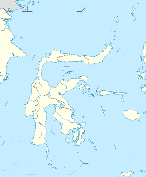
 Location within Central Sulawesi | |
| Coordinates: 0°53′42″S 119°51′34″E | |
| Country | |
| Province | |
| Incorporated | 27 September 1978 |
| City Status | 22 July 1994 |
| Government | |
| • Mayor | Hidayat |
| • Vice Mayor | Sigit Purnomo Syamsuddin Said |
| Area | |
| • Total | 395.06 km2 (152.53 sq mi) |
| Elevation | 118 m (387 ft) |
| Population (2015 Census) | |
| • Total | 367,600 |
| • Density | 930/km2 (2,400/sq mi) |
| Time zone | UTC+8 (Indonesia Central Time) |
| Area code | (+62) 451 |
| Website | www |

Etymology
The name of Palu comes from the word Topalu'e (the elevated land) because this area was meant to be the ocean. There was an earthquake and plate shift (palu koro) so that the area that was once the sea was lifted and formed the land that is now Palu.
Another source mentions that the word origin of Palu comes from the Kaili word Volo, a term of bamboo that grows from the Tawaeli area to the Sigi region. Bamboo is very closely related to the Kaili tribe, this is due to they dependence of bamboo usage as their daily needs, whether it be used as foodstuffs (bamboo shoot), building materials (walls, mats, etc.), daily equipment, games (tilako), as well as musical instruments (lalove).
History

Palu originated from a unity of four villages; namely Besusu, Tanggabanggo (Siranindi, now Kamonji), Panggovia (now Lere) and Boyantongo (now Kelurahan Baru). They formed a customary council called Patanggota. One of their assignments was to elect the king and his assistants for royal activities. The kingdom, which would be known as the Palu Kingdom, eventually became one of the well-known and very powerful kingdom.
The Dutch first visited Palu during the reign of King Maili (Mangge Risa) to get protection from Manado in 1868. In 1888, the Dutch governor of Celebes together with armies and several ships arrived Palu kingdom, they fought in Kayumalue. After the Kayumalue war, King Maili was killed by the Dutch and his body was brought to Palu. He was succeeded by King Jodjokodi, on 1 May 1888 he signed a short agreement to the Dutch East Indies colonial authority.
The town was part of the Dutch Empire until Indonesia won independence in 1945–49. The Dutch controleur's house survives as a testament of that era.
CIA air raids
In April 1958 during the Permesta rebellion in North Sulawesi, the USA supported and supplied the rebels. Pilots from a CIA Taiwan-based front organization, "Civil Air Transport," flew CIA B-26 Invader aircraft, repeatedly bombed and machine-gunned targets in and around Palu; destroying vehicles, buildings, a bridge and a ship.[3]
2005 earthquake
On 24 January 2005 at 04:10 (UTC+8), an earthquake with a magnitude of 6.2 occurred in the city. According to the local meteorological office, the epicenter of the earthquake was around 1.249° S, 119.922° E, some 16 km (10 mi) southeast of Palu at the depth of 30 km (19 mi) of Bora Village's hot spring, Biromaru sub-district, Donggala Regency. Panic ensued as most people sought refuge in the highlands for fear of a repeat disaster like the tsunami as occurred in Aceh. The earthquake killed one person, injured four others, and destroyed 177 buildings.[4][5]
2005 market bombing
On 31 December 2005 at about 07:35 (UTC +8) a bomb blast,[6] described as a nail bomb or similar,[7] detonated around 07:00 in a butcher's market mostly frequented by Christian Minahasa shopping for New Year's Eve celebrations, killing eight people and wounding another 53.[7][8][9]
2018 tsunami
On 28 September 2018, Palu was hit by a 5-meter-high tsunami shortly after a magnitude 7.5 earthquake occurred 80 km north of the city. The earthquake killed 1,705 people, with 1,549 injured and 832 missing in the city. Other cities were also struck by the tsunami.[10][11] As of 2019, the death toll has reached 4,340 as reported by the Indonesian National Board for Disaster Management, over 4 places that were hit by the tsunami.[2]
Climate
Palu has a relatively dry tropical rainforest climate (Af) due to the strong rainshadow of the nearby mountains.
| Climate data for Palu | |||||||||||||
|---|---|---|---|---|---|---|---|---|---|---|---|---|---|
| Month | Jan | Feb | Mar | Apr | May | Jun | Jul | Aug | Sep | Oct | Nov | Dec | Year |
| Record high °C (°F) | 38 (100) |
37 (99) |
37 (99) |
37 (99) |
35 (95) |
37 (99) |
37 (99) |
37 (99) |
38 (100) |
37 (99) |
37 (99) |
38 (100) |
38 (100) |
| Average high °C (°F) | 30.3 (86.5) |
30.5 (86.9) |
30.7 (87.3) |
30.8 (87.4) |
31.1 (88.0) |
30.2 (86.4) |
29.4 (84.9) |
30.8 (87.4) |
30.9 (87.6) |
32.1 (89.8) |
31.3 (88.3) |
30.8 (87.4) |
30.7 (87.3) |
| Daily mean °C (°F) | 26.6 (79.9) |
26.7 (80.1) |
26.9 (80.4) |
26.9 (80.4) |
27.4 (81.3) |
26.6 (79.9) |
25.7 (78.3) |
26.8 (80.2) |
26.7 (80.1) |
27.7 (81.9) |
27.2 (81.0) |
27.0 (80.6) |
26.9 (80.3) |
| Average low °C (°F) | 22.9 (73.2) |
23.0 (73.4) |
23.1 (73.6) |
23.1 (73.6) |
23.8 (74.8) |
23.1 (73.6) |
22.0 (71.6) |
22.8 (73.0) |
22.5 (72.5) |
23.3 (73.9) |
23.1 (73.6) |
23.2 (73.8) |
23.0 (73.4) |
| Record low °C (°F) | 22 (72) |
21 (70) |
18 (64) |
20 (68) |
21 (70) |
21 (70) |
21 (70) |
20 (68) |
20 (68) |
17 (63) |
21 (70) |
21 (70) |
17 (63) |
| Average precipitation mm (inches) | 101 (4.0) |
88 (3.5) |
90 (3.5) |
102 (4.0) |
130 (5.1) |
157 (6.2) |
158 (6.2) |
147 (5.8) |
164 (6.5) |
109 (4.3) |
110 (4.3) |
76 (3.0) |
1,432 (56.4) |
| Average precipitation days | 7 | 8 | 9 | 9 | 10 | 12 | 11 | 9 | 8 | 7 | 9 | 7 | 106 |
| Average relative humidity (%) | 75 | 76.5 | 75.5 | 76 | 75.5 | 76.5 | 77 | 74 | 74.5 | 73 | 73 | 74.5 | 75 |
| Source 1: weatherbase[12] | |||||||||||||
| Source 2: climate-data[13] | |||||||||||||
Administration
The city was divided at 2010 into four districts (kecamatan), tabulated below with their 2010 Census population.[14]
| Name | Population Census 2010 |
|---|---|
| Palu Barat (West Palu) | 98,739 |
| Palu Selatan (South Palu) | 122,752 |
| Palu Timur (East Palu) | 75,967 |
| Palu Utara (North Palu) | 39,074 |
Transport
Palu is served by Mutiara Sis Al-Jufri Airport, which is located outside the city center.
Military
Palu is the site of an Indonesian Navy base, and the planned home of the Indonesian Navy's submarines.[15] A quay wall and environmental shelter covering the submarine berthing area were destroyed in the 2018 Sulawesi earthquake and tsunami.[15]
Sister cities
Notable people
- Longki Djanggola, governor of the province
Indonesia Open Paragliding Championship

Indonesia Open Paragliding Championship is one of the world championship series which it was the first Indonesia Open held in the region on 19–25 June 2011. 78 paragliders taking part in the championship from Indonesia, Japan, Malaysia, the Philippines, Russia, South Korea and Switzerland competed at Wayu village (the Matantimali hills, 800 masl) about 30 kilometres (19 miles) from Palu.[16]
References
- "HASIL SENSUS PENDUDUK 2010 SULAWESI TENGAH". Archived from the original on 18 February 2011. Retrieved 8 December 2010.
- Post, The Jakarta. "Central Sulawesi quake, tsunami inflicted US$911 million in losses: Govt". The Jakarta Post. Retrieved 22 October 2018.
- Conboy, Kenneth; Morrison, James (1999). Feet to the Fire CIA Covert Operations in Indonesia, 1957–1958. Annapolis: Naval Institute Press. pp. 101, 105, 116, 118, 121. ISBN 1-55750-193-9.
- "Indonesian quake causes panic". BBC News. 24 January 2005.
- "EO Natural Hazards: Earthquake in Sulawesi".
- "Indonesia bomb leaves eight dead". BBC News. 31 December 2005.
- "Bombing kills eight at Indonesian market". USA Today. Associated Press. 31 January 2005. Retrieved 28 July 2011.
- "At least eight killed in Indonesia market blast". CTV.ca News. 31 December 2005. Retrieved 28 July 2011.
- "Indonesian police detain man after market bombing". ABC Australia. Reuters. 1 January 2006. Retrieved 28 July 2011.
- (in English) "Tsunami hits Indonesia's Palu after strong earthquake". BBC News. 28 September 2018.
- "BREAKING: Video shows tsunami hitting Palu after 7.7-magnitude quake". The Jakarta Post. 28 September 2018.
- "PALU, INDONESIA". weatherbase.com. Retrieved 15 July 2017.
- "CLIMATE TABLE // HISTORICAL WEATHER DATA". climate-data.org. Retrieved 15 July 2017.
- Biro Pusat Statistik, Jakarta, 2011.
- "Indonesia Submarine Quay and Pier Damaged During Tsunami". bellingcat. 5 October 2018. Retrieved 8 October 2018.
- Maruli, Aditia (18 June 2011). "Indonesia hosts paragliding open championship in Palu". Antara News.
External links
| Wikimedia Commons has media related to Palu. |
- Official site (in Indonesian)
- Step! Magz, Palu Youth Movement Magazine (in Indonesian)
- Sulteng.org – Tempat Ngumpulnya orang Palu (in Indonesian)
Regencies and cities of Central Sulawesi | ||
|---|---|---|
Capital: Palu | ||
| Regencies | ||
| Cities | ||
| 2,000,000 and more | |
|---|---|
| 1,000,000–1,999,999 | |
| 500,000–999,999 | |
| 200,000–499,999 | |
Provincial capitals in Indonesia | ||
|---|---|---|
| Sumatra |  | |
| Java | ||
| Kalimantan |
| |
| Lesser Sunda | ||
| Sulawesi | ||
| Maluku | ||
| Papua | ||