Donggala Regency
Donggala Regency is a regency in the Central Sulawesi Province of Indonesia.
Donggala Regency Kabupaten Donggala | |
|---|---|
 Seal | |
| Motto(s): Roso Risi Rasa (Kaili) (Strong Tough Prosperous) | |
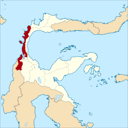 Location within Central Sulawesi | |
| Coordinates: 0°41′40″S 119°43′50″E | |
| Country | Indonesia |
| Province | Central Sulawesi |
| Capital | Banawa |
| Government | |
| • Regent | Kasman Lassa |
| • Vice Regent | Vera Elena Laruni |
| Area | |
| • Total | 13,593.5 km2 (5,248.5 sq mi) |
| • Land | 10,471.7 km2 (4,043.1 sq mi) |
| • Water | 3,121.8 km2 (1,205.3 sq mi) |
| Population (2010) | |
| • Total | 277,236 |
| • Density | 20/km2 (53/sq mi) |
| Time zone | UTC+8 (ICST) |
| Area code | (+62) 451/457 |
| Website | donggala |

The capital of Donggala is Banawa, located a 30-minute drive (34 km) north from Palu the capital of the province. Habir Ponulele is the governor of the regency. The regency has a land area of 10,472 km² and had a population of 277,236 at the 2010 Census. the regency lies between 0° 30" north and 2°20" south latitude, and between 119° 45°" and 121° 45" east longitude.[1]
In September 2018, Donggala and Palu suffered heavy casualties due to a tsunami.[2]
Administration

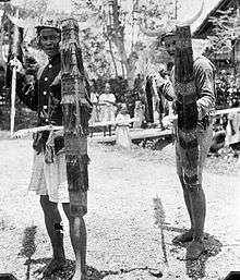
Before the Dutch assumed administration in 1904 under Governor-General J. B. van Heutsz, the area was the home of eight small kingdoms (kerajaan): Palu, Sigi Dolo, Kulawi, Biromaru, Banawa, Tawaili, Parigi, and Moutong.[3][4]
In 2010, Donggala Regency was divided into sixteen districts (kecamatan). [5] The district has 287 villages/wards.[1]
2010
The Muna Regency was divided at 2010 into 33 districts (kecamatan), tabulated below with their 2010 Census population.[6]
These are physically divided into two sections, lying to the west and to the east of the Palu River Valley respectively, and separated from each other by Palu city and the Sigi Regency. The first section comprises five districts, of which the northern Banawa and Banawa Tengah (known as Donggala town) were the areas grievously inundated by the 2018 earthquake and tsunami. The second comprises eleven districts, stretching south to north along the west coast of Sulawesi's northern peninsula.
| Name | Area in km2. | Population Census 2010 |
|---|---|---|
| Banawa | 89.9 | 32,018 |
| Banawa Tengah (Central Banawa) | 72.5 | 10,072 |
| Banawa Selatan (South Banawa) | 401.1 | 23,677 |
| Pinembani | 377.8 | 5,936 |
| Rio Pakava | 805.2 | 21,820 |
| Western section | 1,746.5 | 93,523 |
| Tanantovea | 271.1 | 15,182 |
| Labuan | 127.8 | 13,319 |
| Sindue | 153.3 | 18,436 |
| Sindue Tombusabora | 214.4 | 11,320 |
| Sindue Tobata | 184.7 | 8,775 |
| Sirenja | 262.9 | 20,206 |
| Balaesang Tanjung | 183.9 | 10,350 |
| Balaesang | 286.5 | 22,796 |
| Damsol | 697.8 | 28,938 |
| Sojol | 650.2 | 25,419 |
| Sojol Utara (North Sojol) | 129.1 | 9,356 |
| Eastern section | 3,161.7 | 184,097 |
2013
Most of the districts of Donggala Regency, together with Palu city and some of the districts of Sigi Regency, were covered in the Rencana Pembangunan Jangka Panjang (Long-Term Development Plan) as of 2013. In all, the area of the Plan covered twenty-one districts.[1]
- Balaesang
- Balaesang Tanjung (Balaesang Cape)
- Banawa, Central Sulawesi
- Banawa Selatan (South Banawa)
- Banawa Tengah, Donggala (Central Banawa)
- Damsol
- Dolo, Sulawesi
- Dolo Selatan (South Dolo)
- Gumbasa
- Kulawi
- Kulawi Selatan (South Kulawi)
- Labuan, Sulawesi
- Marawola
- Pipikoro
- Palolo, Sulawesi
- Rio Pakava
- Sigi-Biromaru
- Sirenja
- Sojol
- Tana Mbulava
- Tana Ntovea (Tanantovea)
- Tawaeli
Tourist attractions
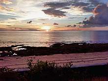
- Tanjung Karang Beach, Donggala, Labuan Bajo, Banawa
- Pusentasi (pusat Laut), Towale
- Boneoge Beach, Banawa
- Anjungan Gonenggati, Banawa
- Kabonga Beach, Banawa
- Art & Culture, Home Industry, Sarong Donggala, Salubomba village, Limboro,Watusampu, Kola-Kola, Ganti, Kabonga, Loli, Wani [7]
- Gonenggati Mangrove Forest, Kabonga Besar, Banawa
- Enu Beach, Enu
- Bambarano Beach
- Kalukku Beach, Limboro
- Hayalan Beach, Salubomba
- Lembasada Beach, Lembasada
- Surumana Beach, Surumana
- Tosale Beach, Tosale
- Batusuya Beach, Batusuya
- Salur Beach, Sioyong, Sabang
- Taipa Beach, Taipa
- Parimpi Indah Beach, Lende, Sirenja
- Saget Beach and LendeNtovea, Sojol Utara
- Majang Beach, Long Village, Damsol
- Sivalenta Beach Sirenja
- Salumbone Beach, Salumbone
- Labuana Beach, Lende Ntovea, Sirenja
- Lake Talaga
- Lake Dampelas
- Rano Lake
- Lino Lake, Lino
- Talaga Lake, Dampelas
- Kaledo (soup)
- Bambahano, Sabang
- Pasoso Island, Balaesang
- Maputi Island, Pangalaseang
- Taring Island, Lenju, Sojol Utara
- Loli Tasiburi Waterfall
- Powelua Waterfall, Banawa Tengah
- Walandanu Waterfall, Balaesang
- Bou Waterfall, Bou, Damsol
- Nupabomba Waterfall, Nupabomba
- Bale Waterfall, Bale, Tanantovea
- Ogoamas Waterfall, Sojol Utara
- Hotspring, Tambu Village
- Camping Ground Nupabomba, Nupabomba
- Pemandian Loli Indah, Loli Oge, Banawa
- Nature Reserve Sojol Mountain, Sojol
References
- "Rencana Pembangunan Jangka Panjang (Long-Term Development Plan)" (in Indonesian). Bagian Humas Pemkab Donggala (Public Relations Department, Donggala Regency). Archived from the original on 28 July 2014. Retrieved 28 July 2014.
- "Large numbers of casualties in Indonesian city due to tsunami". MSN. Reuters. 29 September 2018. Retrieved 29 September 2018.
- "Sejarah Kabupaten Donggala (History of Donggala Regency)" (in Indonesian). Bagian Humas Pemkab Donggala (Public Relations Department, Donggala Regency). Archived from the original on 28 July 2014. Retrieved 28 July 2014.
- Vickers, Adrian (2013). A History of Modern Indonesia (second ed.). Cambridge, England: Cambridge University Press. p. 14. ISBN 978-1-107-01947-8.
- Biro Pusat Statistik, Jakarta, 2011.
- Biro Pusat Statistik, Jakarta, 2011.
- Pidii.co.id
Regencies and cities of Central Sulawesi | ||
|---|---|---|
Capital: Palu | ||
| Regencies | ||
| Cities | ||