National Register of Historic Places listings in Ross County, Ohio
This is a list of the National Register of Historic Places listings in Ross County, Ohio.
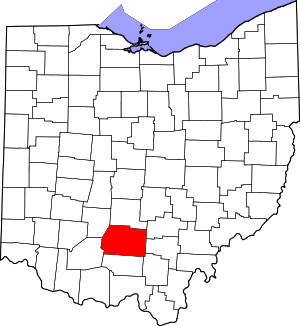
Location of Ross County in Ohio
This is intended to be a complete list of the properties and districts on the National Register of Historic Places in Ross County, Ohio, United States. The locations of National Register properties and districts for which the latitude and longitude coordinates are included below, may be seen in an online map.[1]
There are 43 properties and districts listed on the National Register in the county, including 2 National Historic Landmarks. Another property was once listed but has been removed.
- This National Park Service list is complete through NPS recent listings posted June 26, 2020.[2]
Current listings
| [3] | Name on the Register[4] | Image | Date listed[5] | Location | City or town | Description |
|---|---|---|---|---|---|---|
| 1 | Adena (Thomas Worthington House) |  Adena (Thomas Worthington House) |
November 10, 1970 (#70000515) |
Box 831 Adena Rd. 39°21′13″N 83°00′55″W |
Chillicothe | |
| 2 | Adena Mound | 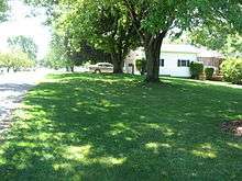 Adena Mound |
June 5, 1975 (#75001529) |
947-999 Orange St.[6] 39°21′20″N 83°00′29″W |
Chillicothe | Levelled after excavation[7] |
| 3 | Levi Anderson House | 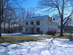 Levi Anderson House |
December 12, 1976 (#76001524) |
West of Chillicothe on Anderson Station Rd. 39°21′38″N 83°04′32″W |
Union Township | |
| 4 | Howard Baum Site (33RO270) | August 14, 1986 (#86001663) |
South of Bourneville along Paint Creek[8] 39°15′53″N 83°09′12″W |
Twin Township | ||
| 5 | Austin Brown Mound | 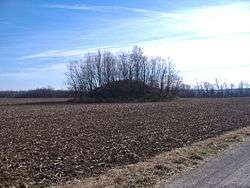 Austin Brown Mound |
February 15, 1974 (#74001613) |
Near Brown Chapel, northwest of Chillicothe[9] 39°28′56″N 83°05′53″W |
Deerfield Township | |
| 6 | Buchwalter House-Applethorpe Farm | 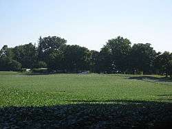 Buchwalter House-Applethorpe Farm |
May 26, 1983 (#83002053) |
292 Whissler Rd., north of Hallsville 39°27′10″N 82°49′14″W |
Colerain Township | |
| 7 | T.C. Campbell Mound | 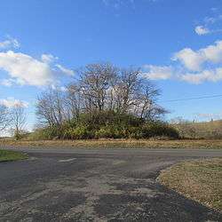 T.C. Campbell Mound |
July 15, 1974 (#74001610) |
1 mile (1.6 km) southwest of Bainbridge[10] 39°13′26″N 83°16′55″W |
Paxton Township | Last surviving component of the Trefoil Works;[11] also known as the "Rockhold Mound"[12] |
| 8 | Canal Warehouse | 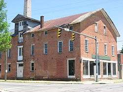 Canal Warehouse |
April 24, 1973 (#73001522) |
Main and Mulberry Sts. 39°20′03″N 82°58′44″W |
Chillicothe | |
| 9 | Cedar-Bank Works | 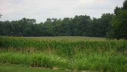 Cedar-Bank Works |
February 15, 1974 (#74001614) |
Eastern bank of the Scioto River, north of Chillicothe[8] 39°24′04″N 82°58′36″W |
Green Township | |
| 10 | Chillicothe Business District | 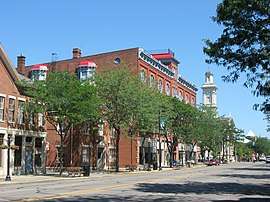 Chillicothe Business District |
June 11, 1979 (#79001931) |
Roughly bounded by Water, 4th, Walnut and Hickory Sts. 39°20′03″N 82°58′56″W |
Chillicothe | |
| 11 | Chillicothe Veterans Administration Hospital |  Chillicothe Veterans Administration Hospital |
March 12, 2012 (#12000110) |
17273 State Route 104, north of Chillicothe 39°23′19″N 83°01′07″W |
Union Township | |
| 12 | Chillicothe Water and Power Company Pumping Station | 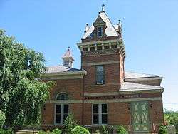 Chillicothe Water and Power Company Pumping Station |
November 15, 1979 (#79001932) |
Enderlin Circle 39°20′22″N 82°58′55″W |
Chillicothe | |
| 13 | Chillicothe's Old Residential District | 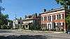 Chillicothe's Old Residential District |
November 28, 1973 (#73001523) |
Roughly bounded by 4th, S. Mulberry, S. Walnut and 7th Sts. 39°19′43″N 82°59′04″W |
Chillicothe | |
| 14 | Frankfort Works Mound | 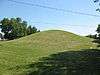 Frankfort Works Mound |
May 17, 1973 (#73001530) |
Western side of Frankfort[13] 39°24′17″N 83°11′14″W |
Frankfort | |
| 15 | Gartner Mound and Village Site | 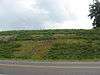 Gartner Mound and Village Site |
July 27, 2005 (#05000752) |
Along the Scioto River, 6 miles (9.7 km) north of Chillicothe[8] 39°24′46″N 82°59′00″W |
Green Township | |
| 16 | Grandview Cemetery | 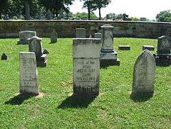 Grandview Cemetery |
December 19, 1978 (#78002180) |
240 S. Walnut St. 39°19′28″N 82°59′10″W |
Chillicothe | |
| 17 | Great Seal Park Archeological District | 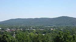 Great Seal Park Archeological District |
December 2, 1974 (#74001615) |
In Great Seal State Park, 3 miles (4.8 km) from Chillicothe[14] 39°22′N 82°56′W |
Springfield Township | |
| 18 | Dr. John Harris Dental School | 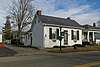 Dr. John Harris Dental School |
July 23, 1973 (#73001521) |
Main St. 39°13′38″N 83°16′21″W |
Bainbridge | |
| 19 | Higby House | 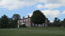 Higby House |
November 29, 1979 (#79001933) |
South of Chillicothe on Three Locks Rd. 39°11′50″N 82°51′58″W |
Franklin Township | |
| 20 | High Banks Works |  High Banks Works |
July 16, 1973 (#73001524) |
Eastern bank of the Scioto River, southeast of Chillicothe[15] 39°17′48″N 82°55′03″W |
Liberty Township | |
| 21 | Highbank Farm |  Highbank Farm |
October 20, 1980 (#80003215) |
Southeast of Chillicothe at 28532 Old U.S. Route 35 39°16′15″N 82°53′49″W |
Liberty Township | |
| 22 | Hopeton Earthworks |  Hopeton Earthworks |
October 15, 1966 (#66000623) |
On a terrace of the Scioto River at Hopetown, 1 mile (1.6 km) east of the main Mound City group[16] 39°23′11″N 82°58′45″W |
Springfield Township | |
| 23 | Hopewell Mound Group |  Hopewell Mound Group |
February 12, 1974 (#74001616) |
Northern bank of the North Fork of Paint Creek[8] 39°21′40″N 83°05′24″W |
Union Township | |
| 24 | Kinzer Mound | January 17, 1974 (#74001617) |
Address Restricted |
South Salem | ||
| 25 | Henry Mace House | 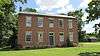 Henry Mace House |
February 12, 1998 (#98000101) |
17380 State Route 104, N. 39°23′32″N 83°00′45″W |
Union Township | |
| 26 | Mary Worthington Macomb House | 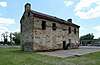 Mary Worthington Macomb House |
April 26, 1976 (#76001525) |
490 S. Paint St. 39°19′19″N 82°58′48″W |
Chillicothe | |
| 27 | McCafferty Run Farmstead | 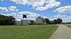 McCafferty Run Farmstead |
September 3, 2004 (#04000945) |
17114 and 17226 State Route 104 39°23′25″N 83°00′43″W |
Union Township | |
| 28 | Charles Metzger Mound | June 18, 1973 (#73001526) |
2 miles (3.2 km) southwest of Yellow Bud, on a hilltop above Deer Creek[17] 39°26′58″N 83°02′16″W |
Union Township | ||
| 29 | Mound City Group National Monument | 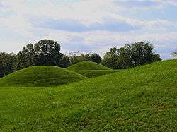 Mound City Group National Monument |
October 15, 1966 (#66000119) |
North of Chillicothe 39°22′33″N 83°00′16″W |
Union Township | |
| 30 | Mountain House | 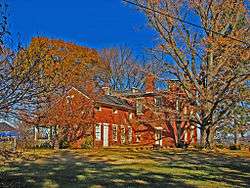 Mountain House |
December 29, 1978 (#78002181) |
Highland Ave. 39°19′55″N 82°59′29″W |
Chillicothe | |
| 31 | Oak Hill | 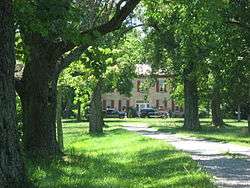 Oak Hill |
April 3, 1973 (#73001527) |
Dun Rd. 39°19′35″N 83°01′28″W |
Scioto Township | |
| 32 | Renick House, Paint Hill | 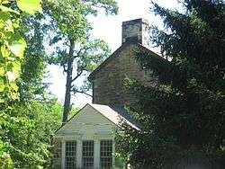 Renick House, Paint Hill |
May 9, 1973 (#73001528) |
17 Mead Dr. 39°19′24″N 82°59′26″W |
Chillicothe | |
| 33 | Seip Earthworks and Dill Mounds District | 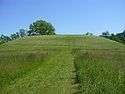 Seip Earthworks and Dill Mounds District |
August 13, 1974 (#74001611) |
Southern side of U.S. Route 50, 3 miles (4.8 km) east of Bainbridge[18] 39°14′16″N 83°13′13″W |
Paxton Township | |
| 34 | Seip House | 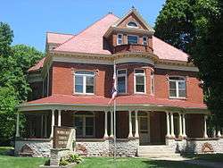 Seip House |
May 12, 1981 (#81000450) |
345 Allen Ave. 39°20′30″N 82°59′37″W |
Chillicothe | |
| 35 | South Salem Academy | 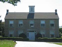 South Salem Academy |
February 23, 1979 (#79001937) |
Church St. 39°20′10″N 83°18′38″W |
South Salem | |
| 36 | South Salem Covered Bridge | 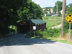 South Salem Covered Bridge |
March 4, 1975 (#75001530) |
West of South Salem on Lower Twin Rd. across Buckskin Creek 39°20′03″N 83°18′52″W |
Buckskin Township | |
| 37 | Spruce Hill Works | 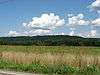 Spruce Hill Works |
February 23, 1972 (#72001039) |
On a hill overlooking Bourneville[8] 39°16′33″N 83°08′15″W |
Twin Township | |
| 38 | David Stitt Mound | November 9, 1972 (#72001040) |
Address Restricted |
Chillicothe | ||
| 39 | Story Mound State Memorial | 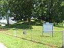 Story Mound State Memorial |
March 7, 1973 (#73001529) |
East of the junction of Cherokee and Delano Streets 39°20′31″N 82°59′58″W |
Chillicothe | |
| 40 | Tanglewood | 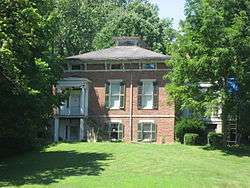 Tanglewood |
June 20, 1979 (#79001934) |
177 Belleview Ave. 39°19′39″N 82°59′19″W |
Chillicothe | |
| 41 | Vanmeter Church Street House | 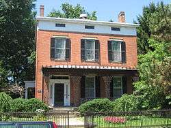 Vanmeter Church Street House |
February 21, 1979 (#79001935) |
178 Church St. 39°20′10″N 82°59′29″W |
Chillicothe | |
| 42 | Anthony and Susan Cardinal Walke House |  Anthony and Susan Cardinal Walke House |
February 21, 2007 (#07000065) |
381 Western Ave. 39°20′06″N 82°59′55″W |
Chillicothe | |
| 43 | Wesley Chapel | 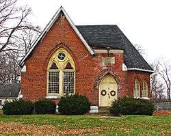 Wesley Chapel |
February 2, 1979 (#79001936) |
Off U.S. Route 23 at Hopetown 39°22′40″N 82°58′22″W |
Springfield Township |
Former listing
| [3] | Name on the Register | Image | Date listed | Date removed | Location | City or town | Summary |
|---|---|---|---|---|---|---|---|
| 1 | Kendrick-Barrett House |  Kendrick-Barrett House |
March 14, 1973 (#73001525) | November 25, 1977 | 475 Western Ave. 39°20′03″N 83°00′09″W |
Springfield Township |
See also
| Wikimedia Commons has media related to National Register of Historic Places in Ross County, Ohio. |
References
- The latitude and longitude information provided in this table was derived originally from the National Register Information System, which has been found to be fairly accurate for about 99% of listings. Some locations in this table may have been corrected to current GPS standards.
- "National Register of Historic Places: Weekly List Actions". National Park Service, United States Department of the Interior. Retrieved on June 26, 2020.
- Numbers represent an ordering by significant words. Various colorings, defined here, differentiate National Historic Landmarks and historic districts from other NRHP buildings, structures, sites or objects.
- "National Register Information System". National Register of Historic Places. National Park Service. April 24, 2008.
- The eight-digit number below each date is the number assigned to each location in the National Register Information System database, which can be viewed by clicking the number.
- Location derived from its Federal Register notice; the NRIS lists the site as "Address Restricted"
- Adena Mound Archived 2010-08-01 at the Wayback Machine, Ohio Historical Society, 2004. Accessed 2009-10-17.
- Location derived from Mills, William C. Archeological Atlas of Ohio. Columbus: Ohio State Archeological and Historical Society, 1914, pages 71-71A and plate 71. The NRIS lists the site as "Address Restricted".
- Location derived from Ohio Archaeological and Historical Quarterly, vol. 7. Columbus: Ohio State Archaeological and Historical Society, 1899, 137. Accessed 2009-10-19. The NRIS lists the site as "Address Restricted"
- Squier, E.G., and E.H. Davis. Ancient Monuments of the Mississippi Valley. Washington: Smithsonian, 1848, page 92 and plate 15.
- Owen, Lorrie K., ed. Dictionary of Ohio Historic Places. Vol. 2. St. Clair Shores: Somerset, 1999, 1214.
- Case, D. Troy, and Christopher Carr. The Scioto Hopewell and Their Neighbors: Bioarchaeological Documentation and Cultural Understanding. New York: Springer, 2007, Appendix 7.1.
- Location derived from the "Indian Mound" marked on USGS maps of Frankfort; the NRIS lists the site as "Address Restricted"
- Location derived from Moorehead, Warren King. Primitive Man in Ohio. New York: Knickerbocker, 1892, 145. Accessed 2009-10-20. The NRIS lists the site as "Address Restricted".
- Location derived from this National Park Service document; the NRIS lists the site as "Address Restricted"
- Location derived from this National Park Service webpage; the NRIS lists the site as "Address Restricted"
- Location derived from Proceedings of the Academy of Natural Sciences of Philadelphia, Academy of Natural Sciences of Philadelphia, 1894, 314. Accessed 2009-10-19. The NRIS lists the site as "Address Restricted"
- Location derived from DeLorme. Ohio Atlas & Gazetteer. 7th ed. Yarmouth: DeLorme, 2004, 77. ISBN 0-89933-281-1. The NRIS lists the site as "Address Restricted".

Municipalities and communities of Ross County, Ohio, United States | ||
|---|---|---|
| City | Map of Ohio highlighting Ross County | |
| Villages | ||
| Townships | ||
| CDPs | ||
| Unincorporated communities |
| |
| Ghost town | ||
| Footnotes | ‡This populated place also has portions in an adjacent county or counties | |
This article is issued from Wikipedia. The text is licensed under Creative Commons - Attribution - Sharealike. Additional terms may apply for the media files.