National Register of Historic Places listings in Licking County, Ohio
This is a list of the National Register of Historic Places listings in Licking County, Ohio.
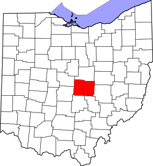
Location of Licking County in Ohio
This is intended to be a complete list of the properties and districts on the National Register of Historic Places in Licking County, Ohio, United States. The locations of National Register properties and districts for which the latitude and longitude coordinates are included below, may be seen in an online map.[1]
There are 63 properties and districts listed on the National Register in the county, including 1 National Historic Landmark.
- This National Park Service list is complete through NPS recent listings posted June 19, 2020.[2]
Current listings
| [3] | Name on the Register[4] | Image | Date listed[5] | Location | City or town | Description |
|---|---|---|---|---|---|---|
| 1 | Alligator Effigy Mound | 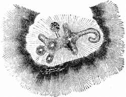 Alligator Effigy Mound |
November 5, 1971 (#71000643) |
End of Bryn Du Dr.[6] 40°04′12″N 82°30′04″W |
Granville | |
| 2 | Avery-Hunter House |  Avery-Hunter House |
December 27, 1979 (#79001877) |
221 E. Broadway 40°04′03″N 82°31′04″W |
Granville | |
| 3 | A.A. Bancroft House |  A.A. Bancroft House |
November 28, 1980 (#80003135) |
N. Pearl St. and Washington Dr. 40°04′27″N 82°31′06″W |
Granville | |
| 4 | Belle Hall Covered Bridge |  Belle Hall Covered Bridge |
October 22, 1976 (#76001464) |
East of Hartford on Dutch Cross Rd. 40°14′08″N 82°38′26″W |
Bennington Township | |
| 5 | Bethel Baptist Church | 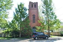 Bethel Baptist Church |
September 22, 1983 (#83001990) |
Vine and Cedar Sts. 40°00′00″N 82°40′40″W |
Pataskala | |
| 6 | Bryn Mawr | 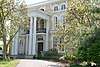 Bryn Mawr |
March 29, 1983 (#83001991) |
3758 Lancaster Rd., SW., south of Granville 40°02′06″N 82°31′25″W |
Union Township | |
| 7 | Buxton Inn |  Buxton Inn |
December 26, 1972 (#72001029) |
313 E. Broadway 40°04′03″N 82°30′58″W |
Granville | |
| 8 | Wallace W. Carpenter House | 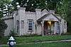 Wallace W. Carpenter House |
November 28, 1980 (#80003136) |
323 Summit Dr. 40°04′11″N 82°30′57″W |
Granville | |
| 9 | Casterton House |  Casterton House |
September 22, 1983 (#83001992) |
105 Broadway 39°59′37″N 82°40′42″W |
Pataskala | |
| 10 | Cedar Hill Cemetery Buildings | 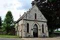 Cedar Hill Cemetery Buildings |
April 13, 1977 (#77001071) |
Cedar St. 40°04′04″N 82°23′10″W |
Newark | |
| 11 | Courthouse Center |  Courthouse Center |
November 29, 1979 (#79001879) |
35-37 S. Park Pl. and junction of S. Park and S. 2nd St. 40°03′26″N 82°24′03″W |
Newark | |
| 12 | The Dawes Arboretum |  The Dawes Arboretum |
August 11, 2016 (#16000525) |
7770 Jacksontown Rd., SE. 39°58′44″N 82°25′01″W |
Licking Township | |
| 13 | Dixon Mound |  Dixon Mound |
June 4, 1973 (#73001494) |
Next to the Homer Public Library in Homer[7] 40°15′05″N 82°31′28″W |
Burlington Township | |
| 14 | Dustin Cabin |  Dustin Cabin |
November 28, 1980 (#80003137) |
597 N. Pearl St. 40°04′30″N 82°31′08″W |
Granville | |
| 15 | Elliot House |  Elliot House |
November 14, 1983 (#83004315) |
301 S. Main St. 39°59′49″N 82°40′32″W |
Pataskala | |
| 16 | Etna Township Mounds I And II | September 5, 1975 (#75001457) |
East of Reynoldsburg off Interstate 70[8] |
Etna Township | ||
| 17 | Evans-Holton-Owens House | 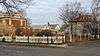 Evans-Holton-Owens House |
October 16, 1986 (#86002874) |
162 W. Locust St. 40°03′32″N 82°24′38″W |
Newark | Destroyed by fire in 2009[9] |
| 18 | Flint Ridge State Memorial |  Flint Ridge State Memorial |
November 10, 1970 (#70000505) |
2 mi (3.2 km) north of Brownsville 39°59′10″N 82°16′04″W |
Hopewell Township | |
| 19 | Fuller House |  Fuller House |
March 22, 1991 (#91000304) |
203 N. Main St. 40°14′13″N 82°27′10″W |
Utica | |
| 20 | Granville Historic District | 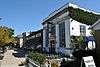 Granville Historic District |
November 28, 1980 (#80003138) |
State Route 37 40°04′04″N 82°31′10″W |
Granville | |
| 21 | Home Building Association Bank | 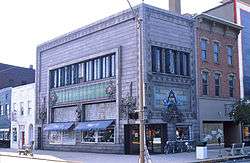 Home Building Association Bank |
July 2, 1973 (#73001495) |
6 W. Main St. 40°03′28″N 82°24′09″W |
Newark | |
| 22 | Hudson Avenue Historic District |  Hudson Avenue Historic District |
March 18, 1987 (#86003506) |
Hudson Ave. between Stevens St. and State Route 16 40°04′10″N 82°24′30″W |
Newark | |
| 23 | Hull Place |  Hull Place |
December 21, 1979 (#79001880) |
686 W. Main St. 40°03′08″N 82°25′43″W |
Newark | |
| 24 | Jersey Independent Order of Odd Fellows Hall |  Jersey Independent Order of Odd Fellows Hall |
March 22, 2018 (#100002232) |
10424 Morse Rd., SW. 40°03′13″N 82°43′22″W |
Jersey Township | |
| 25 | Johnstown Jail |  Johnstown Jail |
April 18, 2003 (#03000274) |
66 W. Pratt St. 40°09′06″N 82°41′08″W |
Johnstown | |
| 26 | Warren F. Kauber Funeral Home |  Warren F. Kauber Funeral Home |
September 22, 1983 (#83001993) |
289 S. Main St. 39°59′50″N 82°40′32″W |
Pataskala | |
| 27 | Licking County Courthouse |  Licking County Courthouse |
March 20, 1973 (#73001496) |
Courthouse Sq. 40°03′28″N 82°24′06″W |
Newark | |
| 28 | Lynnwood Farm |  Lynnwood Farm |
June 22, 1979 (#79001878) |
South of Johnstown at 4986 Caswell Rd. 40°07′40″N 82°40′22″W |
Monroe Township | |
| 29 | McCune's Villa | 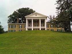 McCune's Villa |
April 22, 1982 (#82003602) |
537 Jones Rd., northeast of Granville 40°05′07″N 82°29′33″W |
Granville Township | |
| 30 | McDaniel Mound | May 2, 1974 (#74001545) |
Address Restricted |
Washington Township | Near Utica | |
| 31 | McNamar-McLure-Miller Residence |  McNamar-McLure-Miller Residence |
June 17, 1982 (#82003603) |
124 W. Main St. 40°03′24″N 82°24′27″W |
Newark | |
| 32 | Mead House |  Mead House |
September 22, 1983 (#83001994) |
245 S. Main St. 39°59′54″N 82°40′33″W |
Pataskala | |
| 33 | Melick Mound | March 27, 1974 (#74001546) |
South of the North Fork of the Licking River, near Utica[8] |
Washington Township | ||
| 34 | Monroe Township Hall-Opera House |  Monroe Township Hall-Opera House |
July 6, 1981 (#81000446) |
1 S. Main St. 40°09′14″N 82°41′04″W |
Johnstown | |
| 35 | Newark Downtown Historic District |  Newark Downtown Historic District |
January 15, 2002 (#01001482) |
Roughly bounded by Church St., 2nd St., 5th St., and Canal St. 40°03′29″N 82°24′12″W |
Newark | |
| 36 | Newark Earthworks | 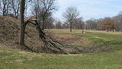 Newark Earthworks |
October 15, 1966 (#66000614) |
Roughly bounded by Union, 30th, James, and Waldo Sts., and State Route 16 40°03′07″N 82°26′55″W |
Heath and Newark | |
| 37 | Newark High School |  Newark High School |
September 14, 2015 (#15000613) |
112 W. Main St., 9 N. 5th St. 40°03′24″N 82°24′24″W |
Newark | Now McGuffey Elementary School |
| 38 | Oakwood |  Oakwood |
May 29, 1980 (#80003141) |
64-70 Penney Ave. 40°03′41″N 82°23′03″W |
Newark | |
| 39 | Ohio Canal Groundbreaking Site |  Ohio Canal Groundbreaking Site |
May 24, 1973 (#73001493) |
State Route 79 40°00′46″N 82°27′27″W |
Heath | |
| 40 | Old Colony Burying Ground |  Old Colony Burying Ground |
June 10, 2005 (#05000577) |
250 S. Main St. 40°03′55″N 82°31′12″W |
Granville | |
| 41 | Outville Depot |  Outville Depot |
August 22, 1995 (#95001034) |
6750 Outville Rd., SW., east of Pataskala 39°59′41″N 82°35′49″W |
Harrison Township | |
| 42 | Outville Hay and Grain Company Building | 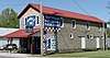 Outville Hay and Grain Company Building |
March 22, 2018 (#100002233) |
6641 Outville Rd., SW. 39°59′41″N 82°35′47″W |
Harrison Township | |
| 43 | Pataskala Banking Company | 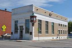 Pataskala Banking Company |
September 22, 1983 (#83001996) |
354 S. Main St. 39°59′45″N 82°40′31″W |
Pataskala | |
| 44 | Pataskala Elementary School |  Pataskala Elementary School |
September 22, 1983 (#83001995) |
396 S. High St. 40°00′00″N 82°40′42″W |
Pataskala | |
| 45 | Pataskala Jail |  Pataskala Jail |
September 22, 1983 (#83001997) |
Main St. 39°59′56″N 82°40′31″W |
Pataskala | |
| 46 | Pataskala Presbyterian Church | 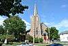 Pataskala Presbyterian Church |
November 14, 1983 (#83004323) |
Atkinson and Main Sts. 39°59′40″N 82°40′32″W |
Pataskala | |
| 47 | Pataskala Town Hall |  Pataskala Town Hall |
September 22, 1983 (#83001998) |
430 Main St. 39°59′38″N 82°40′30″W |
Pataskala | |
| 48 | Pataskala United Methodist Church |  Pataskala United Methodist Church |
September 22, 1983 (#83001999) |
458 S. Main St. 39°59′36″N 82°40′30″W |
Pataskala | |
| 49 | Pennsylvania Railway Station | 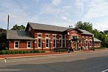 Pennsylvania Railway Station |
November 29, 1979 (#79001881) |
25 E. Walnut St. 40°03′20″N 82°24′02″W |
Newark | |
| 50 | Anthony Pitzer, Jr., House |  Anthony Pitzer, Jr., House |
August 25, 1988 (#88001297) |
6019 White Chapel Rd., south of Newark 39°59′54″N 82°25′41″W |
Licking Township | |
| 51 | Peter F. Rhoads House |  Peter F. Rhoads House |
November 28, 1980 (#80003142) |
74 Granville St. 40°03′38″N 82°24′34″W |
Newark | |
| 52 | Rodrick Bridge | .jpg) Rodrick Bridge |
May 22, 1998 (#98000442) |
North of Granville Rd. between Hall Ave. and Village Dr. W 40°04′05″N 82°26′26″W |
Newark | Moved;[10] originally located southeast of Coshocton, Ohio[11] |
| 53 | Rogers House | 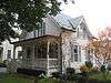 Rogers House |
November 28, 1980 (#80003139) |
304 N. Pearl St. 40°04′13″N 82°30′59″W |
Granville | |
| 54 | Capt. Levi Rose House |  Capt. Levi Rose House |
November 28, 1980 (#80003140) |
631 N. Pearl St. 40°03′59″N 82°31′15″W |
Granville | |
| 55 | St. Luke's Episcopal Church |  St. Luke's Episcopal Church |
April 26, 1976 (#76001465) |
111 E. Broadway St. 40°04′03″N 82°31′11″W |
Granville | |
| 56 | Martin Shaub Mill Site/House |  Martin Shaub Mill Site/House |
January 23, 1985 (#85000119) |
8259 Duncan Plains Rd., northwest of Alexandria 40°06′25″N 82°38′53″W |
St. Albans Township | |
| 57 | Sherwood-Davidson and Buckingham Houses |  Sherwood-Davidson and Buckingham Houses |
November 10, 1977 (#77001072) |
W. Main and 6th Sts. 40°03′23″N 82°24′36″W |
Newark | |
| 58 | Shield's Block |  Shield's Block |
November 29, 1978 (#78002101) |
23-29 S. Park Pl. 40°03′26″N 82°24′03″W |
Newark | |
| 59 | Edwin Stanbery Office | November 30, 1978 (#78002100) |
1 mi (1.6 km) east of central Granville 40°04′03″N 82°30′31″W |
Granville | ||
| 60 | Upham-Wright House |  Upham-Wright House |
June 22, 1979 (#79001882) |
342 Granville St. 40°03′49″N 82°25′10″W |
Newark | |
| 61 | Upland Farm |  Upland Farm |
December 1, 1978 (#78002102) |
North of Newark off State Route 657 40°10′31″N 82°27′07″W |
Newton Township | |
| 62 | West Side Planing Mill (rear) |  West Side Planing Mill (rear) |
January 21, 1983 (#83002000) |
197 Maholm St. 40°03′03″N 82°25′40″W |
Newark | |
| 63 | Elias Williams House |  Elias Williams House |
April 16, 1979 (#79001883) |
565 Granville St. 40°03′53″N 82°25′39″W |
Newark |
See also
| Wikimedia Commons has media related to National Register of Historic Places in Licking County, Ohio. |
References
- The latitude and longitude information provided in this table was derived originally from the National Register Information System, which has been found to be fairly accurate for about 99% of listings. Some locations in this table may have been corrected to current GPS standards.
- "National Register of Historic Places: Weekly List Actions". National Park Service, United States Department of the Interior. Retrieved on June 19, 2020.
- Numbers represent an ordering by significant words. Various colorings, defined here, differentiate National Historic Landmarks and historic districts from other NRHP buildings, structures, sites or objects.
- "National Register Information System". National Register of Historic Places. National Park Service. April 24, 2008.
- The eight-digit number below each date is the number assigned to each location in the National Register Information System database, which can be viewed by clicking the number.
- Location derived from this Ohio Historical Society webpage; the NRIS lists the site as "Address Restricted"
- Location derived from page 10 of this Archived 2010-09-27 at the Wayback Machine Burlington Township document; the NRIS lists the site as "Address Restricted"
- Location derived from its Federal Register notice; the NRIS lists the site as "Address Restricted"
- , Newark Advocate, 2009. Accessed 2012-09-16.
- Rodrick Bridge, Ohio Historical Society, 2007. Accessed 2010-07-23.
- Rodrick Bridge, Ohio Historical Society, 2007. Accessed 2010-07-23.

Municipalities and communities of Licking County, Ohio, United States | ||
|---|---|---|
| Cities | Map of Ohio highlighting Licking County | |
| Villages | ||
| Townships | ||
| CDPs | ||
| Unincorporated communities | ||
| Ghost towns | ||
| Footnotes | ‡This populated place also has portions in an adjacent county or counties | |
This article is issued from Wikipedia. The text is licensed under Creative Commons - Attribution - Sharealike. Additional terms may apply for the media files.