National Register of Historic Places listings in Ashland County, Ohio
This is a list of the National Register of Historic Places listings in Ashland County, Ohio.
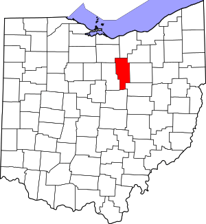
Location of Ashland County in Ohio
This is intended to be a complete list of the properties and districts on the National Register of Historic Places in Ashland County, Ohio, United States. The locations of National Register properties and districts for which the latitude and longitude coordinates are included below, may be seen in an online map.[1]
There are 18 properties and districts listed on the National Register in the county. Another 2 properties were once listed but have been removed.
- This National Park Service list is complete through NPS recent listings posted June 26, 2020.[2]
Current listings
| [3] | Name on the Register[4] | Image | Date listed[5] | Location | City or town | Description |
|---|---|---|---|---|---|---|
| 1 | Anderson Schoolhouse |  Anderson Schoolhouse |
March 25, 1977 (#77001040) |
Southwest of Ashland on U.S. Route 42 40°50′30″N 82°21′32″W |
Milton Township | |
| 2 | Ashland County Children's Home | June 17, 2019 (#100004059) |
1260 Center St. 40°51′23″N 82°18′40″W |
Ashland | ||
| 3 | Ashland County Courthouse |  Ashland County Courthouse |
December 21, 1979 (#79003786) |
W. 2nd St. 40°52′10″N 82°19′03″W |
Ashland | |
| 4 | Philip J. Black House |  Philip J. Black House |
May 29, 1980 (#80002935) |
303 N. Water St. 40°38′18″N 82°14′07″W |
Loudonville | |
| 5 | T.J. and Sarah Bull House |  T.J. and Sarah Bull House |
April 12, 2007 (#07000302) |
109 S. Market St. 40°38′06″N 82°14′00″W |
Loudonville | |
| 6 | Center Street Historic District | 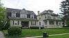 Center Street Historic District |
June 18, 1976 (#76001362) |
Center St. from Vernon to 414 Center St.; also Center St. between Town Creek and Walnut St. and between Samaritan and Morgan Aves. 40°51′46″N 82°18′45″W |
Ashland | Second set of boundaries represents a boundary increase of May 6, 1993 |
| 7 | City Hall and Opera House | 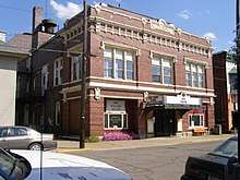 City Hall and Opera House |
January 25, 1997 (#96001618) |
156 N. Water St. 40°38′11″N 82°14′05″W |
Loudonville | |
| 8 | Crittenden Farm |  Crittenden Farm |
April 22, 1982 (#82003540) |
Northwest of Savannah on U.S. Routes 224 and 250 41°01′43″N 82°25′37″W |
Ruggles Township | |
| 9 | John Crumrine Farm | 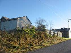 John Crumrine Farm |
December 7, 1990 (#90001778) |
792 County Road 40 north of Nova 41°03′29″N 82°16′50″W |
Troy Township | |
| 10 | Michael Crumrine Farm |  Michael Crumrine Farm |
December 7, 1990 (#90001779) |
871 County Road 40 north of Nova 41°03′27″N 82°17′42″W |
Troy Township | |
| 11 | Downtown Ashland Historic District | 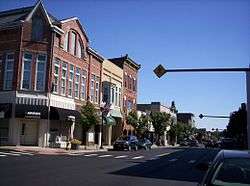 Downtown Ashland Historic District |
January 23, 2013 (#12001209) |
Roughly bounded by Cottage-Claremont Ave., 3rd, 4th, and Union Sts., and Town Creek 40°52′08″N 82°18′56″W |
Ashland | |
| 12 | John Garst House |  John Garst House |
April 29, 1982 (#82003539) |
Northeast of Loudonville on State Route 95 40°43′40″N 82°11′52″W |
Mohican Township | |
| 13 | Hayesville Opera House | 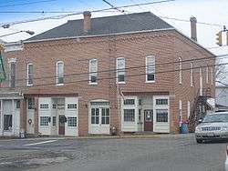 Hayesville Opera House |
May 6, 1976 (#76001364) |
1 E. Main St. 40°46′23″N 82°15′42″W |
Hayesville | |
| 14 | William Kelley Hardware Store-Hayesville Odd Fellows Hall |  William Kelley Hardware Store-Hayesville Odd Fellows Hall |
February 14, 2017 (#100000662) |
7 E. Main St. 40°46′23″N 82°15′42″W |
Hayesville | |
| 15 | Lakefork School |  Lakefork School |
March 5, 1982 (#82003538) |
Southeast of Jeromesville 40°45′17″N 82°08′47″W |
Mohican Township | |
| 16 | Myers Block-Home Company Building |  Myers Block-Home Company Building |
February 5, 1997 (#96001620) |
1 E. Main St. 40°52′06″N 82°18′53″W |
Ashland | |
| 17 | Sprott's Hill Mounds Site |  Sprott's Hill Mounds Site |
January 31, 1976 (#76001363) |
Western side of Township Road 1193 between Bailey Lake and Ashland[6] 40°54′49″N 82°21′42″W |
Clear Creek Township | Two mounds, located on Sprott's Hill[7] |
| 18 | Vermillion Institute |  Vermillion Institute |
March 29, 1978 (#78002000) |
Main and College Sts. 40°46′26″N 82°15′20″W |
Hayesville |
Former listings
| [3] | Name on the Register | Image | Date listed | Date removed | Location | City or town | Summary |
|---|---|---|---|---|---|---|---|
| 1 | Ashland County Jail | December 12, 1976 (#76001361) | February 27, 1978 | W. 2nd and Cottage Streets 40°52′10″N 82°19′05″W |
Ashland | ||
| 2 | First National Bank and Firestone Building | Unavailable (#76002288) | January 1, 1978 | 2-10 W. Main Street 40°52′08″N 82°18′55″W |
Ashland |
See also
| Wikimedia Commons has media related to National Register of Historic Places in Ashland County, Ohio. |
References
- The latitude and longitude information provided in this table was derived originally from the National Register Information System, which has been found to be fairly accurate for about 99% of listings. Some locations in this table may have been corrected to current GPS standards.
- "National Register of Historic Places: Weekly List Actions". National Park Service, United States Department of the Interior. Retrieved on June 26, 2020.
- Numbers represent an ordering by significant words. Various colorings, defined here, differentiate National Historic Landmarks and historic districts from other NRHP buildings, structures, sites or objects.
- "National Register Information System". National Register of Historic Places. National Park Service. April 24, 2008.
- The eight-digit number below each date is the number assigned to each location in the National Register Information System database, which can be viewed by clicking the number.
- Location derived from the GNIS feature record for Sprott's Hill, on which the mounds are located; the NRIS lists the site as "Address Restricted".
- Thomas, Mrs. Cyrus. Bibliography of the Earthworks of Ohio. Washington: Smithsonian Institution, 1888. Accessed 2009-07-22.

Municipalities and communities of Ashland County, Ohio, United States | ||
|---|---|---|
| City | Map of Ohio highlighting Ashland County | |
| Villages | ||
| Townships | ||
| CDP | ||
| Unincorporated communities | ||
| Footnotes | ‡This populated place also has portions in an adjacent county or counties | |
This article is issued from Wikipedia. The text is licensed under Creative Commons - Attribution - Sharealike. Additional terms may apply for the media files.