National Register of Historic Places listings in Montgomery County, Ohio
This is a list of the National Register of Historic Places listings in Montgomery County, Ohio.
This is intended to be a complete list of the properties and districts on the National Register of Historic Places in Montgomery County, Ohio, United States. The locations of National Register properties and districts for which the latitude and longitude coordinates are included below, may be seen in an online map.[1]
There are 152 properties and districts listed on the National Register in the county, including 7 National Historic Landmarks. The city of Dayton is the location of 110 of these properties and districts, including 5 National Historic Landmarks; they are listed separately, while the remaining properties and districts are listed here. A single property, the Miami Valley Golf Course and Clubhouse, is split between Dayton and other parts of the county, and it thus appears on both lists. Another 2 properties were once listed but have been removed.
- This National Park Service list is complete through NPS recent listings posted June 19, 2020.[2]
Current listings
Dayton
Outside Dayton
| [3] | Name on the Register[4] | Image | Date listed[5] | Location | City or town | Description |
|---|---|---|---|---|---|---|
| 1 | Arnold Homestead |  Arnold Homestead |
November 7, 1977 (#77001077) |
North of Dayton on State Route 201 39°52′20″N 84°05′46″W |
Huber Heights | |
| 2 | Aullwood House and Garden | 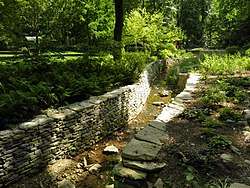 Aullwood House and Garden |
February 5, 1999 (#99000092) |
900 Aullwood Rd., northwest of Dayton 39°52′05″N 84°16′32″W |
Butler Township | |
| 3 | Ausenbaugh-McElhenny House |  Ausenbaugh-McElhenny House |
July 18, 1975 (#75001503) |
7373 Taylorsville Rd. 39°51′39″N 84°06′09″W |
Huber Heights | |
| 4 | George Bixler Farm |  George Bixler Farm |
August 22, 2002 (#02000888) |
13213 Providence Pike, south of Brookville 39°48′19″N 84°25′40″W |
Perry Township | |
| 5 | Robert Bradford House |  Robert Bradford House |
March 21, 1979 (#79001897) |
South of Centerville on Social Row Rd. 39°35′22″N 84°08′26″W |
Washington Township | |
| 6 | Erma Bombeck House | 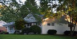 Erma Bombeck House |
February 23, 2015 (#15000043) |
162 Cushwa Dr. 39°38′32″N 84°09′07″W |
Centerville | |
| 7 | Carlisle Fort |  Carlisle Fort |
February 15, 1974 (#74001584) |
Western bank of Twin Creek, south of Germantown[6] 39°35′26″N 84°21′15″W |
German Township | |
| 8 | Centerville Historic District | 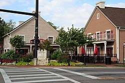 Centerville Historic District |
December 17, 1974 (#74001577) |
Irregular pattern at Franklin and Main Sts. 39°37′42″N 84°09′38″W |
Centerville | |
| 9 | Deerwood Farm |  Deerwood Farm |
November 12, 1975 (#75001507) |
North of Dayton at 7200 Peters Pike 39°51′07″N 84°13′37″W |
Butler Township | |
| 10 | Emmanuel's Evangelical Lutheran Church |  Emmanuel's Evangelical Lutheran Church |
September 6, 1990 (#90001292) |
30 W. Warren St. 39°37′40″N 84°22′18″W |
Germantown | |
| 11 | Joseph Flory House | 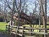 Joseph Flory House |
March 29, 1978 (#78002143) |
Northwest of Clayton on Diamond Mill Rd. 39°51′58″N 84°22′07″W |
Clay Township | |
| 12 | Fox Hollow |  Fox Hollow |
June 9, 2006 (#06000481) |
6320 Mad River Rd. 39°39′22″N 84°11′29″W |
Washington Township | |
| 13 | Gunckel's Town Plan Historic District | 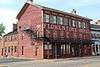 Gunckel's Town Plan Historic District |
May 13, 1976 (#76001502) |
Roughly bounded by Mulberry and Walnut Sts. and Warren and Market Sts. 39°37′32″N 84°22′14″W |
Germantown | |
| 14 | Hawthorn Hill |  Hawthorn Hill |
October 18, 1974 (#74001585) |
Harman and Park Aves. 39°43′20″N 84°10′34″W |
Oakwood | |
| 15 | Jacob's Church |  Jacob's Church |
September 6, 1990 (#90001290) |
213 E. Central Ave. 39°38′31″N 84°17′11″W |
Miamisburg | |
| 16 | Ethol Kellog House |  Ethol Kellog House |
June 18, 1976 (#76001498) |
West of Centerville off State Route 725 on Yankee St. 39°37′47″N 84°12′02″W |
Washington Township | |
| 17 | Charles F. Kettering House |  Charles F. Kettering House |
December 22, 1977 (#77001080) |
3965 Southern Boulevard 39°41′37″N 84°11′38″W |
Kettering | Burned down in 1995. |
| 18 | Koehne-Poast Farm | 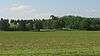 Koehne-Poast Farm |
April 11, 1977 (#77001079) |
West of Germantown off State Route 725 39°37′29″N 84°23′08″W |
German Township and Germantown | |
| 19 | Krug House |  Krug House |
August 12, 1992 (#92000973) |
3473 Sweet Potato Ridge Rd. 39°53′30″N 84°19′10″W |
Union | |
| 20 | Long-Mueller House |  Long-Mueller House |
April 23, 1987 (#87000637) |
986 Laurelwood Rd. 39°42′02″N 84°11′16″W |
Kettering | |
| 21 | Long-Romspert House |  Long-Romspert House |
December 21, 1987 (#87001522) |
1947 Far Hills Ave. 39°42′51″N 84°10′20″W |
Oakwood | |
| 22 | Market Square | 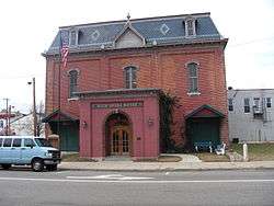 Market Square |
November 10, 1975 (#75001510) |
Both sides of Main St. including junctions at Central and Linden Aves. 39°38′27″N 84°17′22″W |
Miamisburg | |
| 23 | Samuel Martindale House |  Samuel Martindale House |
May 22, 1978 (#78002148) |
Northeast of Englewood off U.S. Route 40 39°53′43″N 84°16′54″W |
Butler Township | |
| 24 | Miami-Erie Canal Lock No. 70 |  Miami-Erie Canal Lock No. 70 |
December 20, 1982 (#82001479) |
Fishburg and Endicott Rds. 39°50′28″N 84°09′32″W |
Huber Heights | |
| 25 | Miamisburg Mound |  Miamisburg Mound |
November 10, 1970 (#70000511) |
Southeast of Miamisburg on State Route 725 39°37′38″N 84°16′51″W |
Miamisburg | |
| 26 | Miami Valley Golf Course and Clubhouse | 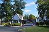 Miami Valley Golf Course and Clubhouse |
June 30, 2015 (#15000372) |
3311 Salem Ave. 39°47′31″N 84°14′34″W |
Harrison Township | Extends into Dayton |
| 27 | Normandy Farms |  Normandy Farms |
November 25, 1983 (#83004322) |
450 W. Alex-Bell Rd., northwest of Centerville 39°38′43″N 84°10′08″W |
Washington Township | |
| 28 | Pease Homestead | 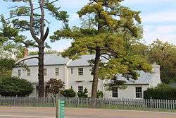 Pease Homestead |
August 11, 1980 (#80003169) |
2123 Alexander-Bellbrook Rd., northwest of Centerville 39°40′17″N 84°12′23″W |
Miami Township | |
| 29 | David Rohr Mansion and Carriage House |  David Rohr Mansion and Carriage House |
May 22, 1978 (#78002149) |
Astoria Rd. and State Route 725 39°37′20″N 84°23′06″W |
Germantown | |
| 30 | Salem Bear Creek Church, Salem Evangelical Lutheran Church |  Salem Bear Creek Church, Salem Evangelical Lutheran Church |
September 6, 1990 (#90001291) |
Roughly bounded by Union Rd., Dayton Germantown Pike, and Bear Creek 39°40′48″N 84°18′34″W |
Moraine | |
| 31 | Schantz Park Historic District |  Schantz Park Historic District |
October 16, 1992 (#92001492) |
Roughly bounded by Far Hills, Irving, Mahart and Schenck Aves. 39°43′54″N 84°10′37″W |
Oakwood | |
| 32 | Adam Schantz, Sr., House | 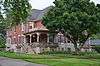 Adam Schantz, Sr., House |
March 7, 1980 (#80003178) |
314-316 Schantz Ave. 39°43′54″N 84°10′35″W |
Oakwood | |
| 33 | Schuter Carpenter Shop and House |  Schuter Carpenter Shop and House |
September 27, 1980 (#80003179) |
3224 W. Alexandersville-Bellbrook Rd., east of West Carrollton 39°40′24″N 84°13′37″W |
Miami Township | |
| 34 | Shuey's Mill |  Shuey's Mill |
September 5, 1975 (#75001508) |
Main St. 39°37′15″N 84°22′13″W |
Germantown | |
| 35 | Skywood Farms |  Skywood Farms |
February 22, 1996 (#96000117) |
732 W. Alex-Bell Rd., northwest of Centerville 39°38′58″N 84°10′46″W |
Washington Township | |
| 36 | Samuel Spitler House | 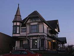 Samuel Spitler House |
September 28, 1973 (#73001507) |
14 Market St. 39°50′08″N 84°24′50″W |
Brookville | Designed by architect George Franklin Barber |
| 37 | John Stump House and Mill | 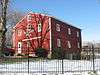 John Stump House and Mill |
July 7, 1975 (#75001509) |
Southwest of Germantown at the junction of Sigel and Oxford Rds. 39°37′02″N 84°23′28″W |
German Township | |
| 38 | Taylorsville Canal Inn |  Taylorsville Canal Inn |
November 16, 1977 (#77001078) |
4240 Taylorsville Rd. 39°51′48″N 84°09′54″W |
Huber Heights | |
| 39 | Trailsend |  Trailsend |
May 22, 1979 (#79001905) |
3500 Governors Trail 39°42′04″N 84°11′57″W |
Kettering | |
| 40 | Trotwood Railroad Station and Depot |  Trotwood Railroad Station and Depot |
January 26, 1981 (#81000448) |
2 E. Main St. 39°47′49″N 84°18′40″W |
Trotwood | |
| 41 | Watkins House |  Watkins House |
December 24, 1974 (#74001578) |
9950 Lebanon Pike, south of Centerville 39°35′57″N 84°09′40″W |
Washington Township | |
| 42 | Wright Library | 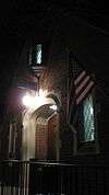 Wright Library |
December 24, 2013 (#13000981) |
1776 Far Hills Ave. 39°42′56″N 84°10′16″W |
Oakwood | |
| 43 | Wolf Creek Mound |  Wolf Creek Mound |
June 4, 1973 (#73001511) |
Atop the highest hill at the confluence of Poplar Run and Wolf Creek, west of central Trotwood[7]:15 39°48′14″N 84°20′48″W |
Trotwood |
Former listings
| [3] | Name on the Register | Image | Date listed | Date removed | Location | City or town | Summary |
|---|---|---|---|---|---|---|---|
| 1 | John Beard Farm | May 5, 1978[8] (#75002151) | 1999 | South of Vandalia on Mulberry Lane |
Vandalia | ||
| 2 | Germantown Covered Bridge | .jpg) Germantown Covered Bridge |
September 3, 1971 (#71000647) | 1999 | Center St., over Little Twin Creek |
Germantown |
See also
| Wikimedia Commons has media related to National Register of Historic Places in Montgomery County, Ohio. |
References
- The latitude and longitude information provided in this table was derived originally from the National Register Information System, which has been found to be fairly accurate for about 99% of listings. Some locations in this table may have been corrected to current GPS standards.
- "National Register of Historic Places: Weekly List Actions". National Park Service, United States Department of the Interior. Retrieved on June 19, 2020.
- Numbers represent an ordering by significant words. Various colorings, defined here, differentiate National Historic Landmarks and historic districts from other NRHP buildings, structures, sites or objects.
- "National Register Information System". National Register of Historic Places. National Park Service. April 24, 2008.
- The eight-digit number below each date is the number assigned to each location in the National Register Information System database, which can be viewed by clicking the number.
- Location derived from Mills, William C. Archeological Atlas of Ohio. Columbus: Ohio State Archeological and Historical Society, 1914, page 57 and plate 57. The NRIS lists the site as "Address Restricted".
- Koleszar, Stephen C. An Archaeological Survey of Southwestern Ohio. Columbus: Ohio Historical Society, 1970.
- 44 FR 7562

Municipalities and communities of Montgomery County, Ohio, United States | ||
|---|---|---|
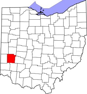
| Cities | Map of Ohio highlighting Montgomery County | |
| Villages | ||
| Townships | ||
| CDPs | ||
| Unincorporated communities | ||
| Ghost towns | ||
| Footnotes | ‡This populated place also has portions in an adjacent county or counties | |