Adelphi, Ohio
Adelphi is a village in Ross County, Ohio, United States. The population was 380 at the 2010 census.
Adelphi, Ohio | |
|---|---|
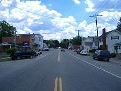 Along State Route 180 | |
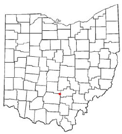 Location of Adelphi, Ohio | |
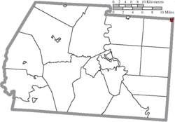 Location of Adelphi in Ross County | |
| Coordinates: 39°27′58″N 82°44′45″W | |
| Country | United States |
| State | Ohio |
| County | Ross |
| Area | |
| • Total | 0.27 sq mi (0.70 km2) |
| • Land | 0.27 sq mi (0.70 km2) |
| • Water | 0 sq mi (0 km2) |
| Elevation | 840 ft (256 m) |
| Population | |
| • Total | 380 |
| • Estimate (2019[4]) | 375 |
| • Density | 1,407.4/sq mi (543.4/km2) |
| Time zone | UTC-5 (Eastern (EST)) |
| • Summer (DST) | UTC-4 (EDT) |
| ZIP code | 43101 |
| Area code(s) | 740 |
| FIPS code | 39-00450[5] |
| GNIS feature ID | 1064300[2] |
Adelphi was laid out in 1804 by two brothers, and named after the Greek word for "brothers".[6] Adelphi was incorporated as a village in 1838.[7]
Geography
Adelphi is located at 39°27′58″N 82°44′45″W (39.466041, -82.745707).[8]
According to the United States Census Bureau, the village has a total area of 0.27 square miles (0.70 km2), all land.[1]
Demographics
| Historical population | |||
|---|---|---|---|
| Census | Pop. | %± | |
| 1820 | 132 | — | |
| 1830 | 247 | 87.1% | |
| 1840 | 250 | 1.2% | |
| 1850 | 412 | 64.8% | |
| 1860 | 378 | −8.3% | |
| 1870 | 417 | 10.3% | |
| 1880 | 469 | 12.5% | |
| 1890 | 489 | 4.3% | |
| 1900 | 516 | 5.5% | |
| 1910 | 407 | −21.1% | |
| 1920 | 329 | −19.2% | |
| 1930 | 412 | 25.2% | |
| 1940 | 414 | 0.5% | |
| 1950 | 392 | −5.3% | |
| 1960 | 441 | 12.5% | |
| 1970 | 455 | 3.2% | |
| 1980 | 472 | 3.7% | |
| 1990 | 398 | −15.7% | |
| 2000 | 371 | −6.8% | |
| 2010 | 380 | 2.4% | |
| Est. 2019 | 375 | [4] | −1.3% |
| U.S. Decennial Census[9] | |||
2010 census
As of the census[3] of 2010, there were 380 people, 154 households, and 100 families living in the village. The population density was 1,407.4 inhabitants per square mile (543.4/km2). There were 175 housing units at an average density of 648.1 per square mile (250.2/km2). The racial makeup of the village was 95.0% White, 1.6% African American, 0.3% Asian, and 3.2% from two or more races.
There were 154 households, of which 34.4% had children under the age of 18 living with them, 47.4% were married couples living together, 11.7% had a female householder with no husband present, 5.8% had a male householder with no wife present, and 35.1% were non-families. 29.2% of all households were made up of individuals, and 11.6% had someone living alone who was 65 years of age or older. The average household size was 2.47 and the average family size was 3.00.
The median age in the village was 39 years. 26.8% of residents were under the age of 18; 6.3% were between the ages of 18 and 24; 25.5% were from 25 to 44; 26.1% were from 45 to 64; and 15.3% were 65 years of age or older. The gender makeup of the village was 51.1% male and 48.9% female.
2000 census
As of the census[5] of 2000, there were 371 people, 156 households, and 111 families living in the village. The population density was 1,343.3 people per square mile (511.6/km²). There were 176 housing units at an average density of 637.3 per square mile (242.7/km²). The racial makeup of the village was 96.23% White, 2.96% African American, and 0.81% from two or more races. Hispanic or Latino of any race were 0.54% of the population.
There were 156 households, out of which 28.2% had children under the age of 18 living with them, 53.8% were married couples living together, 12.2% had a female householder with no husband present, and 28.8% were non-families. 26.3% of all households were made up of individuals, and 12.2% had someone living alone who was 65 years of age or older. The average household size was 2.38 and the average family size was 2.83.
In the village, the population was spread out, with 22.4% under the age of 18, 9.7% from 18 to 24, 28.8% from 25 to 44, 25.3% from 45 to 64, and 13.7% who were 65 years of age or older. The median age was 38 years. For every 100 females there were 101.6 males. For every 100 females age 18 and over, there were 97.3 males.
The median income for a household in the village was $33,125, and the median income for a family was $37,143. Males had a median income of $30,250 versus $24,375 for females. The per capita income for the village was $14,657. About 13.2% of families and 13.6% of the population were below the poverty line, including 18.4% of those under age 18 and 23.3% of those age 65 or over.
Notable people
- Tella Kitchen (1902–1988), folk art painter
- John Purdue - founding benefactor of Purdue University; Purdue Block, Lafayette, Indiana; Tippecanoe County, Indiana, founder
References
- "US Gazetteer files 2010". United States Census Bureau. Archived from the original on 2012-01-24. Retrieved 2013-01-06.
- "US Board on Geographic Names". United States Geological Survey. 2007-10-25. Retrieved 2008-01-31.
- "U.S. Census website". United States Census Bureau. Retrieved 2013-01-06.
- "Population and Housing Unit Estimates". Retrieved May 21, 2020.
- "U.S. Census website". United States Census Bureau. Retrieved 2008-01-31.
- Overman, William Daniel (1958). Ohio Town Names. Akron, OH: Atlantic Press. p. 1.
- Federal Writers' Project (1938). Chillicothe and Ross County. Works Progress Administration. p. 75.
- "US Gazetteer files: 2010, 2000, and 1990". United States Census Bureau. 2011-02-12. Retrieved 2011-04-23.
- "Census of Population and Housing". Census.gov. Retrieved June 4, 2015.
Municipalities and communities of Ross County, Ohio, United States | ||
|---|---|---|
| City | 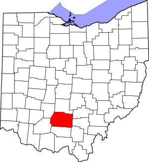 Map of Ohio highlighting Ross County | |
| Villages | ||
| Townships | ||
| CDPs | ||
| Unincorporated communities |
| |
| Ghost town | ||
| Footnotes | ‡This populated place also has portions in an adjacent county or counties | |
| Authority control |
|
|---|