National Register of Historic Places listings in Mercer County, Ohio
This is a list of the National Register of Historic Places listings in Mercer County, Ohio.
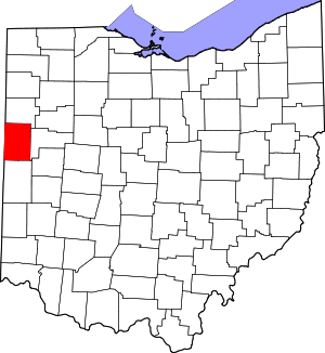
Location of Mercer County in Ohio
This is intended to be a complete list of the properties and districts on the National Register of Historic Places in Mercer County, Ohio, United States. The locations of National Register properties and districts for which the latitude and longitude coordinates are included below, may be seen in a Google map.[1]
There are 29 properties and districts listed on the National Register in the county.
- This National Park Service list is complete through NPS recent listings posted June 26, 2020.[2]
Current listings
| [3] | Name on the Register[4] | Image | Date listed[5] | Location | City or town | Description |
|---|---|---|---|---|---|---|
| 1 | Cassella Catholic Church and Rectory | 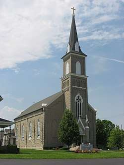 Cassella Catholic Church and Rectory |
July 26, 1979 (#79002822) |
State Route 119 in Cassella 40°24′24″N 84°33′03″W |
Marion Township | |
| 2 | Celina Main Street Commercial Historic District |  Celina Main Street Commercial Historic District |
November 30, 1982 (#82001474) |
Roughly bounded by Walnut, W. Livingston, Ash, and Warren Sts. 40°32′58″N 84°34′15″W |
Celina | |
| 3 | Chickasaw School and Rectory | 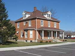 Chickasaw School and Rectory |
July 26, 1979 (#79002848) |
Maple St. 40°26′10″N 84°29′35″W |
Chickasaw | |
| 4 | Coldwater Catholic Church Complex | 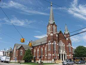 Coldwater Catholic Church Complex |
July 26, 1979 (#79002832) |
E. Main and 2nd Sts. 40°28′49″N 84°37′42″W |
Coldwater | |
| 5 | Fort Recovery Site |  Fort Recovery Site |
November 10, 1970 (#70000509) |
State Route 49 40°24′50″N 84°46′51″W |
Fort Recovery | |
| 6 | Matthias Gast House and General Store |  Matthias Gast House and General Store |
December 29, 1978 (#78002139) |
State Route 119 in Maria Stein 40°24′28″N 84°28′13″W |
Marion Township | |
| 7 | Sen. Thomas J. Godfrey House |  Sen. Thomas J. Godfrey House |
November 26, 1980 (#80003159) |
602 W. Market St. 40°32′56″N 84°34′50″W |
Celina | |
| 8 | Grand Lake St. Marys Lighthouse |  Grand Lake St. Marys Lighthouse |
June 2, 1982 (#82003614) |
Grand Lake St. Marys-Northwood Addition, east of Celina 40°32′36″N 84°28′53″W |
Jefferson Township | |
| 9 | Gruenwald Convent |  Gruenwald Convent |
July 26, 1979 (#79002813) |
0.5 miles south of Cassella 40°24′01″N 84°33′03″W |
Marion Township | |
| 10 | Immaculate Conception Catholic Church Complex | _-_exterior%2C_at_dawn1.jpg) Immaculate Conception Catholic Church Complex |
July 26, 1979 (#79002833) |
Anthony and Walnut Sts. 40°33′07″N 84°34′22″W |
Celina | |
| 11 | Maria Stein Catholic Church and Rectory | 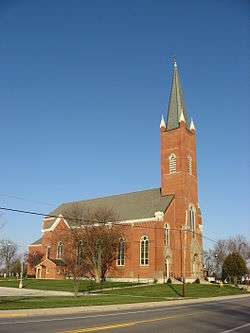 Maria Stein Catholic Church and Rectory |
July 26, 1979 (#79002828) |
St. John's Rd. and State Route 119 in Maria Stein 40°24′29″N 84°28′22″W |
Marion Township | |
| 12 | Maria Stein Convent | 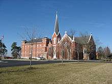 Maria Stein Convent |
May 6, 1976 (#76001490) |
St. John's and Rolfes Rd. in Maria Stein 40°24′57″N 84°28′34″W |
Marion Township | |
| 13 | Mendon Town Hall |  Mendon Town Hall |
December 29, 1978 (#78002140) |
S. Main St. 40°40′23″N 84°31′07″W |
Mendon | |
| 14 | Otis Hospital |  Otis Hospital |
November 25, 1980 (#80003160) |
441 E. Market St. 40°32′58″N 84°33′52″W |
Celina | |
| 15 | Philothea Catholic Church and Priest House | 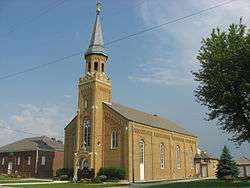 Philothea Catholic Church and Priest House |
July 26, 1979 (#79002823) |
Philothea Rd. in Philothea, between St. Henry and Coldwater 40°27′03″N 84°39′18″W |
Butler Township | |
| 16 | Calvin E. Riley House |  Calvin E. Riley House |
November 30, 1978 (#78002137) |
130 E. Market St. 40°32′55″N 84°34′10″W |
Celina | |
| 17 | St. Aloysius Catholic Church | 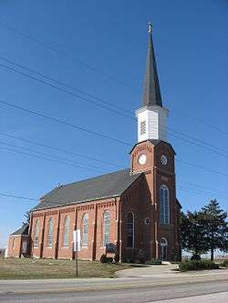 St. Aloysius Catholic Church |
July 26, 1979 (#79002824) |
U.S. Route 127 and State Route 274, west of Carthagena 40°26′11″N 84°34′12″W |
Marion Township | |
| 18 | St. Anthony Catholic Church, Padua | 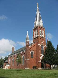 St. Anthony Catholic Church, Padua |
July 26, 1979 (#79002821) |
State Route 49 and St. Anthony Rd. in Padua 40°30′32″N 84°47′07″W |
Washington Township | |
| 19 | St. Bernard Catholic Church and Rectory | 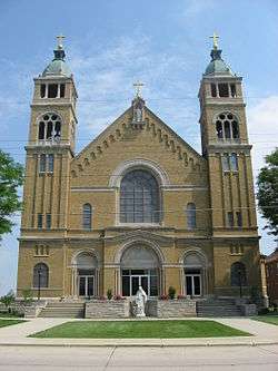 St. Bernard Catholic Church and Rectory |
July 26, 1979 (#79002842) |
Main St. 40°21′08″N 84°38′45″W |
Burkettsville | |
| 20 | St. Charles Seminary and Chapel |  St. Charles Seminary and Chapel |
July 26, 1979 (#79002840) |
0.5 miles south of Carthagena, off U.S. Route 127 40°25′57″N 84°33′48″W |
Marion Township | |
| 21 | St. Francis Catholic Church and Rectory | 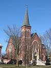 St. Francis Catholic Church and Rectory |
July 26, 1979 (#79002837) |
Cranberry and Ft. Recovery-Minster Rd. in Cranberry Prairie 40°23′34″N 84°34′55″W |
Granville Township | |
| 22 | St. Henry Catholic Church |  St. Henry Catholic Church |
July 26, 1979 (#79002829) |
Main St. 40°25′03″N 84°38′15″W |
St. Henry | |
| 23 | St. Joseph Catholic Church and Rectory | 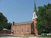 St. Joseph Catholic Church and Rectory |
July 26, 1979 (#79002820) |
Sawmill and St. Joe Rds. in St. Joe 40°25′41″N 84°44′19″W |
Recovery Township | |
| 24 | St. Paul's Catholic Church and Rectory | 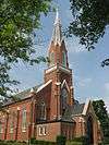 St. Paul's Catholic Church and Rectory |
July 26, 1979 (#79002827) |
Junction of Sharpsburg and Meiring Rds. in Sharpsburg 40°22′02″N 84°42′41″W |
Gibson Township | |
| 25 | St. Peter Catholic Church and Rectory | 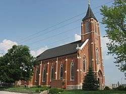 St. Peter Catholic Church and Rectory |
July 26, 1979 (#79002831) |
St. Peter and Philothea Rds. in St. Peter 40°27′03″N 84°44′48″W |
Recovery Township | |
| 26 | St. Rose Catholic Church Complex | 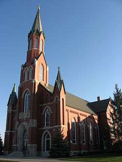 St. Rose Catholic Church Complex |
July 26, 1979 (#79002838) |
Main St. in St. Rose 40°24′26″N 84°30′53″W |
Marion Township | |
| 27 | St. Sebastian Catholic Church and Rectory |  St. Sebastian Catholic Church and Rectory |
July 26, 1979 (#79002830) |
Sebastian Rd. and State Route 716A in St. Sebastian 40°26′39″N 84°31′00″W |
Marion Township | |
| 28 | St. Wendelin Catholic Church, School, and Rectory | 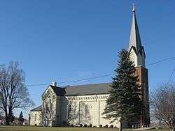 St. Wendelin Catholic Church, School, and Rectory |
July 26, 1979 (#79002885) |
Ft. Recovery-Minster Rd. and Township Line in Wendelin 40°24′00″N 84°41′27″W |
Recovery Township | |
| 29 | Wallischeck Homestead |  Wallischeck Homestead |
November 27, 1978 (#78002138) |
North of Fort Recovery 40°26′40″N 84°48′05″W |
Recovery Township |
See also
References
| Wikimedia Commons has media related to National Register of Historic Places in Mercer County, Ohio. |
- The latitude and longitude information provided in this table was derived originally from the National Register Information System, which has been found to be fairly accurate for about 99% of listings. Some locations in this table may have been corrected to current GPS standards.
- "National Register of Historic Places: Weekly List Actions". National Park Service, United States Department of the Interior. Retrieved on June 26, 2020.
- Numbers represent an ordering by significant words. Various colorings, defined here, differentiate National Historic Landmarks and historic districts from other NRHP buildings, structures, sites or objects.
- "National Register Information System". National Register of Historic Places. National Park Service. April 24, 2008.
- The eight-digit number below each date is the number assigned to each location in the National Register Information System database, which can be viewed by clicking the number.

Municipalities and communities of Mercer County, Ohio, United States | ||
|---|---|---|
| City | Map of Ohio highlighting Mercer County | |
| Villages | ||
| Townships | ||
| Unincorporated communities | ||
| Footnotes | ‡This populated place also has portions in an adjacent county or counties | |
This article is issued from Wikipedia. The text is licensed under Creative Commons - Attribution - Sharealike. Additional terms may apply for the media files.