Ashland, Ohio
Ashland is a city in and the county seat of Ashland County, Ohio, United States,[8] 66 miles southwest of Cleveland and 82 miles northeast of Columbus. The population was 20,362 at the 2010 census. It is the center of the Ashland Micropolitan Statistical Area (as defined by the United States Census Bureau in 2003).
City of Ashland | |
|---|---|
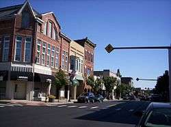 East Main Street, downtown | |
| Motto(s): "Someplace Special"[1] | |
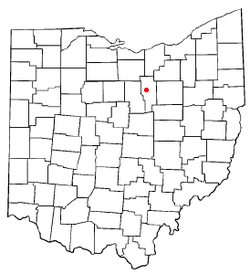 Location of Ashland, Ohio | |
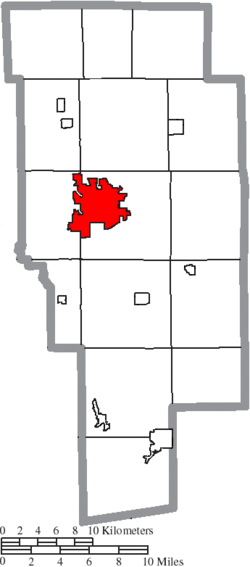 Location of Ashland in Ashland County | |
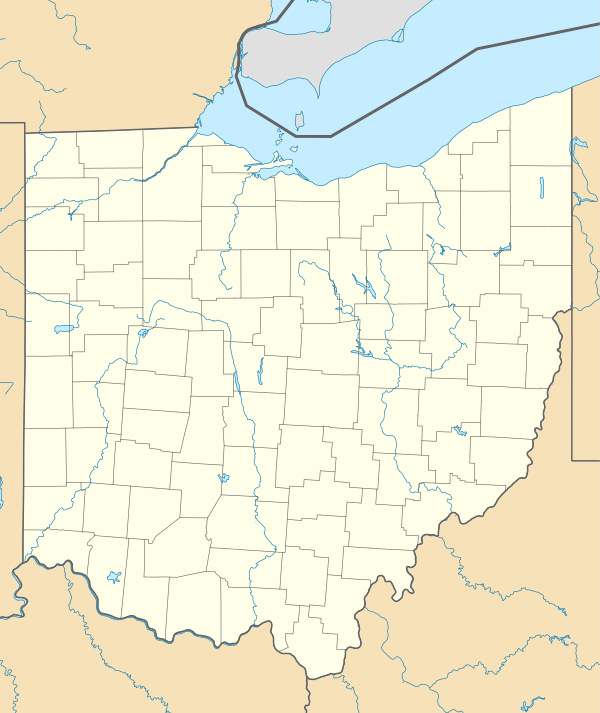 Ashland Location in Ohio  Ashland Ashland (the United States)  Ashland Ashland (North America) | |
| Coordinates: 40°52′1″N 82°18′55″W | |
| Country | United States |
| State | Ohio |
| County | Ashland |
| Government | |
| • Mayor | Matt Miller[2] |
| Area | |
| • Total | 11.23 sq mi (29.09 km2) |
| • Land | 11.17 sq mi (28.93 km2) |
| • Water | 0.06 sq mi (0.16 km2) |
| Elevation | 1,066 ft (325 m) |
| Population | |
| • Total | 20,362 |
| • Estimate (2019[6]) | 20,275 |
| • Density | 1,822.9/sq mi (703.8/km2) |
| Time zone | UTC-5 (Eastern (EST)) |
| • Summer (DST) | UTC-4 (EDT) |
| ZIP code | 44805 |
| Area code(s) | 419, 567 |
| FIPS code | 39-02568[7] |
| GNIS feature ID | 1060832[4] |
| Website | City of Ashland, Ohio |
Ashland is well known in the state for its "welcome sign" that proclaims the city to be "The World Headquarters of Nice People."[9]
Ashland was designated a Tree City USA by the National Arbor Day Foundation.
History
Ashland was laid out by Daniel Carter in 1815. Ashland was originally called Uniontown, but in 1822 the city was compelled to adopt a new name because another city in Ohio was already named Uniontown. The new name of Ashland was selected by supporters of the Kentucky congressman Henry Clay, from Ashland, his estate near Lexington.[10][11]
Later, "Henry Clay High School" was considered as a name for what is now known as Ashland High School.
In the mid-1800s, Ashland pioneers traveled to Oregon, naming a settlement after the town.
In 1878, with financial assistance from the city, the German Baptist Brethren Church opened Ashland College.[12]
Ashland become an early center of manufacturing in Ohio. In 1870, brothers Francis E. Myers and Philip A. Myers went into business selling farm equipment and operating a repair shop. They secured the patent for a double-action pump that delivered water in a steady stream rather than spurts. By 1915, F.E. Myers & Bro. had 800 workers. Myers was the largest of the 47 factories in Ashland at that time.[13][14] Other factories included Reliable Match Co. ("Strike Anywhere Matches"), Kauffman Mfg. Co. (manufacturer of folding chairs used in Union Army encampments), Dr. Hess & Clark (veterinary supplies and disinfectants) and T.W. Miller's Faultless Rubber Co. (rubber sundries, surgical goods and bicycle tires).[13]
In 1912, Harry Ross Gill, an Ashland native, invented the way to make cigar-shaped balloons (until then they were only round).[15] He started the Eagle Rubber Company in 1913 and the National Latex company in 1929.[16] The industry that Gill developed in Ashland led to the city becoming known as "the balloon capital of the world."[16] Ashland still celebrates its balloon heritage with its annual BalloonFest.[17]
In October 1923, the Ashland County chapter of the Ku Klux Klan hosted a "conclave and naturalization ceremony" in Ashland. Crowds lined the streets as 700 Klansmen paraded through the town with banners and floats.[18] Between 7,000-10,000 people watched the ceremony which concluded with fireworks.[18]
In July 2015, Ashland celebrated its bicentennial with a month of community events, the annual Balloonfest, and a Fourth of July parade estimated to have had 10,000 to 12,000 in attendance. Entries included the Budweiser Clydesdale, local businesses, veteran groups, antique tractors, and many community groups.
Geography
Ashland is at 40°52′1″N 82°18′55″W (40.867016, -82.315146).[19]
According to the 2010 census, the city has an area of 11.23 square miles (29.1 km2), of which 11.17 square miles (28.9 km2) (or 99.47%) is land and 0.06 square miles (0.16 km2) (or 0.53%) is water.[20]
The city has 85.6 miles (137.8 km) of streets, one hospital, one fire station, one police station, and five parks.
Demographics
| Historical population | |||
|---|---|---|---|
| Census | Pop. | %± | |
| 1850 | 1,264 | — | |
| 1860 | 1,748 | 38.3% | |
| 1870 | 2,601 | 48.8% | |
| 1880 | 3,004 | 15.5% | |
| 1890 | 3,568 | 18.8% | |
| 1900 | 4,087 | 14.5% | |
| 1910 | 6,795 | 66.3% | |
| 1920 | 9,249 | 36.1% | |
| 1930 | 11,141 | 20.5% | |
| 1940 | 12,453 | 11.8% | |
| 1950 | 14,287 | 14.7% | |
| 1960 | 17,419 | 21.9% | |
| 1970 | 19,872 | 14.1% | |
| 1980 | 20,252 | 1.9% | |
| 1990 | 20,079 | −0.9% | |
| 2000 | 21,249 | 5.8% | |
| 2010 | 20,362 | −4.2% | |
| Est. 2019 | 20,275 | [6] | −0.4% |
| U.S. Decennial Census[21] | |||
2010 census
As of the census[5] of 2010, the city had 20,362 people, 8,063 households, and 4,813 families. The population density was 1,822.9 inhabitants per square mile (703.8/km2). There were 8,914 housing units at an average density of 798.0 per square mile (308.1/km2). The city's racial makeup was 95.8% White, 1.4% African American, 0.1% Native American, 1.0% Asian, 0.1% Pacific Islander, 0.3% from other races, and 1.3% from two or more races. Hispanic or Latino of any race were 1.2% of the population.
There were 8,063 households, of which 28.2% had children under the age of 18 living with them, 43.2% were married couples living together, 12.1% had a female householder with no husband present, 4.4% had a male householder with no wife present, and 40.3% were non-families. 34.2% of all households were made up of individuals and 15.9% had someone living alone who was 65 years of age or older. The average household size was 2.28 and the average family size was 2.91.
The city's median age was 36.1 years. 21% of the city's population was under age 18; 15.7% was from age 18 to 24; 22.5% was from age 25 to 44; 23.1% was from age 45 to 64; and 17.7% was age 65 or older. The city's gender makeup was 46.8% male and 53.2% female.
2000 census
As of the census[7] of 2000, the city had 21,249 people, 8,327 households, and 5,262 families. The population density was 2,051.5 people per square mile (791.9/km²). There were 8,870 housing units at an average density of 856.4/sq mi (330.6/km²). The city's racial makeup was 96.35% White, 1.19% African American, 0.13% Native American, 1.05% Asian, 0.05% Pacific Islander, 0.32% from other races, and 0.91% from two or more races. Hispanic or Latino of any race were 0.85% of the population.
There were 8,327 households, of which 29.1% had children under the age of 18 living with them, 48.3% were married couples living together, 11.4% had a female householder with no husband present, and 36.8% were non-families. 31.8% of all households were made up of individuals and 13.8% had someone living alone who was 65 years of age or older. The average household size was 2.32 and the average family size was 2.92.
22.6% of the city's population was under age 18, 15.4% was from age 18 to 24, 25.1% was from age 25 to 44, 20.3% was from age 45 to 64, and 16.6% was age 65 or older. The median age was 35 years. For every 100 females, there were 87.2 males. For every 100 females age 18 and over, there were 82.0 males.
The city's median household income was $34,250, and the median family income was $42,755. Males had a median income of $33,634 versus $21,781 for females. The city's per capita income was $16,760. About 7.9% of families and 10.5% of the population were below the poverty line, including 13.7% of those under age 18 and 9.1% of those age 65 or over.
Government
The city is governed by a mayor, Matt Miller, and a five-person city council.
Transportation
The Ashland County Airport is three nautical miles (3.5 mi, 5.6 km) northeast of Ashland's central business district.[22]
Education

Ashland Public Schools enroll 3,717 students in public primary and secondary schools.[23] The district operates five public schools, including three elementary schools, one middle school, one high school. Other than public schools, the city is home to Ashland Christian School, St. Edward Catholic School, a US Dept. of Education Blue Ribbon School of Excellence, and Ashland Montessori School.
The city is home to Ashland University and Ashland Theological Seminary. Both were established by the Brethren Church—an Evangelical Protestant church in the Anabaptist tradition—which is headquartered in Ashland.
Ashland contains the Ashland Public Library.[24]
Notable people
- William B. Allison, Congressman from Iowa
- Rolla Kent Beattie, botanist
- Jessica Canseco, ex-wife of former baseball player José Canseco
- Ernest Cline, screenwriter
- Mary Hannah Fulton, medical missionary in China
- Joseph F. Holson, toxicologist and President of WIL Research Laboratories
- James P. Latta, U.S. Representative from Nebraska
- Ronnie Martin, musician
- Fred Martinelli, Hall of Fame College Football Coach
- Joseph D. Moody, president of the Southern California Dental Association and president of the Historical Society of Southern California
- Eric Musselman, NBA coach
- Thomas F. Olin, Chairman of Archway Cookies, Incorporated. (Named Ashland, Ohio's first “Citizen of the Year” in 1991)[25]
- Tim Richmond, NASCAR driver, Indianapolis 500 Rookie of the year
- John Roseboro, Major League Baseball catcher and coach
- Edmund G. Ross, Governor of the New Mexico Territory
- Tim Seder, Football kicker
- Robert C. Springer, astronaut
- Alfred P. Swineford, Member of the Michigan House of Representatives from 1871 to 1872
- Matt Underwood, TV play-by-play announcer for the Cleveland Indians
- Ron Zook, American football player and coach
References
- "City of Ashland, Ohio". City of Ashland, Ohio. Retrieved August 24, 2012.
- . City of Ashland OH http://www.ashland-ohio.com/government/ashland-elected-officials-2. Missing or empty
|title=(help) - "US Gazetteer files 2010". United States Census Bureau. Archived from the original on 2012-01-25. Retrieved 2013-01-06.
- "US Board on Geographic Names". United States Geological Survey. 2007-10-25. Retrieved 2008-01-31.
- "U.S. Census website". United States Census Bureau. Retrieved 2013-01-06.
- "Population and Housing Unit Estimates". Retrieved May 21, 2020.
- "U.S. Census website". United States Census Bureau. Retrieved 2008-01-31.
- "Find a County". National Association of Counties. Archived from the original on 2011-05-31. Retrieved 2011-06-07.
- "Ashland, Ohio". cbsnews.com. Retrieved August 24, 2012.
- Baughman, Abraham J. (1909). History of Ashland County, Ohio, Volume 1. S. J. Clarke Publishing Company. p. 171.
- Overman, William Daniel (1958). Ohio Town Names. Akron, OH: Atlantic Press. p. 6.
- "A Brief History of Ashland University | Administration | Ashland University". ashland.edu. Retrieved 2020-06-15.
- Shellhouse, Jan. "A History of F.E. Myers and Bro. - Equipment". Farm Collector. Retrieved 2020-06-15.
- "Ashland County Historical Society - Myers Family". ashlandhistory.org. Retrieved 2020-06-15.
- Balzer, Mark. "The History of Balloons". balloonhq.com. Retrieved 2020-06-15.
- "History". Hedstrom Plastics. Retrieved 2020-06-15.
- "Historic Ashland - Balloon Festival was precursor to BalloonFest". Ashland Times-Gazette. Retrieved 2020-06-15.
- Stitzlein, Sharon. "Klan had presence in Ashland in 1920s". Ashland Times-Gazette. Retrieved 2020-06-15.
- "US Gazetteer files: 2010, 2000, and 1990". United States Census Bureau. 2011-02-12. Retrieved 2011-04-23.
- "2010 Census U.S. Gazetteer Files for Places – Ohio". United States Census. Archived from the original on 2016-07-02. Retrieved 2012-10-19.
- "Census of Population and Housing". Census.gov. Retrieved June 4, 2015.
- FAA Airport Master Record for 3G4 (Form 5010 PDF). Federal Aviation Administration. effective 30 June 2011.
- greatschools. "Ashland City School District Profile". Retrieved 2013-12-04.
- "Location & Hours". Ashland Public Library. Retrieved 25 February 2018.
- "AU Library Friends honor Thomas Olin", Ashland Times Gazette, March 20, 1991.
External links
| Wikimedia Commons has media related to Ashland, Ohio. |
- City website
- Ashland Chamber of Commerce
- Ashland Area Convention and Visitors Bureau

- Ashland University
Municipalities and communities of Ashland County, Ohio, United States | ||
|---|---|---|
| City | 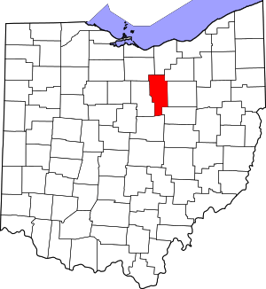 Map of Ohio highlighting Ashland County | |
| Villages | ||
| Townships | ||
| CDP | ||
| Unincorporated communities | ||
| Footnotes | ‡This populated place also has portions in an adjacent county or counties | |
| Authority control |
|
|---|