Nairobi County
Nairobi County is one of the 47 counties of Kenya. The third smallest yet the most populous of the counties, it is coterminous with the city of Nairobi, which is also the capital and largest city of Kenya.[1]
Nairobi County | |
|---|---|
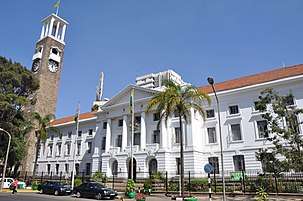 Nairobi City Hall | |
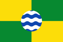 Flag Coat of arms | |
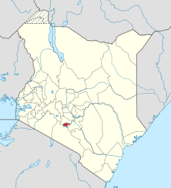 Location in Kenya | |
| Country | |
| Formed | 4 March 2013 |
| Capital | Nairobi |
| Government | |
| • Governor | Mike Sonko |
| Area | |
| • Total | 696 km2 (269 sq mi) |
| Population (2019) | |
| • Total | 4,397,073 |
| • Density | 6,300/km2 (16,000/sq mi) |
| Time zone | UTC+3 (EAT) |
| Website | nairobi.go.ke |
Nairobi County was founded in 2013 on the same boundaries as Nairobi Province, after Kenya's 8 provinces were subdivided into 47 counties.
Constituencies
The county is composed of 17 Parliamentary constituencies:
| Constituency | Wards |
|---|---|
| Westlands | Kitisuru · Parklands/Highridge · Kangemi · Karura · Mountain View |
| Dagoretti North | Kilimani · Kawangware · Gatina · Kileleshwa · Kabiro |
| Dagoretti South | Mutu-ini, Ngand'o · Riruta · Uthiru/Ruthimitu · Waithaka |
| Langata | Karen · Nairobi West · Nyayo Highrise · South C |
| Kibra | Laini Saba · Lindi · Makina · Woodley-Kenyatta Golf Course · Sarang'ombe |
| Roysambu | Githurai · Kahawa West · Zimmerman · Roysambu · Kahawa |
| Kasarani | Clay City · Mwiki · Kasarani · Njiru Shopping · Ruai |
| Ruaraka | Babadogo · Utalii · Mathare North · Lucky Summer · Korogocho |
| Embakasi South | Imara Daima · Kwa Njenga · Kwa Reuben · Pipeline · Kware |
| Embakasi North | Kariobangi North · Dandora Area I · Dandora Area II · Dandora Area III · Dandora Area IV |
| Embakasi Central | Kayole North · Kayole NorthCentral · Kayole South · Komarock · Chokaa · Matopeni/ Spring Valley |
| Embakasi East | Upper Savanna · Lower Savanna · Embakasi · Utawala · Mihang'o |
| Embakasi West | Umoja I · Umoja II · Mowlem · Kariobangi South |
| Makadara | Maringo/ Hamza · Viwandani · Harambee · Makongeni |
| Kamukunji | Pumwani · Eastleigh North · Eastleigh South · Airbase · California |
| Starehe | Nairobi Central · Ngara · Pangani · Ziwani/ Kariokor · Landimawe · Nairobi South |
| Mathare | Hospital · Mabatini · Huruma · Ngei · Mlango Kubwa · Kiamaiko |
Nairobi Metro
Nairobi County is within Greater Nairobi which consists of 5 out of 47 counties in Kenya but the area generates about 60% of the nation's wealth.[2][3] The counties are:
| Area | County | Area (km2) | Population Census 2019 | Cities/Towns/Municipalities in the Counties |
|---|---|---|---|---|
| Core Nairobi | Nairobi County | 694.9 | 4,397,073 | Nairobi |
| Northern Metro | Kiambu County | 2,449.2 | 2,417,735 | Kiambu, Thika, Limuru, Ruiru, Karuri, Kikuyu |
| North Eastern Metro | Murang'a County | 2,325.8 | 1,056,640 | Gatanga, Kandara, Kenol/Kabati, Murang'a |
| Southern Metro | Kajiado County | 21,292.7 | 1,117,840 | Kajiado, Olkejuado, Bissil, Ngong, Kitengela, Kiserian, Ongata Rongai |
| Eastern Metro | Machakos County | 5,952.9 | 1,421,932 | Kangundo-Tala, Machakos, Athi River |
| Totals | Nairobi Metro | 32,715.5 | 10,411,220 |
Source: NairobiMetro/ [Kenya Census 2019
Population
Nairobi has experienced one of the most rapid growths in urban centers. This is unlikely to slow down any time soon because the population in Kenya increases by an average of about 3%.[4]
Quick statistics
Urbanisation
| County | Urbanisation in Nairobi Metro (Percent) | ||||||||
|---|---|---|---|---|---|---|---|---|---|
| Nairobi County | 100 | ||||||||
| Kiambu County | 60.8 | ||||||||
| Murang'a County | 30 | ||||||||
| Machakos County | 52 | ||||||||
| Kajiado County | 41.6 | ||||||||
32.3 | |||||||||
|
Urbanisation by County within Nairobi Metro | |||||||||
Source: OpenDataKenya
Wealth/poverty level
| County | Poverty Level in Nairobi Metro (Percent) | ||||||||
|---|---|---|---|---|---|---|---|---|---|
| Kajiado County | 11.6 | ||||||||
| Kiambu County | 21.8 | ||||||||
| Nairobi County | 22 | ||||||||
| Machakos County | 59.6 | ||||||||
45.9 | |||||||||
|
Poverty level by County | |||||||||
Source: OpenDataKenya Worldbank
See also
References
- "History | Nairobi City County". 25 April 2019. Retrieved 28 May 2020.
- http://196.200.27.243:8080/xmlui/bitstream/handle/123456789/111/Nairobi.pdf?sequence=3%5B%5D
- http://www.nairobimetro.go.ke/index.php?option=com_docman&task=doc_download&gid=43&Itemid=90%5B%5D.
- "History | Nairobi City County". 25 April 2019. Retrieved 28 May 2020.
External links
Nairobi Coat of Arms | |||||
| Neighbourhoods | |||||
| County Divisions | |||||
| Transport | |||||
| Education |
| ||||
| Landmarks | |||||
| History | |||||
Nairobi metropolitan area | ||
|---|---|---|
Population - 7.8 million | ||
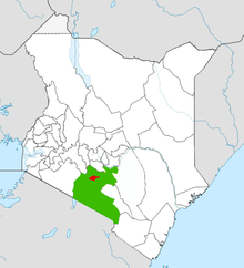
| Counties |  | |
| Major city 3.8 million | ||
| Urban Centres over 200K | ||
| Other major Urban Centres | ||
| Future developments | ||