Homa Bay County
Homa Bay County is a county in the former Nyanza Province of Kenya. Its capital and largest town is Homa Bay. The county has a population of 1,131,950 (2019 census) and an area of 3,154.7 km². Lake Victoria is a major source of livelihood for Homa Bay County.
Homa Bay County Asego Kanyada | |
|---|---|
 Flag  Coat of arms | |
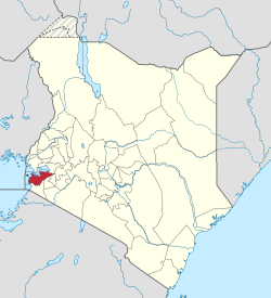 Location in Kenya | |
| Country | |
| Founded | March 4th 2013 |
| Capital | Homa Bay |
| Government | |
| • Governor | Cyprian Awiti |
| Area | |
| • Total | 3,154.7 km2 (1,218.0 sq mi) |
| Population (2019) | |
| • Total | 1,131,950[1] |
| Time zone | UTC+3 (EAT) |
| Website | homabay.go.ke |
Demographics
Homa Bay county has a total population of 1,131,950 persons, of which 539,560 are males, 592,367 females and 23 intersex persons. It has 262, 036 house holds with an average of 4.3 people per household. The county has a population density of 359 people per square kilometre.[2]
| Sub-County | Population |
|---|---|
| Homa Bay | 117,439 |
| Ndhiwa | 218,136 |
| Rachuonyo North | 178,686 |
| Rachuonyo East | 121,822 |
| Rachuonyo South | 130,814 |
| Rangwe | 117,732 |
| Suba North | 124,938 |
| Suba South | 124,938 |
| Total | 1,131,950 |
Source [3]
Administrative and Political Units
Administrative Units
The county has been subdivided into 8 sub-counties with 40 county assembly wards.[4] There are a total of 19 divisions, with 116 locations and 226 sub-locations.[5]
Electoral constituencies
The county has eight electoral constituencies:
Political Leadership
Cyprian Otieno Awiti is the governor and serving his last term in office after being elected in 2013 and 2017 general elections and currently deputised by Hamiliton Onyango Orata.[6] Moses Otieno Kajwang’ is the senator and was elected in 2015 in a by election due the death of brother Gerald Otieno Kajwang.[7] He won also his in 2017 elections. Gladys Atieno Nyasuna Wanga is second women repressentaive to hold office after being elected in 2017.[8][9]
Health
There are a total of 206 health facilities across the county of which 144 are public and 62 are private.[10]
| Public | Number |
|---|---|
| Level 5 | 1 |
| Level 4 | 11 |
| Level 3 | 31 |
| Level 2 | 101 |
| Private | |
| Hospitals (Mission/NGO) | 3 |
| Health centres | 36 |
| Dispensaries | 23 |
| Total | 206 |
Source [3]
Education
The county has 1451 ECD centres of which are 991public and 460 private.[11] There are 1089 primary schools, 312 secondary schools, 50 youth polythenic, 2 technical training institutions, 2 university colleges.[12]
| Category | Public | Private | Total |
|---|---|---|---|
| ECD Centres | 991 | 460 | 1451 |
| Primary schools | 868 | 221 | 1089 |
| Secondary schools | 294 | 18 | 312 |
| Youth Polythecnic | 50 | 0 | 50 |
| Technical Training Institutions | 2 | 2 | |
| Universities | 2 | 2 |
Transport and Communication
The county is covered by road network of 3225 km of which i1840 is covered by earth surface, 1240 km is gravel and 184 km is covered by bitumen.[14] There are 13 postal services with 3,300 installed letter boxes, 1,605 rented letter boxes 1,695 vacant letter boxes.[3]
Trade and Commerce
The county grows a variety agricultural crops based on the ecological zones found the county. Coffee, sugarcane, maize, beans, tobacco, dairy and fish farming in Rakuonyo subcounty, maize, millet, pineapples, sorghum, sunflower and tomatoes are grown in Gwasi Hills of Suba, millet, green grams,tobacco, sugarcane, pineapples, sisal are grown in Ndhiwa, Homa Bay town and Rangwe. Cotton was grown in Rachuonyo and central Mbita before the collapse of the cotton industry. Efforts are, however, underway to revive cotton farming across the county. Some of the animals kept in the county include cattle dairy, cattle beef, sheep, hair goats, dairy goats, meat pigs, rabbit and poultry.[12][3]
Services and Urbanisation
Source: USAid Kenya
Villages and settlements
VILLAGES INCLUDE: KAUMA; KANYIPIR; KA'KDHIMU; KA'KWAJWOK; KANJIRA; KANYALUO.
See also
External links
References
- "Kenya Census 2009 - Census - Kenya". Scribd. Retrieved 21 April 2018.
- Munene, Evans (4 November 2019). "2019 Kenya Population and Housing Census Results". Kenya National Bureau of Statistics. Retrieved 27 May 2020.
- Kenya National Bureau of Statistics. "County Statistical Abstract Homa Bay 2015". Kenya National Bureau of Statistics. Retrieved 27 May 2020.
- IEBC. "The Report of the Interim Independent Boundaries Review Commission (IIBRC): Delimitation of Constituencies and Recommendations on Local Authority Electoral Units and Administrative Boundaries for Districts and Other Units" (PDF). IEBC. Retrieved 27 May 2020.
- interior_admin. "Ministry of Interior and Coordination of National Government". interior.go.ke. Retrieved 27 May 2020.
- "Governors & Deputy Governors". cog.go.ke. Retrieved 27 May 2020.
- "Members of the Senate | The Kenyan Parliament Website". www.parliament.go.ke. Retrieved 27 May 2020.
- "Women Representatives | KEWOPA KENYA". Retrieved 27 May 2020.
- "Gladys Wanga". Mzalendo. Retrieved 27 May 2020.
- "Department of Health, County Governement of Homa Bay". Department of Health. Retrieved 27 May 2020.
- "Home Bay Couny - Department of Education and ICT". Home Bay County. Retrieved 27 May 2020.
- "Second County Integrated Development Plan CIDP 2018-2022 Home Bay County". The Council of Governors. Retrieved 27 May 2020.
- "Ministry of Education". www.education.go.ke. Retrieved 27 May 2020.
- "Kenya Rural Roads Authority". www.kerra.go.ke. Retrieved 27 May 2020.