Nyeri County
Nyeri County is located in the central region of Kenya. Its capital and largest town is Nyeri.[2] It has a population of 759,164 and an area of 2361 km².
Nyeri County | |
|---|---|
 | |
 Flag | |
 Location in Kenya | |
| Country | |
| Formed | March 4th 2013 |
| Capital | Nyeri |
| Government | |
| • Governor | Mutahi Kahiga |
| Area | |
| • Total | 2,361.0 km2 (911.6 sq mi) |
| Population (2019) | |
| • Total | 759,164[1] |
| Time zone | UTC+3 (EAT) |
| Website | nyeri.go.ke |
People
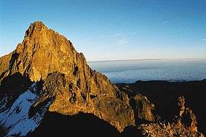
The county is located on the southwest flank of Mount Kenya. Local people are predominantly of the Kikuyu ethnicity.
Horse riding as a means of transport in a mountainous area
| Historical population | ||
|---|---|---|
| Year | Pop. | ±% |
| 1979 | 486,477 | — |
| 1989 | 607,292 | +24.8% |
| 1999 | 661,156 | +8.9% |
| 2009 | 693,558 | +4.9% |
| 2019 | 759,164 | +9.5% |
| source:[3] | ||
Local authorities
| Authority | Type | Population* | Urban pop.* |
|---|---|---|---|
| Nyeri | Municipality | 98,908 | 46,969 |
| Karatina | Municipality | 6,852 | 6,852 |
| Othaya | Town | 21,427 | 4,108 |
| Nyeri county | County | 533,969 | 10,047 |
| * 1999 census. Source: | |||
Administrative divisions
| Division | Population* | Urban pop.* | Headquarters |
|---|---|---|---|
| Kieni east | 83,635 | 2,643 | Naro Moru |
| Kieni west | 68,461 | 5,017 | Mweiga |
| Mathira | 150,998 | 6,275 | Karatina |
| Mukurwe-ini | 87,447 | 1,525 | Mukurwe-ini Town |
| Nyeri municipality | 101,238 | 40,497 | Nyeri |
| Othaya | 88,291 | 3,846 | Othaya |
| Tetu | 80,100 | 2,022 | [Wamagana] |
| * 1999 census. Sources: , , | |||
Sub-Counties/Constituencies
The county has six Sub-Counties/Constituencies):
Central Kenya Region
Urbanisation
| County | Urbanisation in Central Kenya (Percent) | ||||||||
|---|---|---|---|---|---|---|---|---|---|
| Kiambu County | 60.8 | ||||||||
| Nyeri County | 54.21 | ||||||||
| Nyandarua County | 18.5 | ||||||||
| Muranga County | 16.3 | ||||||||
| Kirinyaga County | 15.8 | ||||||||
32.3 | |||||||||
|
Urbanisation by County in Central Kenya | |||||||||
Source: OpenDataKenya
Wealth/Poverty Level
| County | Poverty Level in Central Kenya (Percent) | ||||||||
|---|---|---|---|---|---|---|---|---|---|
| Kirinyaga County | 20.0 | ||||||||
| Muranga County | 28.5 | ||||||||
| Kiambu County | 28.9 | ||||||||
| Nyeri County | 19.30 | ||||||||
| Nyandarua County | 46.6 | ||||||||
45.9 | |||||||||
|
Poverty level by County | |||||||||
Source: OpenDataKenya Worldbank
References
- "I'm not disputing census figures, they are accurate – Governor Kahiga". The Star (Kenya). 5 November 2019. Retrieved 30 January 2020.
- "Archived copy" (PDF). Archived from the original (PDF) on 24 February 2013. Retrieved 27 July 2013.CS1 maint: archived copy as title (link)
- KENYA: Administrative Division population statistics
This article is issued from Wikipedia. The text is licensed under Creative Commons - Attribution - Sharealike. Additional terms may apply for the media files.