Kirinyaga County
Kirinyaga County is a county in the former Central Province of Kenya. Its capital is Kutus and its largest town is Wanguru.[2] In 2019, the county had a population of 610,411[1] and an area of 1,478.1 km². The county is bordered to the east and south by Embu County, to the south by a tiny part of Machakos County, to the southwest by Murang'a County and to the northwest by Nyeri County.
Kirinyaga County | |
|---|---|
 Flag  Coat of arms | |
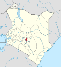 Location in Kenya | |
| Country | |
| Formed | 4 March 2013 |
| Capital | Kutus |
| Government | |
| • Governor | Anne Waiguru |
| Area | |
| • Total | 1,478.1 km2 (570.7 sq mi) |
| Population (2019) | |
| • Total | 610,411 [1] |
| Time zone | UTC+3 (EAT) |
| Website | Kirinyaga County Government Website |
Kirinyaga county lies between 1158 and 5199 metres above sea level; its highest point is the summit of Mount Kenya.[3]
History
Kirinyaga District was created in 1963 out of the western part of Embu District.[2] Kerugoya town was the district headquarters. The district commissioner was based in this town. In 2007, Kirinyaga District was divided into four new districts:
Administration
Since April 2013, the County Government of Kirinyaga administers all of Kirinyaga County. Formerly, The County Council of Kirinyaga administered all of Kirinyaga County, except the area that was administered by the Municipal Council of Kerugoya /Kutus and the Town council of Sagana-Kagio.[2]
In April 2020, attempts by Deputy President William Ruto's allies to impeach Kiriyaga Governor Anne Waiguru as part of a wider Jubilee Party confrontation between Ruto and President Uhuru Kenyatta were reported by Africa Confidential.[4]
Subdivisions
Kirinyaga District is divided as follows:
| Local authorities (councils) | ||||
| Authority | Type | Population* | Urban pop.* | |
|---|---|---|---|---|
| Kerugoya/Kutus | Municipality | 39,441 | 14,056 | |
| Sagana/Kagio | Town | 22,475 | 3,031 | |
| Kirinyaga | County | 395,189 | 13,103 | |
| Total | - | 457,105 | 30,190 | |
| * 1999 census. Source: | ||||
Electoral constituencies
The county has four constituencies:
Population
| Historical population | ||
|---|---|---|
| Year | Pop. | ±% |
| 1979 | 291,431 | — |
| 1989 | 391,516 | +34.3% |
| 1999 | 457,105 | +16.8% |
| 2009 | 528,054 | +15.5% |
| 2019 | 610,411 | +15.6% |
| source:[5] | ||
Central Kenya Region
Urbanisation
| County | Urbanisation in Central Kenya (Percent) | ||||||||
|---|---|---|---|---|---|---|---|---|---|
| Kiambu County | 60.8 | ||||||||
| Nyeri County | 24.5 | ||||||||
| Nyandarua County | 18.5 | ||||||||
| Muranga County | 16.3 | ||||||||
| Kirinyaga County | 15.8 | ||||||||
32.3 | |||||||||
|
Urbanisation by County in Central Kenya | |||||||||
Source: OpenDataKenya
Wealth/Poverty Level
| County | Poverty Level in Central Kenya (Percent) | ||||||||
|---|---|---|---|---|---|---|---|---|---|
| Kirinyaga County | 25.2 | ||||||||
| Muranga County | 28.5 | ||||||||
| Kiambu County | 28.9 | ||||||||
| Nyeri County | 32.7 | ||||||||
| Nyandarua County | 46.6 | ||||||||
45.9 | |||||||||
|
Poverty level by County | |||||||||
Source: OpenDataKenya Worldbank
Economy
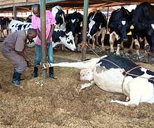
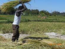
Like most counties in the Mt. Kenya region, agriculture is the main economic activity in Kirinyaga County. The county is best known for rice production at the Mwea Irrigation Scheme. Coffee and tea are also grown in the cooler areas of Ndia, Gichugu, and Kirinyaga Central constituencies. Other crops grown in the area include maize, beans, tomatoes, french beans and other horticultural crops. Due to scarcity of land and high population, most agriculture is done in small scale. There is also fishing at Sagana along the River Sagana. The business sector is also growing very fast. Thumbs to the Successive governments undertaking key infrastructural developments. This has seen the growth of Markets such as Kagio Market. Kagio market serves Murang'a and Kirinyaga counties traders. We welcome investors in real Estate development to venture in to our revamping economy. It also positive to note that in 2013 Kirinyaga was ranked the second Richest County.[6]
Villages and settlements
- Difatha
- Kibingoti
- Kibirigwi
- Thumaita
- Mbiri
- Kiamutugu
- Muthigi-ini
- Kairini
- (mukangu
- Kianjege East and Kianjege West
- Gathoge
- PI
- Mururi
- Kianjiru
- Kimbimbi
- Part of Makutano
- kathangarari
Gathambi Ndiriti Kandegwa Muragara
References
- "Kenya Census 2009 - Kenya (25K views)". Scribd.
- "County Council of Kirinyaga Website". Archived from the original on 16 August 2012. Retrieved 16 August 2012.
- "Kirinyaga County Integrated Development plan 2018-2022". Maarifa Centre. Retrieved 6 November 2019.
- Africa Confidential, "Duelling Impeachments," 16 April 2020.
- KENYA: Administrative Division population statistics
- "MWEA IRRIGATION SCHEME". NATIONAL IRRIGATION BOARD. NATIONAL IRRIGATION BOARD. Retrieved 18 May 2019.