Minchinabad Tehsil
Minchinabad Tehsil (Urdu: تحصِيل مِنچِن آباد), is a tehsil located in Bahawalnagar District, Punjab, Pakistan. The city of Minchinabad is the headquarters of the tehsil which is administratively subdivided into 25 Union Councils.[2]
Minchinabad Tehsil تحصِيل مِنچِن آباد | |
|---|---|
 Tehsil Municipal Administration logo | |
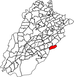 Location of Minchinabad Tehsil in Punjab, Pakistan | |
| Coordinates: 30.1622° N, 73.5653° E | |
| Country | |
| Region | |
| District | Bahawalnagar |
| Capital | Minchinabad |
| Towns | 1 |
| Union councils | 25 |
| Government | |
| • Assistant Commissioner | Muzammal Ilyas |
| • Administrator | Muzammal Ilyas |
| • Chief Officer | Syed Rashid Ghaznavi |
| Area | |
| • Tehsil | 1,818 km2 (702 sq mi) |
| Population | |
| • Tehsil | 526,428 |
| • Urban | 72,541 |
| • Rural | 453,887 |
| Time zone | UTC+5 (PST) |
Mandi Sadiq Gunj TC and Mcload Gunj TC, these smaller cities are also included in Tehsil Minchin Abad.
A canal named Head Ford Wah passes through Minchin Abad city and worth seeing is suspended bridge built on this canal during British Rule in Subcontinent.
The notables in Minchin Abad Tehsil are: Mian Abdul Ghaffar Wattoo MNA .Syed Asghar Shah . Shoukat Ali Laleka . Mian Fida Hussain Wattoo.
Geography
Minchinabad Tehsil has an area of 1,818 km2.[3]
Adjacent tehsils
- Depalpur Tehsil, Okara District (north)
- Fazilka Tehsil, Fazilka District, Punjab, India (northeast)
- Sri Ganganagar Tehsil, Sri Ganganagar District, Rajasthan, India (south)
- Karanpur Tehsil, Sri Ganganagar District, Rajasthan, India (southwest)
- Bahawalnagar Tehsil (southwest)
- Pakpattan Tehsil, Pakpattan District (northwest)
Demographics
| Historical population | ||
|---|---|---|
| Year | Pop. | ±% p.a. |
| 1951 | 118,846 | — |
| 1961 | 138,200 | +1.52% |
| 1972 | 185,985 | +2.74% |
| 1981 | 225,838 | +2.18% |
| 1998 | 354,261 | +2.68% |
| 2017 | 526,428 | +2.11% |
| Source: [4][3] | ||
According to the 2017 Census of Pakistan, there are 526,428 people living in Minchinabad Tehsil and 83,173 households.[1] Its population recorded in the 1998 census was 354,261.[3]
References
- "DISTRICT AND TEHSIL LEVEL POPULATION SUMMARY WITH REGION BREAKUP: PUNJAB" (PDF). Pakistan Bureau of Statistics. 2018-01-03. Archived from the original (PDF) on 2018-04-25. Retrieved 2018-04-24.
- Tehsils & Unions in the District of Bahawalnagar - Government of Pakistan Archived 2012-02-09 at the Wayback Machine
- "PLANNING REPORT BAHAWALNAGAR 2008" (PDF). Punjab Municipal Development Fund Company: Punjab Municipal Services Improvement Project (PMSIP). 2008. Retrieved 2018-05-02.
- "AREA & POPULATION OF ADMINISTRATIVE UNITS BY RURAL/URBAN: 1951-1998 CENSUSES" (PDF). Pakistan Bureau of Statistics. Retrieved 2018-05-14.
External links
| Bahawalpur |
| ||||||||||||
|---|---|---|---|---|---|---|---|---|---|---|---|---|---|
| Dera Ghazi Khan |
| ||||||||||||
| Faisalabad |
| ||||||||||||
| Gujranwala |
| ||||||||||||
| Lahore |
| ||||||||||||
| Multan |
| ||||||||||||
| Rawalpindi |
| ||||||||||||
| Sahiwal |
| ||||||||||||
| Sargodha |
| ||||||||||||