Lake Angelus, Michigan
Lake Angelus is a city in Oakland County in the U.S. state of Michigan. As of the 2010 census, the city had a population of 290, which ranks it as Michigan's least-populated city.[6] Lake Angelus consistently ranks as the city in Michigan with the 5th highest per capita income.
Lake Angelus, Michigan | |
|---|---|
| City of Lake Angelus | |
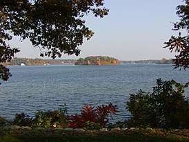 View of Lake Angelus | |
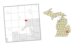 Location within Oakland County | |
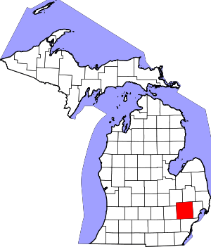
 Lake Angelus Location within the state of Michigan | |
| Coordinates: 42°41′31″N 83°19′32″W | |
| Country | United States |
| State | Michigan |
| County | Oakland |
| Incorporated | 1929 (village) 1984 (city) |
| Government | |
| • Mayor | Lee McNew |
| Area | |
| • City | 1.63 sq mi (4.2 km2) |
| • Land | 1.07 sq mi (2.8 km2) |
| • Water | 0.56 sq mi (1.5 km2) 34.36% |
| Elevation | 984 ft (300 m) |
| Population | |
| • City | 290 |
| • Estimate (2018)[3] | 308 |
| • Density | 305.56/sq mi (118.01/km2) |
| • Metro | 4,296,250 (Metro Detroit) |
| Time zone | UTC-5 (EST) |
| • Summer (DST) | UTC-4 (EDT) |
| ZIP code(s) | 48326 (Auburn Hills) |
| Area code(s) | 248 |
| FIPS code | 26-44440[4] |
| GNIS feature ID | 0629962[5] |
| Website | Official website |
History
In the early 1900s, a small community formed around the lake, then called Three Mile Lake. During the 1920s, the lake was renamed Lake Angelus by Mrs. Sollace B. Collidge as the original name was meaningless. The community was under pressure from nearby government establishments to be annexed. In 1929, however, a special state act of legislation was passed, granting Lake Angelus incorporation as a village.[7] Lake Angelus became a city of its own in 1984.[6]
Geography
According to the United States Census Bureau, the city has a total area of 1.63 square miles (4.22 km2), of which 1.07 square miles (2.77 km2) is land and 0.56 square miles (1.45 km2) (34.36%) is water.[8]
The city completely surrounds the lake of the same name. The city is bordered:
- To the north and east by the city of Auburn Hills
- To the south by the city of Pontiac
- To the west by Waterford Township
Demographics
| Historical population | |||
|---|---|---|---|
| Census | Pop. | %± | |
| 1930 | 27 | — | |
| 1940 | 139 | 414.8% | |
| 1950 | 123 | −11.5% | |
| 1960 | 231 | 87.8% | |
| 1970 | 573 | 148.1% | |
| 1980 | 397 | −30.7% | |
| 1990 | 328 | −17.4% | |
| 2000 | 326 | −0.6% | |
| 2010 | 290 | −11.0% | |
| Est. 2018 | 308 | [3] | 6.2% |
| U.S. Decennial Census[9] | |||
2010 census
At the 2010 census there were 290 people, 130 households, and 100 families living in the city. The population density was 271.0 inhabitants per square mile (104.6/km2). There were 151 housing units at an average density of 141.1 per square mile (54.5/km2). The racial makeup of the city was 96.2% White, 0.3% African American, 2.8% Asian, and 0.7% from two or more races. Hispanic or Latino of any race were 0.3%.[2]
Of the 130 households 14.6% had children under the age of 18 living with them, 70.8% were married couples living together, 3.1% had a female householder with no husband present, 3.1% had a male householder with no wife present, and 23.1% were non-families. 22.3% of households were one person and 9.2% were one person aged 65 or older. The average household size was 2.23 and the average family size was 2.58.
The median age was 55.3 years. 12.1% of residents were under the age of 18; 5.8% were between the ages of 18 and 24; 10.7% were from 25 to 44; 43.8% were from 45 to 64; and 27.6% were 65 or older. The gender makeup of the city was 47.2% male and 52.8% female.
2000 census
At the 2000 census there were 326 people, 132 households, and 104 families living in the city. The population density was 314.5 per square mile (121.0/km²). There were 146 housing units at an average density of 140.8 per square mile (54.2/km²). The racial makeup of the city was 96.32% White, 0.92% African American and 2.76% Asian. Hispanic or Latino of any race were 1.23%.[4]
Of the 132 households 25.8% had children under the age of 18 living with them, 76.5% were married couples living together, 0.8% had a female householder with no husband present, and 21.2% were non-families. 20.5% of households were one person and 7.6% were one person aged 65 or older. The average household size was 2.47 and the average family size was 2.83.
The age distribution was 20.2% under the age of 18, 4.3% from 18 to 24, 17.5% from 25 to 44, 36.8% from 45 to 64, and 21.2% 65 or older. The median age was 49 years. For every 100 females, there were 106.3 males. For every 100 females age 18 and over, there were 101.6 males.
The median household income was $114,524 and the median family income was $131,261. Males had a median income of $100,000 versus $48,750 for females. The per capita income for the city was $83,792. None of the families and 1.2% of the population were living below the poverty line, including none under eighteen and 2.6% of those over 64.
Education
A portion is in the Pontiac School District.[10]
References
- "2017 U.S. Gazetteer Files". United States Census Bureau. Retrieved Jan 3, 2019.
- "U.S. Census website". United States Census Bureau. Retrieved 2012-11-25.
- "Population and Housing Unit Estimates". Retrieved June 22, 2019.
- "U.S. Census website". United States Census Bureau. Retrieved 2008-01-31.
- U.S. Geological Survey Geographic Names Information System: Lake Angelus, Michigan
- "The 18 tiniest cities in Michigan". Flint Journal. Mlive Media Group. December 4, 2016. p. 21. Retrieved December 5, 2016.
- Romig 1986, pp. 227.
- "Michigan: 2010 Population and Housing Unit Counts 2010 Census of Population and Housing" (PDF). 2010 United States Census. United States Census Bureau. September 2012. p. 36 Michigan. Retrieved April 24, 2020.
- "Census of Population and Housing". Census.gov. Retrieved June 4, 2015.
- Murray, Diana Dillaber. "Law being proposed could dissolve Pontiac schools, other struggling districts." Oakland Press. June 12, 2013. Retrieved on May 7, 2014. "Pontiac school district spreads from Pontiac into portions of seven surrounding communities including Auburn Hills, Sylvan Lake, Lake Angeles and townships of Bloomfield, Orion, Waterford and West Bloomfield."
Sources
- Romig, Walter (October 1, 1986) [1973]. Michigan Place Names: The History of the Founding and the Naming of More Than Five Thousand Past and Present Michigan Communities. Great Lakes Books Series (Paperback). Detroit, Michigan: Wayne State University Press. ISBN 081431838X. ISBN 978-0814318386.CS1 maint: ref=harv (link)
Municipalities and communities of Oakland County, Michigan, United States | ||
|---|---|---|
| Cities |
|  Map of Michigan highlighting Oakland County |
| Villages | ||
| Charter townships | ||
| Civil townships | ||
| Unincorporated communities |
| |
| Footnotes | ‡This populated place also has portions in an adjacent county or counties | |