Holly, Michigan
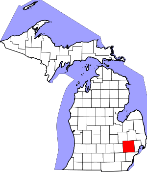
Holly is a village in north Oakland County in the U.S. state of Michigan. The population was 6,086 at the 2010 census.[7] The village is located within Holly Township. It is about 15 miles (24 km) south of Flint and 55 miles (89 km) northwest of Detroit.
Holly, Michigan | |
|---|---|
| Village of Holly | |
 | |
 Location within Oakland County | |
 Holly Location within the state of Michigan | |
| Coordinates: 42°47′31″N 83°37′40″W | |
| Country | United States |
| State | Michigan |
| County | Oakland |
| Township | Holly |
| Incorporated | 1982 |
| Government | |
| • President | Jim Perkins[1] |
| Area | |
| • Village | 3.01 sq mi (7.78 km2) |
| • Land | 2.72 sq mi (7.03 km2) |
| • Water | 0.29 sq mi (0.75 km2) 9.21% |
| Elevation | 928 ft (283 m) |
| Population | |
| • Village | 6,086 |
| • Estimate (2018)[4] | 6,173 |
| • Density | 2,267.30/sq mi (875.38/km2) |
| • Metro | 4,296,250 (Metro Detroit) |
| Time zone | UTC-5 (EST) |
| • Summer (DST) | UTC-4 (EDT) |
| ZIP code(s) | 48442 |
| Area code(s) | 248 |
| FIPS code | 26-38700[5] |
| GNIS feature ID | 0628441[6] |
| Website | Official website |
Geography
According to the United States Census Bureau, the village has a total area of 3.04 square miles (7.87 km2), of which 2.76 square miles (7.15 km2) is land and 0.28 square miles (0.73 km2) is water.[8]
Demographics
| Historical population | |||
|---|---|---|---|
| Census | Pop. | %± | |
| 1860 | 542 | — | |
| 1870 | 1,429 | 163.7% | |
| 1880 | 1,443 | 1.0% | |
| 1890 | 1,266 | −12.3% | |
| 1900 | 1,419 | 12.1% | |
| 1910 | 1,537 | 8.3% | |
| 1920 | 1,888 | 22.8% | |
| 1930 | 2,252 | 19.3% | |
| 1940 | 2,343 | 4.0% | |
| 1950 | 2,663 | 13.7% | |
| 1960 | 3,269 | 22.8% | |
| 1970 | 4,355 | 33.2% | |
| 1980 | 4,874 | 11.9% | |
| 1990 | 5,595 | 14.8% | |
| 2000 | 6,135 | 9.7% | |
| 2010 | 6,086 | −0.8% | |
| Est. 2018 | 6,173 | [4] | 1.4% |
| U.S. Decennial Census[9] | |||
2010 census
As of the census[3] of 2010, there were 6,086 people, 2,453 households, and 1,538 families living in the village. The population density was 2,205.1 inhabitants per square mile (851.4/km2). There were 2,703 housing units at an average density of 979.3 per square mile (378.1/km2). The racial makeup of the village was 95.0% White, 1.2% African American, 0.6% Native American, 0.6% Asian, 0.8% from other races, and 1.9% from two or more races. Hispanic or Latino of any race were 3.6% of the population.
There were 2,453 households of which 34.5% had children under the age of 18 living with them, 43.7% were married couples living together, 13.1% had a female householder with no husband present, 5.9% had a male householder with no wife present, and 37.3% were non-families. 30.9% of all households were made up of individuals and 12.9% had someone living alone who was 65 years of age or older. The average household size was 2.45 and the average family size was 3.09.
The median age in the village was 36.3 years. 25.5% of residents were under the age of 18; 8.2% were between the ages of 18 and 24; 28.8% were from 25 to 44; 24.9% were from 45 to 64; and 12.5% were 65 years of age or older. The gender makeup of the village was 48.7% male and 51.3% female.
2000 census
As of the census[5] of 2000, there were 6,135 people, 2,412 households, and 1,565 families living in the village. The population density was 2,204.6 per square mile (852.1/km²). There were 2,509 housing units at an average density of 901.6 per square mile (348.5/km²). The racial makeup of the village was 95.14% White, 1.29% African American, 0.44% Native American, 0.41% Asian, 0.02% Pacific Islander, 1.01% from other races, and 1.70% from two or more races. Hispanic or Latino of any race were 3.31% of the population.
There were 2,412 households out of which 34.7% had children under the age of 18 living with them, 48.5% were married couples living together, 11.2% had a female householder with no husband present, and 35.1% were non-families. 28.7% of all households were made up of individuals and 12.2% had someone living alone who was 65 years of age or older. The average household size was 2.49 and the average family size was 3.10.
In the village, the population was spread out with 27.0% under the age of 18, 8.3% from 18 to 24, 35.6% from 25 to 44, 17.8% from 45 to 64, and 11.3% who were 65 years of age or older. The median age was 33 years. For every 100 females, there were 96.4 males. For every 100 females age 18 and over, there were 93.0 males.
The median income for a household in the village was $46,436, and the median income for a family was $54,344. Males had a median income of $42,037 versus $27,078 for females. The per capita income for the village was $19,988. About 4.3% of families and 7.3% of the population were below the poverty line, including 6.3% of those under age 18 and 14.3% of those age 65 or over.
Tourism

Holly is home to the Annual Holly Dickens Festival[10] and to the Michigan Renaissance Festival, which was the main shooting location for the 2009 film All's Faire in Love.[11] It is also the starting point of the Shiawassee River Heritage Water Trail at WaterWorks Park.
Mount Holly, the largest ski/snowboard resort in southeastern Michigan, is located 3 miles (5 km) northeast of the village in Groveland Township. The ski area has 19 trails with a range of difficulty, and a high-speed quad chairlift. Also nearby is the state owned Holly Recreation Area.
Crapo Park, named after Michigan Governor Henry H. Crapo (1804–1869),[12] located near the junction of the CSX Saginaw Subdivision and Canadian National Railway's Holly Subdivision is a popular viewing location for railfans. Both lines were formerly served by Holly's small (now abandoned) Holly Union Depot, built in 1886. A nonprofit group is currently attempting to restore the neglected building to its former glory.[13]
The town was featured as a campaign stop in the 1993 movie In The Line Of Fire.
News and media
Holly is served by the Tri-County Times for print news, and the Oakland County Times for online news.
Notable people
- James E. Church, Jr., who developed the Mount Rose snow sampler.
- Karl W. Richter, Vietnam War Air Force hero who at 23 became the youngest pilot in that conflict to shoot down a MiG in air-to-air combat, and winner of numerous medals of valor including the Air Force Cross, Distinguished Flying Cross and Purple Heart.
References
- "Village Council". Village of Holly. Retrieved 2014-05-28.
- "2017 U.S. Gazetteer Files". United States Census Bureau. Retrieved Jan 3, 2019.
- "U.S. Census website". United States Census Bureau. Retrieved 2012-11-25.
- "Population and Housing Unit Estimates". Retrieved June 22, 2019.
- "U.S. Census website". United States Census Bureau. Retrieved 2008-01-31.
- U.S. Geological Survey Geographic Names Information System: Holly, Michigan
- "Race, Hispanic or Latino, Age, and Housing Occupancy: 2010 Census Redistricting Data (Public Law 94-171) Summary File (QT-PL), Holly village, Michigan". United States Census Bureau. Retrieved August 19, 2011.
- "US Gazetteer files 2010". United States Census Bureau. Archived from the original on 2012-01-25. Retrieved 2012-11-25.
- "Census of Population and Housing". Census.gov. Retrieved June 4, 2015.
- Holly Dickens Festival
- Amy Adler (17 September 2009). "All's Faire in Love (2009)". IMDb.
- Crapo Park Michigan Markers
- Restoration continues to return Holly, Michigan train depot to former glory The Flint Journal via MLive.com, February 29, 2008
https://www.hollyvillage.org/village-government/village-council/
External links

