La Frontera Formation
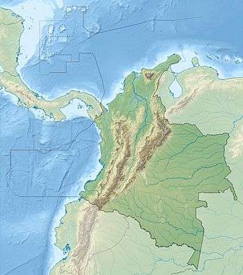
The La Frontera Formation (Spanish: Formación La Frontera, K2F, Ksf) is a geological formation, part of the Villeta Group, of the Altiplano Cundiboyacense and neighbouring areas of the Eastern Ranges of the Colombian Andes. The sequence of limestones and lydites dates to the Late Cretaceous period; Turonian epoch and has a maximum thickness of 206 metres (676 ft).
| La Frontera Formation Stratigraphic range: Turonian ~93.9–89.8 Ma | |
|---|---|
| Type | Geological formation |
| Unit of | Villeta Group |
| Underlies | Conejo Formation |
| Overlies | Simijaca Fm., La Corona Gb. |
| Thickness | up to 206 metres (680 ft) |
| Lithology | |
| Primary | Lydite |
| Other | Limestone |
| Location | |
| Coordinates | 4°54′40″N 74°27′50″W |
| Region | Altiplano Cundiboyacense Eastern Ranges, Andes |
| Country | |
| Type section | |
| Named for | La Frontera quarry |
| Named by | Cáceres & Etayo |
| Location | Albán |
| Year defined | 1969 |
| Coordinates | 4°54′40″N 74°27′50″W |
| Region | Cundinamarca, Boyacá |
| Country | |
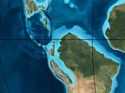 Paleogeography of Northern South America 90 Ma, by Ron Blakey | |
Fossils of Yaguarasaurus columbianus were said to be found in this formation (listed as "La Frontera Member"), although the geological mapping of the area state the time-equivalent Hondita Formation as the stratigraphic unit present in the Quebradas El Ocal and Itaibe in Huila. The La Frontera Formation does not outcrop south of Cundinamarca. A high diversity of ammonites has been found in the La Frontera Formation.
Etymology
The formation was first described by Hubach in 1931 and elevated to formation in 1969 by Cáceres and Etayo.[1] The formation is named after the quarry La Frontera near Albán, Cundinamarca.[2]
Description
Lithologies
The La Frontera Formation is characterised by a lower part consisting of limestones and an upper part comprising lydites.[1]
Stratigraphy and depositional environment
The La Frontera Formation overlies the Simijaca Formation and is overlain by the Conejo Formation, all units belong to the Villeta Group. The age has been estimated to be Turonian.[1] Stratigraphically, the formation is time equivalent with the Chipaque, Hondita and La Luna Formations.[3] The formation has been deposited in an open marine platform to submarine fan setting.[4] The deposition is represented by a maximum flooding surface.[5] The formation contains concretions and a high diversity of ammonites;[6] Wrightoceras munieri, Vascoceras cf. constrictum, Vascoceras cf. venezolanum, Kamerunoceras sp., Kamerunoceras cf. turoniense, Hoplitoides cf. lagiraldae, Codazziceras ospinae, Coilopoceras cf. newelli,[7] Hoplitoides wohltmanni, Neoptychites crassus, Hoplitoides ingens, Mammites sp., ?Fagesia sp., and Prionocycloceras sp.[8] Also the bivalves Anomia colombiana and Inoceramus sp. have been found in the La Frontera Formation.[2]
Yaguarasaurus
Fossils of Yaguarasaurus columbianus were described as coming from the "La Frontera Member", part of the "Villeta Formation", in the Quebrada El Ocal, 26 kilometres (16 mi) southwest of Neiva, Huila,[9][10] and in the Quebrada Itaibe 78 kilometres (48 mi) southwest of Neiva,[11] although in these areas the time-equivalent Hondita Formation is mapped.[12][13]
Outcrops
The La Frontera Formation is apart from its type locality, found at surface in the north of the Bogotá savanna, in the Tabio anticlinal, along the road Ubaté-Carmen de Carupa,[1] north and east of Chiquinquirá,[14] south of Cachipay,[15] to a thin band east of Viotá.[16]
Regional correlations
| Age | Paleomap | VMM | Guaduas-Vélez | W Emerald Belt | Villeta anticlinal | Chiquinquirá- Arcabuco | Tunja- Duitama | Altiplano Cundiboyacense | El Cocuy | ||||
|---|---|---|---|---|---|---|---|---|---|---|---|---|---|
| Maastrichtian | 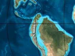 | Umir | Córdoba | Seca | eroded | Guaduas | Colón-Mito Juan | ||||||
| Umir | Guadalupe | ||||||||||||
| Campanian | Córdoba | ||||||||||||
| Oliní | |||||||||||||
| Santonian | La Luna | Cimarrona - La Tabla | La Luna | ||||||||||
| Coniacian | Oliní | Conejo | Chipaque | ||||||||||
Güagüaquí | Loma Gorda | undefined | La Frontera | ||||||||||
| Turonian | | Hondita | La Frontera | Otanche | |||||||||
| Cenomanian | Simití | hiatus | La Corona | Simijaca | Capacho | ||||||||
| Pacho Fm. | Hiló - Pacho | Churuvita | Une | Aguardiente | |||||||||
| Albian | 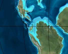 | Hiló | Chiquinquirá | Tibasosa | Une | ||||||||
| Tablazo | Tablazo | Capotes - La Palma - Simití | Simití | Tibú-Mercedes | |||||||||
| Aptian | Capotes | Socotá - El Peñón | Paja | Fómeque | |||||||||
| Paja | Paja | El Peñón | Trincheras | Río Negro | |||||||||
| La Naveta | |||||||||||||
| Barremian | 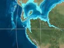 | ||||||||||||
| Hauterivian | Muzo | Cáqueza | Las Juntas | ||||||||||
| Rosablanca | Ritoque | ||||||||||||
| Valanginian | Ritoque | Furatena | Útica - Murca | Rosablanca | Girón | Macanal | |||||||
| Rosablanca | |||||||||||||
| Berriasian |  | Cumbre | Cumbre | Los Medios | Guavio | ||||||||
| Tambor | Arcabuco | Cumbre | |||||||||||
| Sources | |||||||||||||
See also
References
- Montoya & Reyes, 2005, p.24
- Acosta & Ulloa, 2001, p.41
- Montoya & Reyes, 2005, p.26
- García González et al., 2009, p.218
- Villamil, 2012, p.164
- Villamil, 2012, p.181
- Patarroyo, 2016, p.41
- Blanco et al., 2004, p.26
- 'Yaguarasaurus columbianus' in the Paleobiology Database
- Yaguarasaurus columbianus at Fossilworks.org
- Páramo Fonseca, 2000, p.124
- Plancha 344, 1999
- Plancha 345, 1999
- Plancha 190, 2009
- Plancha 227, 1998
- Plancha 246, 1998
Bibliography
- Acosta Garay, Jorge, and Carlos E. Ulloa Melo. 2001. Geología de la Plancha 208 Villeta - 1:100,000, 1-84. INGEOMINAS. Accessed 2017-04-04.
- Blanco, Johana Paola; Paula Andrea Medina, and Pedro Patarroyo. 2004. La Formación La Frontera, Sección Vereda Tóriba: Una propuesta para la designación del Lectoestratotipo. Geología Colombiana 29. 23-40. Accessed 2017-04-04.
- García González, Mario; Ricardo Mier Umaña; Luis Enrique Cruz Guevara, and Mauricio Vásquez. 2009. Informe Ejecutivo - evaluación del potencial hidrocarburífero de las cuencas colombianas, 1-219. Universidad Industrial de Santander.
- Montoya Arenas, Diana María, and Germán Alfonso Reyes Torres. 2005. Geología de la Sabana de Bogotá, 1–104. INGEOMINAS.
- Páramo Fonseca, María Euridice. 2000. Yaguarasaurus columbianus (Reptilia, Mosasauridae), a primitive mosasaur from the Turonian (Upper Cretaceous) of Colombia. Historical Biology 14. 121-131. Accessed 2018-05-30.
- Patarroyo, Pedro. 2016. Amonoideos y otros macrofósiles del lectoestratotipo de la Formación la Frontera, Turoniano inferior - medio (Cretácico Superior) en San Francisco, Cundinamarca (Colombia). Boletín de Geología, Universidad Industrial de Santander 38. 41-54. Accessed 2017-04-04.
- Villamil, Tomas. 2012. Chronology Relative Sea Level History and a New Sequence Stratigraphic Model for Basinal Cretaceous Facies of Colombia, 161–216. Society for Sedimentary Geology (SEPM).
Maps La Frontera Fm. proper
- Ulloa, Carlos E, and Erasmo Rodríguez. 2009. Plancha 170 - Vélez - 1:100,000, 1. INGEOMINAS. Accessed 2017-06-06.
- Fuquen M., Jaime A, and José F. Osorno M. 2009. Plancha 190 - Chiquinquirá - 1:100,000, 1. INGEOMINAS. Accessed 2017-06-06.
- Ulloa, Carlos, and Jorge Acosta. 1998. Plancha 208 - Villeta - 1:100,000, 1. INGEOMINAS. Accessed 2017-06-06.
- Montoya, Diana María, and Germán Reyes. 2009. Plancha 209 - Zipaquirá - 1:100,000, 1. INGEOMINAS. Accessed 2017-06-06.
- Ulloa, Carlos E; Erasmo Rodríguez, and Jorge E. Acosta. 1998. Plancha 227 - La Mesa - 1:100,000, 1. INGEOMINAS. Accessed 2017-06-06.
- Acosta, Jorge E., and Carlos E. Ulloa. 1998. Plancha 246 - Fusagasugá - 1:100,000, 1. INGEOMINAS. Accessed 2017-06-06.
Maps Yaguarasaurus locations
- Marquínez, Germán; C. Morales, and Alberto Núñez. 1999. Plancha 344 - Tesalia - 1:100,000, 1. INGEOMINAS. Accessed 2017-06-06.
- Velandia, F.; C.J. Morales; J.C. Caicedo, and Alberto Núñez. 1999. Plancha 345 - Campoalegre - 1:100,000, 1. INGEOMINAS. Accessed 2017-06-06.
External links
- Gómez, J.; N.E. Montes; Á. Nivia, and H. Diederix. 2015. Plancha 5-09 del Atlas Geológico de Colombia 2015 – escala 1:500,000, 1. Servicio Geológico Colombiano. Accessed 2017-04-04.
Paleontology in Colombia | |||||||||||||||||||||||||||
|---|---|---|---|---|---|---|---|---|---|---|---|---|---|---|---|---|---|---|---|---|---|---|---|---|---|---|---|
| Notable researchers |
|   .jpg) 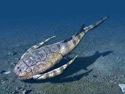 | |||||||||||||||||||||||||
| Major fossiliferous stratigraphic units |
| ||||||||||||||||||||||||||
| Notable fossils |
| ||||||||||||||||||||||||||