Floresta Formation
The Floresta Formation (Spanish: Formación Floresta, Df) is a geological formation of the Altiplano Cundiboyacense in the Eastern Ranges of the Colombian Andes. The sequence of siltstones, shales, coquinas and sandstone beds dates to the Devonian period; Late Emsian, Eifelian and Early Givetian epochs, and has a maximum thickness of 600 metres (2,000 ft). The unit is highly fossiliferous; brachiopods, bryozoans, gastropods, trilobites, corals and bivalves have been found in the Floresta Formation. Some fragments of Placoderm fish fossils were found in the Floresta Formation, while the overlying Cuche Formation is much richer in fish biodiversity.
| Floresta Formation Stratigraphic range: Late Emsian-Early Givetian ~400–387 Ma | |
|---|---|
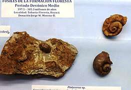 Platyceras nodosum from the Floresta Formation | |
| Type | Geological formation |
| Underlies | Cuche Formation |
| Overlies | El Tíbet Formation |
| Thickness | up to 600 m (2,000 ft) |
| Lithology | |
| Primary | Siltstone |
| Other | Shale, coquina, sandstone |
| Location | |
| Coordinates | 5°51′37.2″N 72°56′57.6″W |
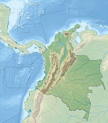
| Region | Altiplano Cundiboyacense Eastern Ranges, Andes |
| Country | |
| Type section | |
| Named for | Floresta |
| Named by | Olsson & Carter |
| Location | Floresta |
| Year defined | 1939 |
| Coordinates | 5°51′37.2″N 72°56′57.6″W |
| Approximate paleocoordinates | 51.7°S 48.1°W |
| Region | Boyacá |
| Country | |
| Thickness at type section | 600 m (2,000 ft) |
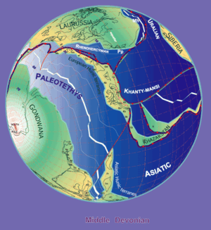 Paleogeography of the Middle Devonian 380 Ma, by Stampfli & Borel | |
Etymology
The formation was first described as Floresta Series by Olsson and Carter in 1939. The current definition was given by Botero in 1950. The formation is named after Floresta, Boyacá, where the formation outcrops.[1]
Description
Lithologies
The Floresta Formation is characterized by a lower sequence of shales and ochre to beige siltstones with alternating coquinas, while the upper part consists of siltstones with sandy beds.[2]
Stratigraphy and depositional environment
The Floresta Formation overlies the El Tíbet Formation and is overlain by the Cuche Formation. The age has been estimated to be Late Emsian to Early Givetian.[3] Stratigraphically, the formation is time equivalent with the Portachuelo Formation around Quetame.[4] The Onondaga Formation of New York is considered time equivalent too.[5] The formation contains concretions and a high diversity of fossils. The formation was deposited in a transgressional and regressional epicontinental marine environment at the edge of the Paleo-Tethys Ocean.[6] The uppermost part of the formation has been deposited in a deltaic setting,[7] with the lower sequence formed in a coral reef environment.[8]
Fossil content
Remains of Barroisella sp.,[9] ?Tarutiglossa sp.,[10] Dipleura cf. dekayi, Dechenella boteroi,[11] Mannopyge sp., Cordania gasepiou, Viaphacops cristata,[12] Anchiopsis armata,[13] Synphoria stemmata, Coronura cf. lessepsensis,[14] Greenops cf. grabaui,[15] Belenopyge contusa, Kettneraspis callicera,[16] Placoderm fishes,[17] Platyceras nodosum,[18] Acrospirifer olssoni, Anoplotheca cf. silvetii, Atrypa harrisi, Australospirifer cf. antarcticus, Aviculopecten wellsi, Brachyspirifer palmerae, Camarotoechia dotis, Chonetes cf. billingsi, C. comstockii, C. cf. stubeli, Chonostrophia knodi, Cyclotrypa boyaca, C. carribeana, C. dickeyi, C. reticulata, C. stellata, Cymostrophia dickeyi, C. schucherti, C. waringi, Cypricardinia cf. subindenta, Cyrtina hamiltonensis, Dalmanites cf. patacamayaensis, Dictyostrophia cooperi, Elytha colombiana, Eodevonaria imperialis, Favosites aff. hamiltonensis, Fenestrellina colombiana, F. olssoni, F. acuta, F. quadrata, F. harrisi, Fistulipora anomala, F. megalopora, Florestacanthus morenoi, Heliophyllum halli,[18] Intrapora fragilis, I. megalopora, Leiorhynchus mysia, Leptaena boyaca, Meganteris australis, Megastrophia hopkinsi, M. pygmaea, Meristella wheeleri, Nucleospira concinna, Odontopleura callicera, Pentagonia gemmisulcata, Phacops cf. salteri, Pholidops florestae, Platyostoma lineata, Pleurodictyum americanum, Polypora elegantula, P. granulifera, Prismopora inornata, Schellwienella goldringae, Semicoscinium colombiensis, S. minutum, Spinocyrtia cf. valenteana, Spinulicosta spinulicosta, Spirifer kingi, Strophonella floweri, S. meridionalis, Sulcoretepora olssoni, S. subramosa, Taeniopora florestae, Tropidoleptus carinatus, Unitrypa casteri, Acanthograptus sp., Actinopteria sp, Amphigenia sp., Anthozoa sp., Camarotoechia sp., Cryptonella sp., Cyphaspis sp., Cryphaeus sp., Dalmanites sp., Derbyina sp., Gastropoda sp., Grammysia sp., Homalonotus sp., Leptostrophia sp., Mediospirifer sp., Orthoceras sp., Ostracoda sp., Orthis sp., Paraspirifer sp., Proetus sp., Pterinea sp., Strophodonta sp., Thamnopora sp., and Vitulina sp. have been described from the Floresta Formation.[19] Colombianaspis carvalhoae gen. et sp. nov., Schizobolus pilasiensis sp. nov. and Tarijactinoides sp. nov.,[16] were newly described in 2015.[3]
Outcrops
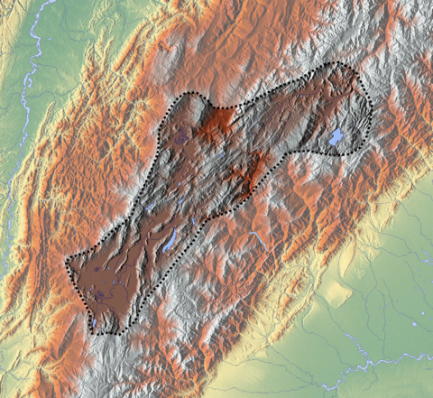
The Floresta Formation is found at the Floresta Massif around its type locality in Floresta, Boyacá,[20] stretching to the south until between Busbanzá and Nobsa and to the west close to Belén, Cerinza and Tutazá.[21] The formation is also found in the upper course of the Chicamocha River in the eponymous canyon.
Many of the fossils are on display in the paleontological museum of Floresta.
Regional correlations
| Ma | Age | Paleomap | Regional events | Catatumbo | Cordillera | proximal Llanos | distal Llanos | Putumayo | VSM | Environments | Maximum thickness | Petroleum geology | Notes |
|---|---|---|---|---|---|---|---|---|---|---|---|---|---|
| 0.01 | Holocene |  | Holocene volcanism Seismic activity | alluvium | Overburden | ||||||||
| 1 | Pleistocene | 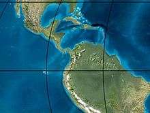 | Pleistocene volcanism Andean orogeny 3 Glaciations | Guayabo | Soatá Sabana | Necesidad | Guayabo | Gigante Neiva | Alluvial to fluvial (Guayabo) | 550 m (1,800 ft) (Guayabo) | [22][23][24][25] | ||
| 2.6 | Pliocene | 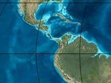 | Pliocene volcanism Andean orogeny 3 GABI | Subachoque | |||||||||
| 5.3 | Messinian | Andean orogeny 3 Foreland | Marichuela | Caimán | Honda | [24][26] | |||||||
| 13.5 | Langhian | Regional flooding | León | hiatus | Caja | León | Lacustrine (León) | 400 m (1,300 ft) (León) | Seal | [25][27] | |||
| 16.2 | Burdigalian | Miocene inundations Andean orogeny 2 | C1 | Carbonera C1 | Ospina | Proximal fluvio-deltaic (C1) | 850 m (2,790 ft) (Carbonera) | Reservoir | [26][25] | ||||
| 17.3 | C2 | Carbonera C2 | Distal lacustrine-deltaic (C2) | Seal | |||||||||
| 19 | C3 | Carbonera C3 | Proximal fluvio-deltaic (C3) | Reservoir | |||||||||
| 21 | Early Miocene | Pebas wetlands | C4 | Carbonera C4 | Barzalosa | Distal fluvio-deltaic (C4) | Seal | ||||||
| 23 | Late Oligocene | 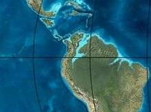 | Andean orogeny 1 Foredeep | C5 | Carbonera C5 | Orito | Proximal fluvio-deltaic (C5) | Reservoir | [23][26] | ||||
| 25 | C6 | Carbonera C6 | Distal fluvio-lacustrine (C6) | Seal | |||||||||
| 28 | Early Oligocene | C7 | C7 | Pepino | Gualanday | Proximal deltaic-marine (C7) | Reservoir | [23][26][28] | |||||
| 32 | Oligo-Eocene | C8 | Usme | C8 | onlap | Marine-deltaic (C8) | Seal Source | [28] | |||||
| 35 | Late Eocene | 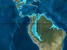 | Mirador | Mirador | Coastal (Mirador) | 240 m (790 ft) (Mirador) | Reservoir | [25][29] | |||||
| 40 | Middle Eocene | Regadera | hiatus | ||||||||||
| 45 | |||||||||||||
| 50 | Early Eocene | 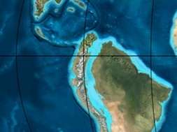 | Socha | Los Cuervos | Deltaic (Los Cuervos) | 260 m (850 ft) (Los Cuervos) | Seal Source | [25][29] | |||||
| 55 | Late Paleocene | PETM 2000 ppm CO2 | Los Cuervos | Bogotá | Gualanday | ||||||||
| 60 | Early Paleocene | SALMA | Barco | Guaduas | Barco | Rumiyaco | Fluvial (Barco) | 225 m (738 ft) (Barco) | Reservoir | [22][23][26][25][30] | |||
| 65 | Maastrichtian | 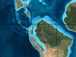 | KT extinction | Catatumbo | Guadalupe | Monserrate | Deltaic-fluvial (Guadalupe) | 750 m (2,460 ft) (Guadalupe) | Reservoir | [22][25] | |||
| 72 | Campanian | End of rifting | Colón-Mito Juan | [25][31] | |||||||||
| 83 | Santonian | Villeta/Güagüaquí | |||||||||||
| 86 | Coniacian | ||||||||||||
| 89 | Turonian | Cenomanian-Turonian anoxic event | La Luna | Chipaque | Gachetá | hiatus | Restricted marine (all) | 500 m (1,600 ft) (Gachetá) | Source | [22][25][32] | |||
| 93 | Cenomanian | 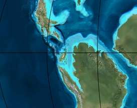 | Rift 2 | ||||||||||
| 100 | Albian | Une | Une | Caballos | Deltaic (Une) | 500 m (1,600 ft) (Une) | Reservoir | [26][32] | |||||
| 113 | Aptian | 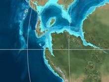 | Capacho | Fómeque | Motema | Yaví | Open marine (Fómeque) | 800 m (2,600 ft) (Fómeque) | Source (Fóm) | [23][25][33] | |||
| 125 | Barremian | High biodiversity | Aguardiente | Paja | Shallow to open marine (Paja) | 940 m (3,080 ft) (Paja) | Reservoir | [22] | |||||
| 129 | Hauterivian | 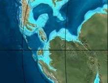 | Rift 1 | Tibú- Mercedes | Las Juntas | hiatus | Deltaic (Las Juntas) | 910 m (2,990 ft) (Las Juntas) | Reservoir (LJun) | [22] | |||
| 133 | Valanginian | Río Negro | Cáqueza Macanal Rosablanca | Restricted marine (Macanal) | 2,935 m (9,629 ft) (Macanal) | Source (Mac) | [23][34] | ||||||
| 140 | Berriasian | Girón | |||||||||||
| 145 | Tithonian | Break-up of Pangea | Jordán | Arcabuco | Buenavista Batá | Saldaña | Alluvial, fluvial (Buenavista) | 110 m (360 ft) (Buenavista) | "Jurassic" | [26][35] | |||
| 150 | Early-Mid Jurassic | 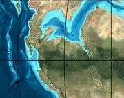 | Passive margin 2 | La Quinta | Montebel Noreán | hiatus | Coastal tuff (La Quinta) | 100 m (330 ft) (La Quinta) | [36] | ||||
| 201 | Late Triassic | 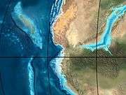 | Mucuchachi | Payandé | [26] | ||||||||
| 235 | Early Triassic |  | Pangea | hiatus | "Paleozoic" | ||||||||
| 250 | Permian | 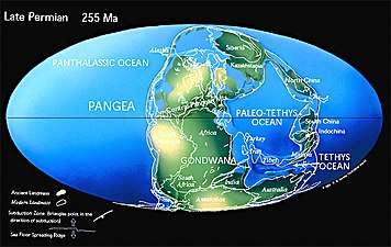 | |||||||||||
| 300 | Late Carboniferous |  | Famatinian orogeny | Cerro Neiva () | [37] | ||||||||
| 340 | Early Carboniferous | Fossil fish Romer's gap | Cuche (355-385) | Farallones () | Deltaic, estuarine (Cuche) | 900 m (3,000 ft) (Cuche) | |||||||
| 360 | Late Devonian | | Passive margin 1 | Río Cachirí (360-419) | Ambicá () | Alluvial-fluvial-reef (Farallones) | 2,400 m (7,900 ft) (Farallones) | [34][38][39][40][41] | |||||
| 390 | Early Devonian |  | High biodiversity | Floresta (387-400) El Tíbet | Shallow marine (Floresta) | 600 m (2,000 ft) (Floresta) | |||||||
| 410 | Late Silurian | Silurian mystery | |||||||||||
| 425 | Early Silurian | align=center | colspan=6 bgcolor=darkgrey align=center | hiatus | ||||||||||
| 440 | Late Ordovician |  | Rich fauna in Bolivia | San Pedro (450-490) | Duda () | ||||||||
| 470 | Early Ordovician | First fossils | Busbanzá (>470±22) Chuscales Otengá | Guape () | Río Nevado () | Hígado () | [42][43][44] | ||||||
| 488 | Late Cambrian |  | Regional intrusions | Chicamocha (490-515) | Quetame () | Ariarí () | SJ del Guaviare (490-590) | San Isidro () | [45][46] | ||||
| 515 | Early Cambrian | Cambrian explosion | [44][47] | ||||||||||
| 542 | Ediacaran | 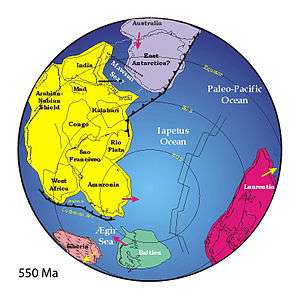 | Break-up of Rodinia | pre-Quetame | post-Parguaza | El Barro () | Yellow: allochtonous basement (Chibcha Terrane) Green: autochtonous basement (Río Negro-Juruena Province) | Basement | [48][49] | ||||
| 600 | Neoproterozoic | 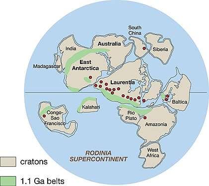 | Cariri Velhos orogeny | Bucaramanga (600-1400) | pre-Guaviare | [45] | |||||||
| 800 |  | Snowball Earth | [50] | ||||||||||
| 1000 | Mesoproterozoic | 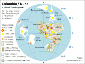 | Sunsás orogeny | Ariarí (1000) | La Urraca (1030-1100) | [51][52][53][54] | |||||||
| 1300 | Rondônia-Juruá orogeny | pre-Ariarí | Parguaza (1300-1400) | Garzón (1180-1550) | [55] | ||||||||
| 1400 | 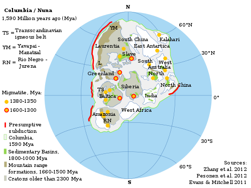 | pre-Bucaramanga | [56] | ||||||||||
| 1600 | Paleoproterozoic | Maimachi (1500-1700) | pre-Garzón | [57] | |||||||||
| 1800 |  | Tapajós orogeny | Mitú (1800) | [55][57] | |||||||||
| 1950 | Transamazonic orogeny | pre-Mitú | [55] | ||||||||||
| 2200 | Columbia | ||||||||||||
| 2530 | Archean |  | Carajas-Imataca orogeny | [55] | |||||||||
| 3100 | Kenorland | ||||||||||||
| Sources | |||||||||||||
- Legend
- group
- important formation
- fossiliferous formation
- minor formation
- (age in Ma)
- proximal Llanos (Medina)[note 1]
- distal Llanos (Saltarin 1A well)[note 2]
See also
Notes
References
- Mojica & Villarroel, 1984, p.64
- Morzadec et al., 2015, p.332
- Morzadec et al., 2015, p.355
- Morzadec et al., 2015, p.331
- Giroud López, 2014, p.168
- Janvier & Villarroel, 1998, p.6
- Giroud López, 2014, p.169
- Giroud López, 2014, p.170
- Morzadec et al., 2015, p.335
- Morzadec et al., 2015, p.336
- Morzadec et al., 2015, p.340
- Morzadec et al., 2015, p.342
- Morzadec et al., 2015, p.344
- Morzadec et al., 2015, p.346
- Morzadec et al., 2015, p.348
- Morzadec et al., 2015, p.352
- Janvier & Villarroel, 1998, p.9
- Giroud López, 2014, p.39
- Floresta at Fossilworks.org
- Mojica & Villarroel, 1984, p.70
- Plancha 172, 1998
- García González et al., 2009, p.27
- García González et al., 2009, p.50
- García González et al., 2009, p.85
- Barrero et al., 2007, p.60
- Barrero et al., 2007, p.58
- Plancha 111, 2001, p.29
- Plancha 177, 2015, p.39
- Plancha 111, 2001, p.26
- Plancha 111, 2001, p.24
- Plancha 111, 2001, p.23
- Pulido & Gómez, 2001, p.32
- Pulido & Gómez, 2001, p.30
- Pulido & Gómez, 2001, pp.21-26
- Pulido & Gómez, 2001, p.28
- Correa Martínez et al., 2019, p.49
- Plancha 303, 2002, p.27
- Terraza et al., 2008, p.22
- Plancha 229, 2015, pp.46-55
- Plancha 303, 2002, p.26
- Moreno Sánchez et al., 2009, p.53
- Mantilla Figueroa et al., 2015, p.43
- Manosalva Sánchez et al., 2017, p.84
- Plancha 303, 2002, p.24
- Mantilla Figueroa et al., 2015, p.42
- Arango Mejía et al., 2012, p.25
- Plancha 350, 2011, p.49
- Pulido & Gómez, 2001, pp.17-21
- Plancha 111, 2001, p.13
- Plancha 303, 2002, p.23
- Plancha 348, 2015, p.38
- Planchas 367-414, 2003, p.35
- Toro Toro et al., 2014, p.22
- Plancha 303, 2002, p.21
- Bonilla et al., 2016, p.19
- Gómez Tapias et al., 2015, p.209
- Bonilla et al., 2016, p.22
- Duarte et al., 2019
- García González et al., 2009
- Pulido & Gómez, 2001
- García González et al., 2009, p.60
Bibliography
- Giroud López, Marie Joëlle. 2014. El Mar en la Localidad Tipo del Devónico Medio, del Municipio de Floresta - Boyacá, Colombia, 1-174. Universidad de La Habana. Accessed 2017-03-31.
- Janvier, Philippe, and Carlos Villarroel A. 1998. Los Peces Devónicos del Macizo de Floresta (Boyacá, Colombia). Consideraciones taxonómicas, bioestratigráficas, biogeográficas y ambientales. Geología Colombiana 23. 3-18. Accessed 2017-03-31.
- Mojica, Jairo, and Carlos Villarroel A. 1984. Contribución al conocimiento de las unidades paleozoicas del área de Floresta (Cordillera Oriental Colombiana; Departamento de Boyacá) y en especial al de la Formación Cuche. Geología Colombiana 13. 55-80. Accessed 2017-03-31.
- Morzadec, Pierre; Michal Mergl; Carlos Villarroel; Philippe Janvier, and Patrick R. Racheboeuf. 2015. Trilobites and inarticulate brachiopods from the Devonian Floresta Formation of Colombia: a review. Bulletin of Geosciences 90. 331-358. Accessed 2017-04-04.
Maps
- Royero, José María; J. Zambrano; Rommel Daconte; H. Mendoza, and Rodrigo Vargas. 1999. Plancha 111 - Toledo - 1:100,000, 1. INGEOMINAS. Accessed 2017-06-06.
- Angarita, Leonidas; Víctor Carrillo; Alfonso Castro; Rommel Daconte; Mario Niño; Orlando G. Pulido; J. Antonio Rodríguez; José María Royero, and Rosalba Salinas, Carlos Ulloa and Rodrigo Vargas. 2009. Plancha 135 - San Gil - 1:100,000, 1. INGEOMINAS. Accessed 2017-06-06.
- Vargas, Rodrigo; Alfonso Arias; Luis Jaramillo, and Noel Tellez. 1984. Plancha 136 - Málaga - 1:100,000, 1. INGEOMINAS. Accessed 2017-06-06.
- Pulido González, Orlando. 2009. Plancha 151 - Charalá - 1:100,000, 1. INGEOMINAS. Accessed 2017-06-06.
- Ulloa, Carlos E.; Álvaro Guerra, and Ricardo Escovar. 1998. Plancha 172 - Paz de Río - 1:100,000, 1. INGEOMINAS. Accessed 2017-06-06.
External links
- (in Spanish) Peces devónicos de Colombia, diversidad en los mares y ríos de hace 410-355 millones de años
Paleontology in Colombia | |||||||||||||||||||||||||||
|---|---|---|---|---|---|---|---|---|---|---|---|---|---|---|---|---|---|---|---|---|---|---|---|---|---|---|---|
| Notable researchers |
|   .jpg) 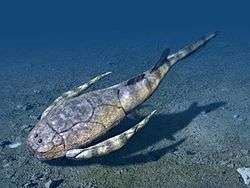 | |||||||||||||||||||||||||
| Major fossiliferous stratigraphic units |
| ||||||||||||||||||||||||||
| Notable fossils |
| ||||||||||||||||||||||||||