Jablanica, Bosnia and Herzegovina
Jablanica is a town and municipality located in Herzegovina-Neretva Canton of the Federation of Bosnia and Herzegovina, an entity of Bosnia and Herzegovina. It is situated on the Neretva river and Jablanica lake.
Jablanica Јабланица | |
|---|---|
Town and municipality | |
 Coat of arms | |
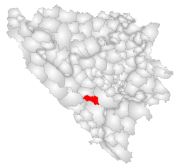 Location of Jablanica within Bosnia and Herzegovina | |
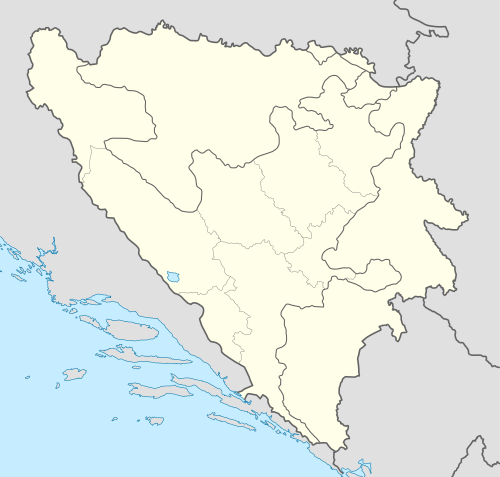 Jablanica Location of Jablanica, Bosnia and Herzegovina | |
| Coordinates: 43°39′N 17°45′E | |
| Country | Bosnia and Herzegovina |
| Canton | Herzegovina-Neretva Canton |
| Government | |
| • Municipality president | Salem Dedić[1] (SDA) |
| Area | |
| • Total | 301 km2 (116 sq mi) |
| Population (2013 census) | |
| • Total | 10,111 |
| • Density | 35/km2 (90/sq mi) |
| Time zone | UTC+1 (CET) |
| • Summer (DST) | UTC+2 (CEST) |
| Area code(s) | +387 36 |
| Website | www |
Municipality
The municipality of Jablanica is a major tourist destination in Bosnia and Herzegovina. The municipality offer a wide variety of activities. The surrounding mountains such as Plasa, Čvrsnica and Prenj offer both hunting grounds and a variety of hiking trails. One popular hiking destination is "Hajdučka Vrata", a natural wonder, the product of wind erosion, located 2,000 meters above sea level on the mountain of Čvrsnica.
Risovac is a settlement in the municipality, located on a plateau outside of the city, it has several attractions. It is the site of two necropolises, both locations filled with medieval tombstones known as Stećci. Stećci necropolises are characteristic and most prevalent in Bosnia and Herzegovina. Risovac has a ski center attracting winter tourists.
The Jablanica Lake (Jablaničko Jezero) is a very important resource. The lake borders many of its settlements and is used for several purposes. The lake is used to generate electricity while it also serves as a top summer destination for fishing, swimming, water sports and other activities. Notable settlements include Ostrožac, which hosts the start of the annual rowing marathon and Donje Paprasko, the location of a public beach and the host of the marathon finish line.
Geography
The mean elevation of Jablanica is 202 metres (663 ft) above sea level. Some 69% of the municipalities 301 km2 (116 sq mi) of area is forested. The Jablanica lake is an important geographical as well as economic presence in Jablanica.
Settlements
- Baćina
- Bijela
- Čehari
- Čivelj
- Djevor
- Dobrigošće
- Dobrinja
- Doljani
- Donja Jablanica
- Donje Paprasko
- Dragan Selo
- Glodnica
- Glogošnica
- Gornje Paprasko
- Jablanica
- Jelačići
- Kosne Luke
- Krstac
- Lendava
- Lug
- Mirke
- Mrakovo
- Ostrožac
- Poda
- Ravna
- Risovac
- Rodići
- Slatina
- Sovići
- Šabančići
- Šanica
- Zlate
- Žuglići
Demographics
Governance
The main local government of the municipality is Municipal Council of Jablanica (Bosnian: Općinska skupština; Croatian: Općinsko vijeće; Serbian Latin: Opštinska skupština). Council has 19 members elected for a four-year term by proportional representation. Jablanica also has its municipal mayor who is the highest-ranking officer in the municipal government.
Structure of the Council
| party | 2016– | |||||||||
|---|---|---|---|---|---|---|---|---|---|---|
| Party of Democratic Action (SDA) | 6 | |||||||||
| Social Democratic Party (SDP) | 3 | |||||||||
| Union for a Better Future of BiH (SBB) | 2 | |||||||||
| Liberal Democratic Party (LDS) | 1 | |||||||||
| Independent Nihad Širić | 1 | |||||||||
| Party for Bosnia and Herzegovina | 1 | |||||||||
| Democratic Front (DF) | 1 | |||||||||
| Independent Džana Motika | 1 | |||||||||
| Croatian Democratic Union (HDZ) | 1 | |||||||||
| Independent Idriz Čilić | 1 | |||||||||
| Independent Šefik Gusić | 1 | |||||||||
| Sources:[2] | ||||||||||
History
During the Battle of the Neretva in 1943, Jablanica was the site of a successful raid by a group of Partisans led by Josip Broz Tito. A rail bridge over the river was blown up while a train was in the middle of crossing. There is a park and monument commemorating this action at the site. The bridge section and the locomotive which can still be seen in the river gorge are the remains of a film set depicting the battle, from the 1960s.
Notable people
- Vahid Halilhodžić, former football player, football manager
- Senad Lulić, footballer
- Hasan Salihamidžić, footballer
- Mirza Teletović, basketball player
- Jasmin Šćuk, footballer
References
- "Rezultati lokalnih izbora 2016. za načelnika za općinu Jablanica". izbori.ba. Retrieved 29 October 2018.
- "Lokalni izbori 2012. - Općinsko vijeće". izbori.ba (in Bosnian). Central Election Commission of Bosnia and Herzegovina. Retrieved 3 July 2016.
External links
| Wikimedia Commons has media related to Jablanica, Bosnia and Herzegovina. |
| Wikivoyage has a travel guide for Jablanica. |
Municipalities of the Herzegovina-Neretva Canton | ||
|---|---|---|
| Countries |  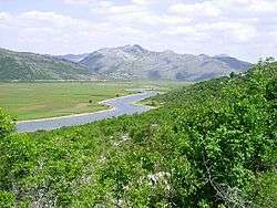 | ||||||||||||||||
|---|---|---|---|---|---|---|---|---|---|---|---|---|---|---|---|---|---|
| Places | |||||||||||||||||
| Wellsprings |
| ||||||||||||||||
| Tributaries |
| ||||||||||||||||
| Lakes |
| ||||||||||||||||
| Hydroelectric Power Plants |
| ||||||||||||||||
| Related articles | |||||||||||||||||
| Trebišnjica drainage: sub-basin of the Neretva |
| ||||||||||||||||