Usora Municipality
Usora (Serbian Cyrillic: Усора) is a village and municipality located in Zenica-Doboj Canton of the Federation of Bosnia and Herzegovina, an entity of Bosnia and Herzegovina. It borders with Doboj and Tešanj municipality, and it is named after the Usora River.
Usora Усора | |
|---|---|
Village and municipality | |
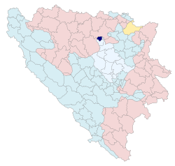 Location of Usora municipality within Bosnia and Herzegovina. | |
| Country | Bosnia and Herzegovina |
| Entity | Federation of Bosnia and Herzegovina |
| Canton | Zenica-Doboj |
| Government | |
| • Municipality president | Zvonimir Anđelić (HDZ BiH) |
| Area | |
| • Total | 49,8 km2 (192 sq mi) |
| Population (2013 census) | |
| • Total | 6,603 |
| • Density | 133/km2 (340/sq mi) |
| Time zone | UTC+1 (CET) |
| • Summer (DST) | UTC+2 (CEST) |
| Area code(s) | +387 32 |
It was created through secession from Tešanj and Doboj municipalities, during the 1992–95 Bosnian War.
Demographics
Population
| Population of settlements – Usora municipality | |||
|---|---|---|---|
| Settlement | 1991. | 2013. | |
| Total | 5,038 | 7,568 | |
| 1 | Alibegovci | 1,440 | 1,034 |
| 2 | Bejići | 424 | 233 |
| 3 | Makljenovac | 361 | |
| 4 | Omanjska | 1,233 | 953 |
| 5 | Sivša | 1,609 | 1,295 |
| 6 | Srednja Omanjska | 842 | 693 |
| 7 | Tešanjka | 531 | |
| 8 | Ularice | 1,147 | 777 |
| 9 | Žabljak | 801 | 659 |
Ethnic composition
| Sastav stanovništva – općina Usora | |||||||
|---|---|---|---|---|---|---|---|
| 2013. | 1991. | ||||||
| Total | 7,568 (100,0%) | 5,038 (100,0%) | |||||
| Croats | 6,095 (92,31%) | 4,736 (94,01%) | |||||
| Bosniaks | 384 (5,816%) | 136 (2,699%) | |||||
| Serbs | 61 (0,924%) | 43 (0,854%) | |||||
| Unaffiliated | 26 (0,394%) | ||||||
| Roma | 19 (0,288%) | ||||||
| Others | 9 (0,136%) | 47 (0,933%) | |||||
| Unknown | 5 (0,076%) | ||||||
| Montenegrins | 2 (0,030%) | ||||||
| Albanians | 2 (0,030%) | ||||||
| Yugoslavs | 76 (1,509%) | ||||||
See also
- Rivers of Bosnia and Herzegovina
References
External links
Municipalities/Cities of the Zenica-Doboj Canton | ||
|---|---|---|
This article is issued from Wikipedia. The text is licensed under Creative Commons - Attribution - Sharealike. Additional terms may apply for the media files.