Rakitnica
Rakitnica is the main tributary of the first section of the Neretva river, also called Upper Neretva (Bosnian: Gornja Neretva). It meets Neretva from the right, flowing from north to south, between Bjelašnica and Visočica mountains.
| Rakitnica | |
|---|---|
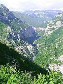 Upstream view on the Rakitnica river, squeezed in a deep narrow canyon between Bjelašnica (on the left) and Visočica (on the right). | |
 | |
| Location | |
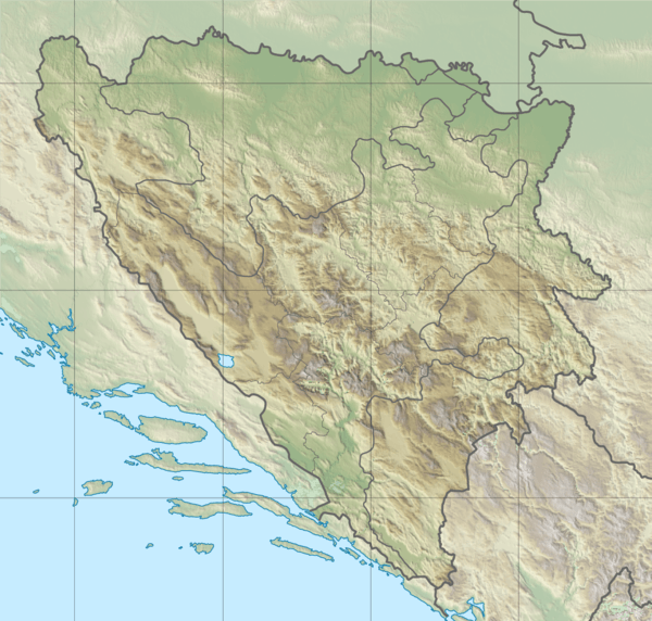
| Country | Bosnia and Herzegovina |
| Physical characteristics | |
| Source | Zucina Vtela |
| ⁃ location | Above Rakitnica village under the northwestern ridge of Treskavica mountain. |
| ⁃ coordinates | 43.634420°N 18.317633°E |
| ⁃ elevation | 1,270 m (4,170 ft) |
| 2nd source | Confluence of Crna Rijeka & Glibovac |
| ⁃ location | 2 kilometers downstream of Zucina Vrela |
| ⁃ coordinates | 43.6430165°N 18.2998538°E |
| ⁃ elevation | 1,200 m (3,900 ft) |
| Mouth | |
⁃ location | The Neretva river between Glavatičevo and Konjic |
⁃ coordinates | 43.5544°N 18.0700°E |
⁃ elevation | 323 m (1,060 ft) |
| Length | 33 km (21 mi) |
| Basin features | |
| Progression | Neretva→ Adriatic Sea |
| Landmarks | Lukomir, Stećak's UNESCO World Heritage Site |
| Tributaries | |
| ⁃ left | Glibovac, Pijevac, Velaškovac, Tušilska Rijeka, Međeđa, Grušćanska Rijeka |
| ⁃ right | Veliki Do, Lađevac, Kolijevka, Potoci, Zapolje, Šklope, Studenac |
| Waterbodies | Blatačko Lake |
| Waterfalls | Peruće |
Geography
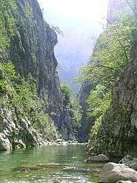
The Rakitnica river begins as Crna Rijeka (English = Black River) from "Zucina Vrela" (English = "Zuco's Wellsprings") that emerges in the areal above Rakitnica village under the northwestern ridge of Treskavica mountain, and after a short run, cca. 2 kilometers, and confluence with Glibovac creek it becomes Rakitnica. The Rakitnica river forms a 26 km long canyon, on its 33 km long stretch, carved between Bjelašnica and Visočica, southeast from Sarajevo. There is a hiking trail along the ridge of the Rakitnica canyon, all the way to famous village of Lukomir. The village, inhabited by Bosniaks, is the only remaining semi-nomadic traditional mountain village in Bosnia and Herzegovina. At almost 1,500m, Lukomir, with its unique stone homes with cherry-wood roof tiles, is also the highest and most isolated. Indeed, access to the village is impossible from the first snows in November until late April and sometimes even later, except by skis or on foot. A newly constructed lodge is now complete to receive guests and hikers.[1]
Protection
Bosnia and Herzegovina on several occasions, since 1998, was preparing to establish a large national park which, according to developed but never operationalized plans, would comprise the entire region of Gornja Neretva (English: Upper Neretva), including the Rakitnica river.[2][3]
See also
Water bodies
- Neretva
- Upper Neretva
- Lađanica
- Boračko Lake
- Mostarska Bijela
- Rama
- Buna river
- Bunica
- Trebižat
- Bregava
- Krupa River
- Trebišnjica
Settlements
Protected environment and treasures
- Blatačko Lake
- Lukomir
- Stara Ćuprija
- List of national parks of BiH
Nature and culture
- Salmo obtusirostris
- Salmo dentex
- Salmo marmoratus
- Environmental impacts of dams
- Environment and electricity generation
- Tourism in Bosnia and Herzegovina
- Stećci
- Bogomilism
- Treskavica
- Bjelašnica
- Visočica
- List of ancient tribes in Illyria
- List of Illyrian cities
External links
- Glavatičevo
- ZELENI-NERETVA Konjic NGO For Preservation Of The Neretva River And Environment Protection
- Declaration For The Protection Of The Neretva River for download - Declaration Initiator, ZELENI-NERETVA Konjic NGO For Preservation Of The Neretva River And Environment Protection
- WWF Panda - Living Neretva
- Regional Programme for Cultural and Natural Heritage in South East Europe Council of Europe - Directorate of Culture, Cultural and Natural Heritage
- Balkan Trout Restoration Group Site
- Center of expertise on hydropower impacts on fish and fish habitat, Canada
- REC Transboundary Cooperation Through the Management of Shared Natural Resources
- Bosnia and Herzegovina Commission for Preservation of National Monuments
- International Rivers
- Interactive site that demonstrates dams' effects on rivers
- Municipal Website of Konjic (in Bosnian)
- Website of Konjic (in Bosnian and English)
- Konjicani
- Neretva.org Open Project
- Rafting Neretva
- Ambasada Neretva Rafting
References
- "BH Tourism - Rakitnica Canyon". www.bhtourism.ba. Retrieved 2 June 2018.
- "Our view of the Hydroelectrical Power Station System "Upper Neretva"" (PDF). ZELENI-NERETVA Konjic NGO For Preservation Of The Neretva River And Environment Protection. Retrieved 2009-06-22.
- "Arguments Pro&Contra - Why Are We Contra The Hydroelectrical Power Station System "Upper Neretva"". ZELENI-NERETVA Konjic NGO For Preservation Of The Neretva River And Environment Protection. Retrieved 2009-06-22.
| Wikimedia Commons has media related to Rakitnica. |
| Countries | 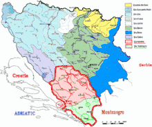 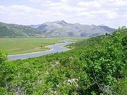 | ||||||||||||||||
|---|---|---|---|---|---|---|---|---|---|---|---|---|---|---|---|---|---|
| Places | |||||||||||||||||
| Wellsprings |
| ||||||||||||||||
| Tributaries |
| ||||||||||||||||
| Lakes |
| ||||||||||||||||
| Hydroelectric Power Plants |
| ||||||||||||||||
| Related articles | |||||||||||||||||
| Trebišnjica drainage: sub-basin of the Neretva |
| ||||||||||||||||