Doljani (Jablanica)
Doljani is populated place in Jablanica Municipality, Bosnia and Hercegovina, between Jablanica and Mostar. This village lies along the Doljanka river (which was named after it) Doljani are located in the northern Herzegovina, in the northeastern part of the Nature Park "Blidinje". Elevation ranges from 600 to 750 meters in the place. The highest peaks that surround the village are Baćin (1,282 m), Borovinka (1430 m), and Vitlenica (1655 m) Throughout the Doljani valley flowing the river Doljanka.[1][2]
Doljani | |
|---|---|
Village | |
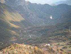 The view from the Obruč (Rim) | |
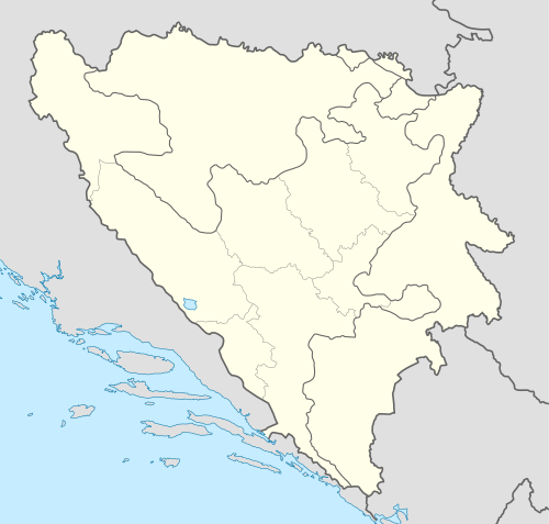 Doljani Location in Bosnia and Herzegovina | |
| Coordinates: 43.69°N 17.66°E | |
| Country | Bosnia and Herzegovina |
| Entity | Federacija Bosne i Hercegovine |
| Municipality | Jablanica |
| Highest elevation | 750 m (2,460 ft) |
| Lowest elevation | 600 m (2,000 ft) |
| Population (1991) | |
| • Total | 1.049 |
Demography
| Doljani Total population in 2013: 568[3] | ||||||
| Census Year | 1991. | 1981. | 1971. | |||
| Croats | 708 (67,49%) | 731 (69,68%) | 754 (71,80%) | |||
| Bosniaks | 326 (31,07%) | 316 (30,12%) | 294 (28,00%) | |||
| Serbs | 0 | 1 (0,09%) | 1 (0,09%) | |||
| Yugoslavians | 10 (0,95%) | 0 | 0 | |||
| Others and unknown | 5 (0,47%) | 1 (0,09%) | 1 (0,09%) | |||
| Total | 1,049 | 1,049 | 1.050 | |||
References
- Spahić M. et al. (2000): Bosna i Hercegovina (1:250.000). Izdavačko preduzeće "Sejtarija", Sarajevo.
- Mučibabić B., ed. (1998). Geografski atlas Bosne i Hercegovine. Geodetski zavod BiH. Sarajevo. ISBN 9958-766-00-0.
- "Nezavisna Agencija za Statistiku Bosne i Hercegovine, naselje Doljani". nasbih.com. Retrieved 11 January 2017.
This article is issued from Wikipedia. The text is licensed under Creative Commons - Attribution - Sharealike. Additional terms may apply for the media files.