Fulton County, New York
Fulton County is a county in the U.S. state of New York. As of the 2010 census, the population was 55,531.[1] Its county seat is Johnstown.[2] The county is named in honor of Robert Fulton,[3] who is widely credited with developing the first commercially successful steamboat.
Fulton County | |
|---|---|
County | |
 Fulton County Courthouse | |
 Flag  Seal | |
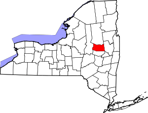 Location within the U.S. state of New York | |
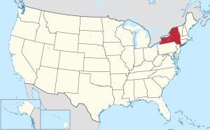 New York's location within the U.S. | |
| Coordinates: 43°07′N 74°25′W | |
| Country | |
| State | |
| Founded | 1838 |
| Named for | Robert Fulton |
| Seat | Johnstown |
| Largest city | Gloversville |
| Area | |
| • Total | 533 sq mi (1,380 km2) |
| • Land | 495 sq mi (1,280 km2) |
| • Water | 37 sq mi (100 km2) 7.0% |
| Population (2010) | |
| • Total | 55,531 |
| • Density | 112/sq mi (43/km2) |
| Time zone | UTC−5 (Eastern) |
| • Summer (DST) | UTC−4 (EDT) |
| Congressional district | 21st |
| Website | www |
Fulton County comprises the Gloversville, NY Micropolitan Statistical Area, which is included in the Albany-Schenectady, NY Combined Statistical Area.
History
In 1838, Fulton County was split off from Montgomery, shortly after the Montgomery county seat was moved to Fonda, New York. The creation of Fulton County was engineered by Johnstown lawyer Daniel Cady, whose wife was a cousin of Robert Fulton.[4]
Fulton County was created on April 18, 1838 by a partition of Montgomery County, resulting in a county with an area of 550 square miles (1,400 km2).[5]
The old Tryon County courthouse, later the Montgomery County courthouse, became the Fulton County Courthouse, where it is New York's oldest operating courthouse.
One adjustment has been made to the area of Fulton County. On April 6, 1860, 10 square miles (26 km2) on the northern border was transferred to Hamilton in the vicinity of Sacandaga Park.[6] This resulted in the Fulton County that exists today.
In the mid-18th century, Sir William Johnson, founder of Fort Johnson in Montgomery County and of Johnstown, arrived in what would become Fulton County. Sir William Johnson, 1st Baronet, was an Irish pioneer and army officer in colonial New York, and the British Superintendent of Indian Affairs from 1755 to 1774. His homes, Fort Johnson and Johnson Hall are current New York State Historic Sites.
Fulton County was also home to Elizabeth Cady Stanton, a central pioneer in America's women's rights movement.
Shortly after the American Revolutionary War, the manufacture of gloves and leather became the area's primary industry. At one point, Johnstown and Gloversville were known as the world's Glove and Leather capital. The largest rise in population and growth came as a result of the fruits of these businesses.
Many residents of Fulton County can trace their ancestry to the glove and leather trades. Today few glovers, tanners and leather dressers remain in the area, although some companies have adapted to the changes in the market to remain competitive.
Geography
According to the U.S. Census Bureau, the county has a total area of 533 square miles (1,380 km2), of which 495 square miles (1,280 km2) is land and 37 square miles (96 km2) (7.0%) is water.[7] Fulton County is in the central part of the state, northwest of Albany, lying in the southern Adirondack Mountains. Approximately 58% of the county is within the boundaries of Adirondack Park.
Adjacent counties
- Hamilton County - north
- Saratoga County - east
- Montgomery County - south
- Herkimer County - west
Demographics
| Historical population | |||
|---|---|---|---|
| Census | Pop. | %± | |
| 1840 | 18,049 | — | |
| 1850 | 20,171 | 11.8% | |
| 1860 | 24,162 | 19.8% | |
| 1870 | 27,064 | 12.0% | |
| 1880 | 30,985 | 14.5% | |
| 1890 | 37,650 | 21.5% | |
| 1900 | 42,842 | 13.8% | |
| 1910 | 44,534 | 3.9% | |
| 1920 | 44,927 | 0.9% | |
| 1930 | 46,560 | 3.6% | |
| 1940 | 48,597 | 4.4% | |
| 1950 | 51,021 | 5.0% | |
| 1960 | 51,304 | 0.6% | |
| 1970 | 52,637 | 2.6% | |
| 1980 | 55,153 | 4.8% | |
| 1990 | 54,191 | −1.7% | |
| 2000 | 55,073 | 1.6% | |
| 2010 | 55,531 | 0.8% | |
| Est. 2018 | 53,591 | [8] | −3.5% |
| U.S. Decennial Census[9] 1790-1960[10] 1900-1990[11] 1990-2000[12] 2010-2013[1] | |||
As of the census[13] of 2000, there were 55,073 people, 21,884 households, and 14,509 families residing in the county. The population density was 111 people per square mile (43/km²). There were 27,787 housing units at an average density of 56 per square mile (22/km²). The racial makeup of the county was 95.99% White, 1.80% Black or African American, 0.19% Native American, 0.53% Asian, 0.02% Pacific Islander, 0.56% from other races, and 0.91% from two or more races. 1.61% of the population were Hispanic or Latino of any race. 17.2% were of Italian, 16.4% German, 13.2% Irish, 10.0% English, 8.3% American, 5.8% French and 5.7% Polish ancestry according to Census 2000. 96.1% spoke English and 1.6% Spanish as their first language.
There were 21,884 households out of which 30.50% had children under the age of 18 living with them, 50.00% were married couples living together, 11.30% had a female householder with no husband present, and 33.70% were non-families. 27.70% of all households were made up of individuals and 12.90% had someone living alone who was 65 years of age or older. The average household size was 2.43 and the average family size was 2.94.
In the county, the population was spread out with 24.90% under the age of 18, 7.20% from 18 to 24, 28.10% from 25 to 44, 23.60% from 45 to 64, and 16.30% who were 65 years of age or older. The median age was 39 years. For every 100 females there were 97.10 males. For every 100 females age 18 and over, there were 93.60 males.
The median income for a household in the county was $33,663, and the median income for a family was $39,801. Males had a median income of $29,538 versus $22,173 for females. The per capita income for the county was $16,844. About 9.20% of families and 12.50% of the population were below the poverty line, including 17.50% of those under age 18 and 7.50% of those age 65 or over.
Education
Fulton–Montgomery Community College is in Johnstown, New York.
Transportation
Airports
The following public use airports are located in the county:[14]
- Fulton County Airport (NY0) – Johnstown
- Dolgeville Airport (1F6) – Dolgeville
Politics
| Year | Republican | Democratic | Third parties |
|---|---|---|---|
| 2016 | 63.5% 13,462 | 30.6% 6,496 | 5.9% 1,256 |
| 2012 | 54.6% 10,814 | 43.5% 8,607 | 1.9% 378 |
| 2008 | 53.7% 11,709 | 44.4% 9,695 | 1.9% 420 |
| 2004 | 56.6% 12,570 | 41.4% 9,202 | 2.0% 443 |
| 2000 | 52.8% 11,434 | 43.0% 9,314 | 4.3% 927 |
| 1996 | 37.3% 7,881 | 46.3% 9,779 | 16.4% 3,470 |
| 1992 | 40.0% 9,137 | 36.8% 8,400 | 23.2% 5,308 |
| 1988 | 56.2% 11,757 | 43.1% 9,012 | 0.8% 162 |
| 1984 | 65.8% 14,887 | 33.8% 7,644 | 0.4% 87 |
| 1980 | 53.2% 11,448 | 37.7% 8,105 | 9.2% 1,969 |
| 1976 | 56.2% 12,161 | 43.1% 9,323 | 0.7% 145 |
| 1972 | 67.3% 15,200 | 32.4% 7,303 | 0.3% 72 |
| 1968 | 54.5% 11,895 | 40.7% 8,871 | 4.8% 1,052 |
| 1964 | 31.4% 7,278 | 68.5% 15,846 | 0.1% 23 |
| 1960 | 58.1% 14,455 | 41.8% 10,409 | 0.1% 19 |
| 1956 | 74.2% 18,244 | 25.8% 6,352 | 0.0% 0 |
| 1952 | 70.3% 18,068 | 29.5% 7,570 | 0.2% 58 |
| 1948 | 60.5% 12,787 | 36.3% 7,667 | 3.2% 680 |
| 1944 | 59.8% 13,195 | 39.9% 8,813 | 0.3% 62 |
| 1940 | 62.0% 14,896 | 37.6% 9,040 | 0.3% 79 |
| 1936 | 60.1% 14,253 | 37.8% 8,977 | 2.1% 507 |
| 1932 | 71.4% 14,984 | 27.1% 5,678 | 1.6% 326 |
| 1928 | 71.2% 15,043 | 27.1% 5,728 | 1.7% 368 |
| 1924 | 72.5% 11,858 | 19.2% 3,143 | 8.3% 1,357 |
| 1920 | 70.4% 10,946 | 20.5% 3,192 | 9.0% 1,401 |
| 1916 | 54.4% 5,756 | 38.6% 4,085 | 7.1% 750 |
| 1912 | 38.0% 3,741 | 25.9% 2,550 | 36.1% 3,555 |
| 1908 | 58.0% 6,574 | 30.9% 3,508 | 11.1% 1,260 |
| 1904 | 56.9% 6,521 | 33.9% 3,884 | 9.2% 1,059 |
| 1900 | 61.9% 7,230 | 31.5% 3,678 | 6.6% 771 |
| 1896 | 63.4% 7,704 | 31.7% 3,849 | 4.9% 590 |
| 1892 | 51.7% 5,368 | 41.4% 4,293 | 6.9% 717 |
| 1888 | 53.9% 5,892 | 42.4% 4,634 | 3.7% 399 |
| 1884 | 54.0% 5,138 | 43.0% 4,091 | 3.0% 289 |
See also
References
- "State & County QuickFacts". United States Census Bureau. Archived from the original on June 7, 2011. Retrieved October 11, 2013.
- "Find a County". National Association of Counties. Archived from the original on 2011-05-31. Retrieved 2011-06-07.
- Gannett, Henry (1905). The Origin of Certain Place Names in the United States. Govt. Print. Off. pp. 133.
- New England Historic Genealogical Society Archived 2007-09-27 at the Wayback Machine
- New York. Laws of New York.: 1838, 61st Session, Chapter 332, Section 1, Page 328.
- New York. Laws of New York.: 1860, 83rd Session, Chapter 178; Page 298.
- "2010 Census Gazetteer Files". United States Census Bureau. August 22, 2012. Archived from the original on May 19, 2014. Retrieved January 4, 2015.
- "Population and Housing Unit Estimates". Retrieved December 20, 2019.
- "U.S. Decennial Census". United States Census Bureau. Retrieved January 4, 2015.
- "Historical Census Browser". University of Virginia Library. Retrieved January 4, 2015.
- "Population of Counties by Decennial Census: 1900 to 1990". United States Census Bureau. Retrieved January 4, 2015.
- "Census 2000 PHC-T-4. Ranking Tables for Counties: 1990 and 2000" (PDF). United States Census Bureau. Retrieved January 4, 2015.
- "U.S. Census website". United States Census Bureau. Retrieved 2008-01-31.
- Fulton County Public and Private Airports, New York. Retrieved June 13, 2013.
- Leip, David. "Dave Leip's Atlas of U.S. Presidential Elections". uselectionatlas.org. Retrieved 2018-10-22.
External links
- Fulton County Government Website
- "Glovers and Tanners of Fulton County"
- Fulton County Chamber of Commerce
- "Fulton-Montgomery Photo Archives
- "Fulton County Museum"
- Fulton County at Curlie
- Early history of Fulton County
Places adjacent to Fulton County, New York | ||||||||||
|---|---|---|---|---|---|---|---|---|---|---|
| ||||||||||
Municipalities and communities of Fulton County, New York, United States | ||
|---|---|---|
| Cities | | |
| Towns | ||
| Villages | ||
| CDP | ||
| Other Hamlets | ||
| Footnotes | ‡This populated place also has portions in an adjacent county or counties | |
Albany (capital) | ||
| Topics |
|  |
| Politics | ||
| Regions |
| |
| Metro areas | ||
| Counties |
| |
| Places |
| |
| Authority control |
|
|---|