Four Corners, Florida
Four Corners, also known as Citrus Ridge, is an unincorporated suburban community and census-designated place (CDP) in the U.S. state of Florida, located near the borders of Lake, Orange, Osceola, and Polk counties. The population of the Four Corners CDP was 26,116 at the 2010 census,[2] up from 12,015 at the 2000 census.
Four Corners, Florida Citrus Ridge | |
|---|---|
 Location in Lake County and the state of Florida | |
 U.S. Census Bureau map showing CDP boundaries | |
| Coordinates: 28°20′3″N 81°38′43″W | |
| Country | United States |
| State | Florida |
| Counties | Lake, Polk, Osceola, Orange |
| Area | |
| • Total | 50.8 sq mi (131.7 km2) |
| • Land | 47.4 sq mi (122.8 km2) |
| • Water | 3.4 sq mi (8.9 km2) |
| Elevation | 114 ft (35 m) |
| Population (2010) | |
| • Total | 26,116 |
| • Density | 551/sq mi (212.6/km2) |
| Time zone | UTC-5 (Eastern (EST)) |
| • Summer (DST) | UTC-4 (EDT) |
| ZIP codes | 33897, 34714, 34747, 34787 |
| FIPS code | 12-24581[1] |
The Lake, Orange, and Osceola County portions of Four Corners are part of the Orlando–Kissimmee–Sanford, Florida Metropolitan Statistical Area, while the Polk County portion is part of the Lakeland–Winter Haven Metropolitan Statistical Area.
Geography
Four Corners is located at 28°20′1″N 81°38′33″W (28.333701, -81.642451),[3] with the four-way intersection of the Lake, Orange, Osceola, and Polk County borders near the center of the CDP. Neighboring communities are Horizon West and Bay Lake to the northeast, Celebration to the east, and Loughman to the southeast. It is 25 miles (40 km) southwest of Orlando and 37 miles (60 km) northeast of Lakeland.
According to the United States Census Bureau, the Four Corners CDP has a total area of 50.8 square miles (131.7 km2), of which 47.4 square miles (122.8 km2) are land and 3.4 square miles (8.9 km2), or 6.74%, are water.[1]
The Census-drawn boundaries for the area include Interstate 4 along part of the southern border and U.S. Route 27 along part of the western border. The Western Beltway (Florida State Road 429) travels through the eastern portion of the CDP. Areas outside the CDP that are sometimes considered part of Four Corners include north along US 27 to Lake Louisa State Park (4 miles north of US 192), south along US 27 to Heart of Florida Hospital (3 miles south of I-4), west to SR 33, and east to Walt Disney World Resort and Celebration. Four Corners is the only community in Florida to be located in four counties.
Splendid China was a theme park in Four Corners. It opened in 1993, closed on December 31, 2003, and sat abandoned for 10 years after that. Splendid China Florida cost $100 million to build. It was a 75-acre (30 ha) miniature park with more than 60 replicas at one-tenth scale. Margaritaville Resort opened on the former Splendid China site, with resort homes, condos and timeshares in a Jimmy Buffett-themed setting. In the summer of 2019, the Sunset Walk restaurants and shops opened next to the Margaritaville Resort. Radio Margaritaville broadcasts from the Margaritaville Resort.
Demographics
As of the census of 2010, there were 26,116 people, 9,904 households, and 6,976 families residing in the CDP. The population density was 551 people per square mile (212.6/km²). There were 26,531 housing units, of which 16,627, or 62.7%, were vacant. 13,499 of the vacant units were for seasonal or recreational use. The racial makeup of the CDP was 76.1% White, 8.0% African American, 0.5% Native American, 2.5% Asian, 0.1% Pacific Islander, 9.2% some other race, and 3.5% from two or more races. Hispanic or Latino of any race were 30.1% of the population.[2]
Of the 9,904 households, 33.6% had children under the age of 18 living with them, 52.0% were headed by married couples living together, 13.3% had a female householder with no husband present, and 29.6% were non-families. 21.0% of all households were made up of individuals, and 4.9% were someone living alone who was 65 years of age or older. The average household size was 2.64, and the average family size was 3.05.[2]
23.7% of the CDP population were under the age of 18, 8.6% were from 18 to 24, 30.1% were from 25 to 44, 25.0% were from 45 to 64, and 12.7% were age 65 or older. The median age was 36.7 years. For every 100 females, there were 94.6 males. For every 100 females age 18 and over, there were 91.8 males.[2]
For the period 2013-17, the estimated median annual income for a household in the CDP was $53,750, and the median income for a family was $57,173. Male full-time workers had a median income of $36,079 versus $30,070 for females. The per capita income for the CDP was $23,653. About 12.8% of families and 15.9% of the population were below the poverty line, including 27.4% of those under age 18 and 6.7% of those age 65 or over.[4]
Government and infrastructure

Osceola County Fire Rescue operates Station 71 in Four Corners. Polk County Fire Rescue operates Station 42 (on U.S. 27 just south of U.S.192) and 33 (on Ronald Reagan Blvd just East of U.S. 27) in Four Corners. Lake County Fire Rescue operates Station 112 in Four Corners. Orange County Fire Rescue operates Station 32 in Four Corners.[5]
Education
The CDP is served by four different school districts:[6]
- Lake County Schools
- Polk County Public Schools
- School District of Osceola County, Florida
- Orange County Public Schools
- Residents of that section are zoned to: Keene's Crossing Elementary School,[7] Bridgewater Middle School,[8] and starting in 2017, Windermere High School.[9] Residents were previously assigned to West Orange High School.[10]
Transportation
The Four Corners area is served by U.S. Routes 27 and 192, which intersect one mile west of the quadripoint.
The area is served by two Lynx bus routes, which terminate at Legacy Boulevard on US 192.[11] Link 55 travels east on US 192, and link 427 travels south on US 27.
References
- "U.S. Gazetteer Files: 2019: Places: Florida". U.S. Census Bureau Geography Division. Retrieved November 13, 2019.
- "Profile of General Population and Housing Characteristics: 2010 Census Summary File 1 (DP-1), Four Corners CDP, Florida". American FactFinder. U.S. Census Bureau. Archived from the original on February 13, 2020. Retrieved November 13, 2019.
- "US Gazetteer files: 2010, 2000, and 1990". United States Census Bureau. 2011-02-12. Retrieved 2011-04-23.
- "Four Corners CDP, Florida: ACS 5-Year Estimates Subject Tables (2017)". data.census.gov. Retrieved November 13, 2019.
- "Station 71." Osceola County. Retrieved on April 19, 2017. " 8706 W. Irlo Bronson Memorial Hwy. Kissimmee, FL 34747"
- "2010 CENSUS - CENSUS BLOCK MAP (INDEX): Four Corners CDP, FL." U.S. Census Bureau. Retrieved on April 22, 2017. Map pages: 1, 2, 3, 4, 5, 6, 7, 8, 9, 10, A01, B01, C01, D01.
- "Keene's Crossing Elementary School Zone." Orange County Public Schools Office of Pupil Assignment. February 20, 2015. Retrieved on April 21, 2017.
- "Bridgewater Middle School Zone Archived 2017-04-22 at the Wayback Machine." Orange County Public Schools Office of Planning & Governmental Relations and Student Enrollment. April 28, 2016. Retrieved on April 22, 2017.
- "Windermere High School Attendance Zone map, effective 08/2017" (PDF). OCPS Department of Student Enrollment. Archived from the original (PDF) on 2017-03-22.
- "Rezoning Spring 2016 Archived 2017-02-04 at the Wayback Machine." Orange County Public Schools. Retrieved on April 22, 2017.
- "LYNX website". Archived from the original on 2014-01-11. Retrieved 2014-01-11.
Municipalities and communities of Lake County, Florida, United States | ||
|---|---|---|
| Cities | 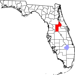 | |
| Towns | ||
| CDPs | ||
| Unincorporated communities | ||
| Footnotes | ‡This populated place also has portions in an adjacent county or counties | |
Municipalities and communities of Orange County, Florida, United States | ||
|---|---|---|
| Cities | 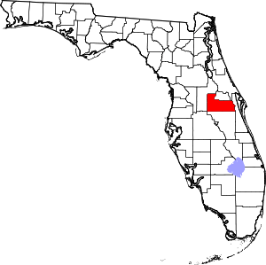 | |
| Towns | ||
| CDPs |
| |
| Unincorporated communities | ||
| Footnotes | ‡This populated place also has portions in an adjacent county or counties | |
Municipalities and communities of Osceola County, Florida, United States | ||
|---|---|---|
| Cities | 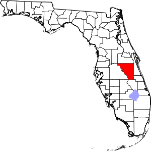 | |
| CDPs | ||
| Unincorporated communities |
| |
| Ghost town | ||
| Footnotes | ‡This populated place also has portions in an adjacent county or counties | |
Municipalities and communities of Polk County, Florida, United States | ||
|---|---|---|
| Cities |  | |
| Towns | ||
| Village | ||
| CDPs | ||
| Unincorporated communities | ||
| Ghost town | ||
| Footnotes | ‡This populated place also has portions in an adjacent county or counties | |
| Principal cities | 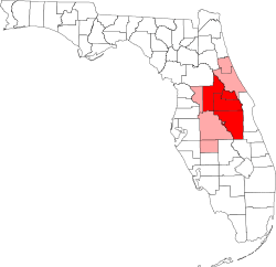 | ||||
|---|---|---|---|---|---|
| Counties |
| ||||
| Populated places | |||||
| Topics | |||||