Astatula, Florida
Astatula is a town in Lake County, Florida, United States. The population was 1,810 at the 2010 census[2] and an estimated 2,059 in 2018.[3] It is part of the Orlando–Kissimmee–Sanford Metropolitan Statistical Area.
Astatula, Florida | |
|---|---|
 Location in Lake County, Florida | |
| Coordinates: 28°42′48″N 81°44′3″W | |
| Country | |
| State | |
| County | |
| Area | |
| • Total | 3.16 sq mi (8.19 km2) |
| • Land | 3.13 sq mi (8.10 km2) |
| • Water | 0.03 sq mi (0.09 km2) |
| Elevation | 95 ft (29 m) |
| Population | |
| • Total | 1,810 |
| • Estimate (2018)[3] | 2,059 |
| • Density | 659/sq mi (254.3/km2) |
| Time zone | UTC-5 (Eastern (EST)) |
| • Summer (DST) | UTC-4 (EDT) |
| ZIP code | 34705 |
| Area code(s) | 352 |
| FIPS code | 12-02250[4] |
| GNIS feature ID | 0293916[5] |
| Website | www |
Geography
Astatula is located in central Lake County at 28°42′48″N 81°44′3″W (28.713220, -81.734248),[6] on the east side of Little Lake Harris. County Road 561 (Monroe Street) is the main road through the town; it leads north 8 miles (13 km) to Tavares, the county seat, and south 7 miles (11 km) to U.S. Route 27 near Minneola.
According to the United States Census Bureau, Astatula has a total area of 3.2 square miles (8.2 km2), of which 0.03 square miles (0.09 km2), or 1.12%, are water.[1]
Demographics
| Historical population | |||
|---|---|---|---|
| Census | Pop. | %± | |
| 1930 | 167 | — | |
| 1940 | 153 | −8.4% | |
| 1950 | 255 | 66.7% | |
| 1960 | 357 | 40.0% | |
| 1970 | 388 | 8.7% | |
| 1980 | 755 | 94.6% | |
| 1990 | 995 | 31.8% | |
| 2000 | 1,388 | 39.5% | |
| 2010 | 1,810 | 30.4% | |
| Est. 2018 | 2,059 | [3] | 13.8% |
| U.S. Decennial Census[7] | |||
At the 2000 census there were 1,298 people, 482 households, and 359 families in the town. The population density was 593.7 people per square mile (228.8/km²). There were 546 housing units at an average density of 249.8 per square mile (96.3/km²). The racial makeup of the town was 84.36% White, 1.23% African American, 0.54% Native American, 0.31% Asian, 10.48% from other races, and 3.08% from two or more races. Hispanic or Latino of any race were 19.41%.[4]
Of the 482 households 33.2% had children under the age of 18 living with them, 60.0% were married couples living together, 9.3% had a female householder with no husband present, and 25.5% were non-families. 19.5% of households were one person and 9.5% were one person aged 65 or older. The average household size was 2.69 and the average family size was 3.09.
The age distribution was 26.0% under the age of 18, 6.3% from 18 to 24, 29.4% from 25 to 44, 23.4% from 45 to 64, and 14.9% 65 or older. The median age was 38 years. For every 100 females, there were 92.9 males. For every 100 females age 18 and over, there were 95.5 males.
The median household income was $31,625 and the median family income was $33,393. Males had a median income of $26,602 versus $20,313 for females. The per capita income for the town was $15,832. About 6.8% of families and 8.0% of the population were below the poverty line, including 9.6% of those under age 18 and 4.9% of those age 65 or over.
In popular culture
Astatula is featured in an episode of the World's Strictest Parents.
References
- "U.S. Gazetteer Files: 2019: Places: Florida". U.S. Census Bureau Geography Division. Retrieved November 8, 2019.
- "Profile of General Population and Housing Characteristics: 2010 Census Summary File 1 (DP-1), Astatula town, Florida". American FactFinder. U.S. Census Bureau. Archived from the original on February 13, 2020. Retrieved November 8, 2019.
- "Population and Housing Unit Estimates". Retrieved June 4, 2019.
- "U.S. Census website". United States Census Bureau. Retrieved 2008-01-31.
- "US Board on Geographic Names". United States Geological Survey. 2007-10-25. Retrieved 2008-01-31.
- "US Gazetteer files: 2010, 2000, and 1990". United States Census Bureau. 2011-02-12. Retrieved 2011-04-23.
- "Census of Population and Housing". Census.gov. Retrieved June 4, 2015.
Municipalities and communities of Lake County, Florida, United States | ||
|---|---|---|
| Cities | 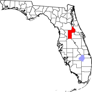 | |
| Towns | ||
| CDPs | ||
| Unincorporated communities | ||
| Footnotes | ‡This populated place also has portions in an adjacent county or counties | |
| Authority control |
|
|---|