Taraganj Upazila
Taraganj (Bengali: তারাগঞ্জ) is an Upazila of Rangpur District in the Division of Rangpur, Bangladesh.[1]
Taragonj তারাগঞ্জ | |
|---|---|
Upazila | |
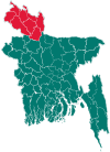
 Taragonj Location in Bangladesh | |
| Coordinates: 25°48.7′N 89°1′E | |
| Country | |
| Division | Rangpur Division |
| District | Rangpur District |
| Area | |
| • Total | 128.64 km2 (49.67 sq mi) |
| Population (2011) | |
| • Total | 140,823 |
| • Density | 1,100/km2 (2,800/sq mi) |
| Demonym(s) | Taraganji, Taragonji |
| Time zone | UTC+6 (BST) |
| Postal code | 5420 |
| Website | Official Website of Taragonj |
Geography
Taragonj is located at 25.8111°N 89.0167°E . It has 21234 households and total area 128.64 km².
Demographics
As of the 2011 Bangladesh census, Taraganj has a population of 140823. Males constitute 51.48% of the population, and females 48.52%. This Upazila's eighteen up population is 87803. Taraganj has an average literacy rate of 23.3% (7+ years), and the national average of 32.4% literate.[2]
Points of interest
Taragonj Haat is a famous & big in the northern side of Bangladesh and also it is called a business linkage place of Rangpur district. Tara BIBI's mazar is situated in the middle of the Haat. and by the name of TARA BIBI Taragonj was name and it is populated to the people.
In Sadar of Taraganj there is 50 beds hospital, One Degree College, Degree Madrasa, One Boys high school, Girls high school.
Administration
Taraganj has 5 Unions/Wards, 40 Mauzas/Mahallas, and 41 villages.
Unions are: 1. Alampur 2. Kursha 3. Ekarchali 4. Hariarkuti & 5. Soyar
See also
- Upazilas of Bangladesh
- Districts of Bangladesh
- Divisions of Bangladesh
References
- Abdul Malek (2012), "Taraganj Upazila", in Sirajul Islam and Ahmed A. Jamal (ed.), Banglapedia: National Encyclopedia of Bangladesh (Second ed.), Asiatic Society of Bangladesh
- "Population Census Wing, BBS". Archived from the original on 2005-03-27. Retrieved November 10, 2006.
| Upazila/Thana: |
| |
|---|---|---|
Capital: Rangpur | ||
| Dinajpur District |
|  |
| Gaibandha District | ||
| Kurigram District | ||
| Lalmonirhat District | ||
| Nilphamari District | ||
| Panchagarh District | ||
| Rangpur District | ||
| Thakurgaon District | ||