Badarganj Upazila
Badarganj (Bengali: বদরগঞ্জ) is an upazila of Rangpur District in the Division of Rangpur, Bangladesh.
Badarganj বদরগঞ্জ | |
|---|---|
Upazila | |
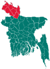
 Badarganj Location in Bangladesh | |
| Coordinates: 25°40′N 89°03′E | |
| Country | |
| Division | Rangpur Division |
| District | Rangpur District |
| Area | |
| • Total | 301.29 km2 (116.33 sq mi) |
| Population (2011) | |
| • Total | 287,746 |
| • Density | 960/km2 (2,500/sq mi) |
| Demonym(s) | Badarganji, Bodorgonji |
| Time zone | UTC+6 (BST) |
| Website | badargonj |
History
Archaeological heritage and relics include: Nine-domed Mosque at Lal Dighir Par of Radhanagar union (Mughal period), tomb of Kutub Shah at Kutubpur union, Bakhtyar Danga, Bhim Garh at Mansinghapur, Madai Khamar, Zamindar Bari at Dilalpur, Baroari Kali Mandir (BS. 1305) Sree Sree Praneswari Kali Mandir (BS. 1310), Gopinathpur Ashram and Mandir (BS. 1335), ruins of Jalubar Mandir, Ghatabeel Mandir, Burir Mandap, Shiva Mandir at Sekher Hat.
Historical events: Badarganj was a part of Barind region during the eleventh century. The king of the Barind area, Mahipal II used to collect taxes mercilessly. As a result, the kaibarta (fishermen) community rebelled against the king in 1071. The people of this region took part in anti British fakir-sannyasi resistance and Krishak Praja Bidraha (peasant-tenant rebellion) during 1760 to 1812. The indigo planters of Badarganj constructed a number of Neekhutis including Hariar Kuthi and Chandamari Kuthi. It is known that the peasants of Badarganj participated in the indigo resistance movement during 1859-1862. Besides, tebhaga movement in favour of the sharecroppers, was held under Haji Mohammad Danesh of Dinajpur in which Darajuddin Mandal, Comrade Jiten Datta, Chhayen Uddin participated. During the war of liberation Badarganj was declared a free zone during April 2 to April 14. The freedom fighters destroyed the railway lines to disrupt the movements of the Pakistani army. On 17 April 1971 the Pakistani army and their local collaborators conducted mass killings and set on fire such villages as Khalisa Hajipur, Bujruk Hajipur, Ghatabeel and Ramnathpur. War of Liberation memorial: Mass killing site 2 (Jharuar Beel and Padmapukur).
Geography
Badarganj is located at 25°40′N 89°03′E . It has 44029 households and total area 301.29 km². It is surrounded by Taraganj Upazila, Rangpur Sadar Upazila and Saidpur Upazila on the north, Nawabganj Upazila on the south, Rangpur Sadar Upazila and Mithapukur Upazilas on the east, Parbatipur Upazila on the west.
Rivers and depressions
Jamuneshwari, Chirnai, Katgara; Bhelakoba, Nandair, Chaprar, Haribhanga, Bashdaha, Varardaha, Patil Vasa, Saila and' Boali beels are notable.
Demographics
As of the 1991 Bangladesh census, Badarganj has a population of 213431. Males constitute 51.28% of the population, and females 48.72%. This Upazila's eighteen up population is 109320. Badarganj has an average literacy rate of 23.9% (7+ years), and the national average of 32.4% literate.[1]
Economy
Main sources of income Agriculture 69.54%, non-agricultural labourer 3.32%, industry 0.48%, commerce 13.8%, transport and communication 2.25%, service 4.58%, construction 0.75%, religious service 0.2%, rent and remittance 0.07% and others 5.01%. Ownership of agricultural land Landowner 41.42%, landless 50.58%; agricultural landowner: urban 36.56% and rural 51.26%. Main crops Paddy, jute, wheat, potato, mustard seed, tobacco, vegetables.' Extinct or nearly extinct crops Kaun, sesame, pulse. Main fruits Mango, banana, blackberry, jamrul, custard-apple. Fisheries, dairies and poultries This upazila has a number of fisheries, dairies and poultries. Communication facilities Pucca road 79 km, semi-pucca road 21 km, mud road 866 km; railway 19.31 km; waterway 29.70 nautical miles. Extinct or nearly extinct traditional transport Palanquin, horse carriage, bullock cart. Noted manufactories Sugar mill, rice mill, flour mill, threshed rice (chira) mill, ice cream factory, welding, steel factory, brick field, cold-storage. Cottage industries Goldsmith, blacksmith, potteries, weaving, wood work, sataranji industry, bidi factory, tailoring, bamboo work.
Points of interest
Among Archaeological heritage and relics are Nine-domed Mosque at Lal Dighir Par of Radhanagar union, tomb of Kutub Shah at Kutubpur union, Bakhtyar Danga, Vhim Garh at Mansinghapur, Madai Khamar, Zamindar Bari at Dilalpur.[2]
Administration
Administration Badarganj Thana was formed in 1793 and it was turned into an upazila in 1983.[3] Badarganj has 10 Unions/Wards, 64 Mauzas/Mahallas, and 119 villages.
Health centres include Upazila health complex 1, union health and family welfare centre 10, health centre 1. Religious institutions Mosque 315, temple 32, church 6, sacred place 1. There are above hats, bazars and fairs Total in Badarganj. The most noted hats and bazars are Badarganj, Laldighi, Kutubpur, Bagmara, Faridpur, Bakshmiganj, Bagarganj, Mominpur hat; noted fairs are Badarganj fair, Pirpal (Laldighi) Fair, Bakshmiganj and Badarganj fair.[2] BRAC, ASA, Grameen bank, RDRS, Seba, Grambikash are active NGOs in Badarganj.
See also
- Upazilas of Bangladesh
- Districts of Bangladesh
- Divisions of Bangladesh
References
- "Population Census Wing, BBS". Archived from the original on 27 March 2005. Retrieved 10 November 2006.
- Abdus Sattar, "Badarganj Upazila", Banglapedia
- Abdus Sattar. "Badarganj Upazila". Banglapedia.
| Upazila/Thana: |
| |
|---|---|---|
Capital: Rangpur | ||
| Dinajpur District |
|  |
| Gaibandha District | ||
| Kurigram District | ||
| Lalmonirhat District | ||
| Nilphamari District | ||
| Panchagarh District | ||
| Rangpur District | ||
| Thakurgaon District | ||