Baliadangi Upazila
Baliadangi (Bengali: বালিয়াডাঙ্গী) is an Upazila of Thakurgaon District in the Division of Rangpur, Bangladesh.[1]
Baliadangi বালিয়াডাঙ্গী | |
|---|---|
Upazila | |
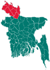
 Baliadangi Location in Bangladesh | |
| Coordinates: 26°6′N 88°16.5′E | |
| Country | |
| Division | Rangpur Division |
| District | Thakurgaon District |
| Area | |
| • Total | 284.12 km2 (109.70 sq mi) |
| Population (1991) | |
| • Total | 147,163 |
| • Density | 520/km2 (1,300/sq mi) |
| Time zone | UTC+6 (BST) |
| Website | Official Map of Baliadangi |
Geography
Baliadangi is located at 26.1000°N 88.2750°E . It has 28477 households and total area 284.12 km².
Baliadangi upazila is bounded by Atwari Upazila in Panchagarh District on the north, Thakurgaon Sadar Upazila on the east, Ranisankail Upazila on the south and Goalpokhar I and Islampur CD blocks in Uttar Dinajpur district, West Bengal, India, on the west.[2][3][4]
Demographics
As of the 1991 Bangladesh census, Baliadangi has a population of 147163. Males constitute 51.32% of the population, and females 48.68%. This Upazila's eighteen up population is 72500. Baliadangi has an average literacy rate of 23.8% (7+ years), and the national average of 32.4% literate.[5]
Administration
Baliadangi has 8 Unions/Wards, 78 Mauzas/Mahallas, and 78 villages.
College
Somiruddin Smrity College is a renowned College in Baliadang.
Somiruddin Smriti College Alumni Association
This student Organization was found in 2008. Somir is the most popular Magazine published by that Organization.
See also
- Upazilas of Bangladesh
- Districts of Bangladesh
- Divisions of Bangladesh
References
- Abu Md Iqbal Rumi Shah (2012), "Baliadangi Upazila", in Sirajul Islam and Ahmed A. Jamal (ed.), Banglapedia: National Encyclopedia of Bangladesh (Second ed.), Asiatic Society of Bangladesh
- "Baliadangi Upazila". Banglapedia. Retrieved 6 January 2019.
- "District Census Handbook Uttar Dinajpur, Series 20, Part XII A" (PDF). Map of Uttar Dinajpur district on the fifth page. Directorate of Census Operations, West Bengal. Retrieved 6 January 2018.
- "District Human Development Report". Uttar Dinajpur. Page 14: Map showing locational setting of Uttar Dinajpur district (includes Dakshin Dinajpur district). Department of Planning, Statistics and Programme Implementation, Government of West Bengal. Retrieved 6 January 2019.
- "Population Census Wing, BBS". Archived from the original on 2005-03-27. Retrieved November 10, 2006.
| Upazila/Thana: | ||
|---|---|---|
Capital: Rangpur | ||
| Dinajpur District |
|  |
| Gaibandha District | ||
| Kurigram District | ||
| Lalmonirhat District | ||
| Nilphamari District | ||
| Panchagarh District | ||
| Rangpur District | ||
| Thakurgaon District | ||