Ranisankail Upazila
Ranisankail (Bengali: রাণীশংকৈল) is an Upazila of Thakurgaon District in the Division of Rangpur, Bangladesh.[1]
Ranisankail রাণীশংকৈল | |
|---|---|
Upazila | |
 Ranisankail Location in Bangladesh | |
| Coordinates: 25°53.3′N 88°15.1′E | |
| Country | |
| Division | Rangpur Division |
| District | Thakurgaon District |
| Area | |
| • Upazila | 287.59 km2 (111.04 sq mi) |
| • Metro | 10.00 km2 (3.86 sq mi) |
| Population (1991) | |
| • Upazila | 156,107 |
| • Density | 540/km2 (1,400/sq mi) |
| Time zone | UTC+6 (BST) |
| Website | ranisankail |
Geography
Ranisankail is one of the ancient areas of Bengal. It lies in the North-east corner of Bangladesh and has a total area of 287.59 km². It lies about 420 km from Dhaka, the capital City of Bangladesh. The main rivers flowing through Ranisankail are the Kulic, Nagar, and Timai rivers. Land use total: cultivable land, 22405.09 hectares; fallow land, 6115.74; single crop, 30%, double crop, 55%; and treble crop 15%; cultivable land under irrigation, 69%.
Ranisankail upazila is bounded by Baliadangi and Thakurgaon Sadar upazilas on the north, Thakurgaon Sadar upazila on the east, Hemtabad CD block in Uttar Dinajpur district, West Bengal, India, on the south and Haripur Upazila on the west.[2][3][4]
Demographics
At the 1991 Bangladesh census, Ranisankail had a population of 156107 inhabitants. Males constitute 51.67% of the population and females 48.33%. The number of adults was 76,136. Ranisankail had an average literacy rate of 25.7% (7+ years), below the national average of 32.4%.[5]
Ranisankail (Town) consists of five mouzas. The area of the town is 13.94 km2. The town has a population of 25500; male 52.09%, female 47.91%; population density per km2 970. Literacy rate among the town people is 42.9%.
Population 156107; male 51.67%, female 48.33%. Muslim 76.23%, Hindu 22.79%, Christian 0.30% and others 0.98%; ethnic nationals: Santal 537 families. Main occupations Agriculture 53.7%, agricultural laborer 28.52%, wage laborer 2.59%, commerce 6.41%, service 2.41% and others 6.37%.
Economy
Land control - Among the peasants, 3.43% are landless, 14.01% marginal, 12.78% small, 64.59% intermediate and 5.19% rich; cultivable land per head 0.13 hectare.
Places of interest
Ranisankail is not only known for its natural environment, but also for its historical places. They include the Khunia Dighi Memorial, Palace of King Tonko Nath, Ramrai Dighi (a pond covering 50 acres), Nekmord Oras mela (Fair of Nekmardon), Nekamard Shah Nasiruddin Mazar. Nekmarad Hat. Katihar Hat in Razore village (known for Hindu shib mondir, Rash mela, Extinct Maghi Mela), Kulic river, Gorkoi Nath mondir (Temple-900 Years old), Dharmagar, Banglagar, Shidassory Pond (sida Digi, Bhandagram), Ranisonkail Pilot High School, Ancient Primary School (100 years old) and Rautnagar hat.
Administration
In Ranisankail there are 1 Pourasava with 9 woards and 8 Unions/Wards, 124 Mauzas/Mahallas, and 122 villages.
- City Mayor: Alamgir Sarker
- Chairman: Sahariar Ajam Munna
- Vice Chairman: Sohel Rana
- Woman Vice Chairman: Most. Sefali Begum
- Upazila Nirbahi Officer (UNO): Mousumi Afrida[6]
Transport
There are some highway bus services from Dhaka,Rajshahi to Ranisankail run by companies such as BRTC, Hanif, Nabil Poribahan, Rozina, Shymoli, Rahbar, AK Travels, Keya Poribahan, Depjol and others. Most of them go from Shamoly, Asadgate, Gabtoli of Dhaka. A bus trip from Dhaka to Ranisankail takes about 9–10 hours. These buses go through Bangabandhu Jamuna bridge on the Dhaka to Thakurgaon highway road. And Rajshahi to Ranisankail takes about 8-9 hours. Some BRTC buses go Rajshahi Via Gobindaganj.
Gallery
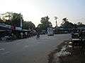 Shibdhighi Three point at Ranisankail
 Kulik River at westside of Ranisankail Upazila
References
- Abu Md. Iqbal Rumi Shah (2020), "Ranisankail Upazila", in Rahul Basak, Sirajul Islam and Ahmed A. Jamal (ed.), Banglapedia: National Encyclopedia of Bangladesh (Third ed.), Asiatic Society of Bangladesh
- "Ranisankail Upazila". Banglapedia. Retrieved 6 January 2019.
- "District Census Handbook Uttar Dinajpur, Series 20, Part XII A" (PDF). Map of Uttar Dinajpur district on the fifth page. Directorate of Census Operations, West Bengal. Retrieved 6 January 2018.
- "District Human Development Report". Uttar Dinajpur. Page 14: Map showing locational setting of Uttar Dinajpur district (includes Dakshin Dinajpur district). Department of Planning, Statistics and Programme Implementation, Government of West Bengal. Retrieved 6 January 2019.
- "Population Census Wing, BBS". Archived from the original on 2005-03-27. Retrieved November 10, 2006.
- "Archived copy". Archived from the original on 2020-02-26. Retrieved 2020-01-20.CS1 maint: archived copy as title (link)
| Upazila/Thana: | ||
|---|---|---|
Capital: Rangpur | ||
| Dinajpur District |
|  |
| Gaibandha District | ||
| Kurigram District | ||
| Lalmonirhat District | ||
| Nilphamari District | ||
| Panchagarh District | ||
| Rangpur District | ||
| Thakurgaon District | ||