Calistoga, California
Calistoga is a city in Napa County, in California's Wine Country. During the 2010 census, the population was 5,155.
Calistoga, California | |
|---|---|
City | |
 Looking north on 1200 block of Lincoln Ave | |
 Location of Calistoga in Napa County, California. | |
| Coordinates: 38°34′53″N 122°34′58″W | |
| Country | United States of America |
| State | California |
| County | Napa |
| Incorporated | January 6, 1886[1] |
| Government | |
| • Mayor | Chris Canning[2] |
| Area | |
| • Total | 2.62 sq mi (6.78 km2) |
| • Land | 2.60 sq mi (6.73 km2) |
| • Water | 0.02 sq mi (0.05 km2) 0.70% |
| Elevation | 348 ft (106 m) |
| Population | |
| • Total | 5,155 |
| • Estimate (2018)[6] | 5,322 |
| • Density | 2,044.26/sq mi (789.28/km2) |
| Time zone | UTC-8 (Pacific) |
| • Summer (DST) | UTC-7 (Pacific) |
| ZIP code | 94515 |
| Area code(s) | 707 |
| FIPS code | 06-09892 |
| GNIS feature IDs | 277482, 2409963 |
| Website | City Website |
History
The Upper Napa Valley was once the home of a significant population of Indigenous People, called the Wappo during the Spanish colonial era of the late 18th century. With abundant oak trees providing acorns as a food staple and the natural hot springs as a healing ground Calistoga (Wappo: Nilektsonoma, "Chicken Hawk Place")[7] was the site of several villages. Following Mexican Independence, mission properties were secularized and disposed of by the Mexican government with much of the Napa Valley being partitioned into large ranchos in the 1830s and 1840s. The first Anglo settlers began arriving in the 1840s, with several taking up lands in the Calistoga area.
Samuel Brannan was the leader of a Mormon settlement expedition on the ship Brooklyn landing in Yerba Buena (San Francisco) in 1846. He published San Francisco's first English language newspaper, the California Star. Following the discovery of gold in Coloma, Brannan pursued many business ventures, which made him California's first millionaire and became a leader in San Francisco's Committee of Vigilance. Fascinated by Calistoga's natural hot springs, Brannan purchased more than 2,000 acres (8 km2) with the intent to develop a spa reminiscent of Saratoga Springs in New York. "The name of Calistoga was given to the place in the fall of 1867, by Mr. Brannan. It was his boast that he was going to make the place the Saratoga of California, so he spliced the names and called it Cal (is) toga, the middle syllable for euphony. The place had already been previously called Hot Springs by the few Americans, and Agua Caliente by the Spaniards and Indians."
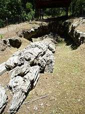
A writer[8] later claimed that Brannan intended to say "I'll make this place the Saratoga of California," but it came out "the Calistoga of Sarifornia".[9] His Hot Springs Resort surrounding Mt Lincoln with the Spa/Hotel located at what is now Indian Springs Resort and Brannan Cottage Inn, opened to California's rich and famous in 1862. In 1868 Brannan's Napa Valley Railroad Company's track was completed to Calistoga. This provided an easier travel option for ferry passengers making the journey from San Francisco. With the addition of railroad service, Calistoga became not only a destination, but also the transportation hub for the upper valley and a gateway to Lake and Sonoma Counties. A 6-meter diorama of this early Calistoga can be seen in the Sharpsteen Museum.

Calistoga's economy was based on mining (silver and mercury) agriculture (grapes, prunes and walnuts) and tourism (the hot springs). One of the early visitors was Robert Louis Stevenson. Yet to write his great novels, he had just married Fanny Vandegrift in San Francisco in May 1880, and the couple honeymooned at the Calistoga Hot Springs Hotel days later. Desiring to stay in the area, they moved from the hotel to an abandoned cabin at the nearby Silverado Mine on Mount Saint Helena. While working on other stories Stevenson kept a journal which became the Silverado Squatters describing many local features, residents and characters.
Calistoga made national headlines in 1881 when Anson Tichenor claimed that he had invented a way to extract gold from the waters of the hot springs. Tichenor's invention was soon proved to be a fraud.
In 1920, Giuseppe Musante, a soda fountain and candy store owner in Calistoga, was drilling for a cold water well at the Railway Exchange when he tapped into a hot water source. In 1924 he set up a bottling line and began selling Calistoga Sparkling Mineral Water. The company became a major player in the bottled water business after Elwood Sprenger bought the small bottling plant in 1970 known today as Calistoga Water Company.
Calistoga was named a Distinctive Destination by the National Trust for Historic Preservation in 2001.[10]
Scenes from the Disney movie Bedtime Stories starring Adam Sandler were filmed in Calistoga in June 2008.[11] .[12][13]
In 1964 the Hanley wildfire raced down the western slope of Mt St Helena and burned all the way to the outskirts of Santa Rosa. 30 miles to the west.[14]
In 2017, the Tubbs Fire, which killed at least 19 people, started off of Highway 128 and Bennett Lane in Calistoga. The fire led to the evacuation of almost the entire population of Calistoga. The 2017 Tubbs Fire took exactly the same path as the 1964 Hanley Fire
Geography
According to the United States Census Bureau, the city has a total area of 2.6 square miles (6.7 km2), 99.30% of it land and 0.70% of it water.[15]
Climate
According to National Weather Service records, Calistoga has cool, wet winters with temperatures dropping to freezing on an average of 34.1 days. Summers are usually very dry, with daytime temperatures regularly reaching 90 °F (32 °C) or higher on an average of 72.8 days, but nights are cool, dropping into the lower fifties. Average January temperatures range from 59.8 °F (15.4 °C) to 36.8 °F (2.7 °C). Average July temperatures range from 92.3 °F (33.5 °C) to 53.1 °F (11.7 °C). The record high temperature of 111 °F (44 °C) occurred on July 23, 2006. The record low temperature of 12 °F (−11 °C) was recorded on December 22, 1990. Calistoga has a hot-summer Mediterranean climate (Csa) according to the Köppen climate classification system.
Average annual rainfall is 37.56 inches (954 mm) with measurable precipitation falling on an average of 63 days each year. The wettest year was 1983 with 75.38 inches (1,915 mm) and the driest year was 1976 with 12.43 inches (316 mm). The most rainfall in one month was 32.06 inches (814 mm) in February 1986. The most rainfall in 24 hours was 8.10 inches (206 mm) on February 17, 1986. Snow often falls in the nearby mountains during the winter months, but is rare in Calistoga. On January 3, 1974, 3.0 inches of snow fell in the city.[16]
| Climate data for Calistoga, California (1981–2010 normals) | |||||||||||||
|---|---|---|---|---|---|---|---|---|---|---|---|---|---|
| Month | Jan | Feb | Mar | Apr | May | Jun | Jul | Aug | Sep | Oct | Nov | Dec | Year |
| Average high °F (°C) | 59.5 (15.3) |
62.9 (17.2) |
67.2 (19.6) |
72.4 (22.4) |
78.7 (25.9) |
85.9 (29.9) |
91.4 (33.0) |
90.7 (32.6) |
87.9 (31.1) |
79.3 (26.3) |
66.4 (19.1) |
58.5 (14.7) |
75.1 (23.9) |
| Average low °F (°C) | 37.3 (2.9) |
39.0 (3.9) |
40.4 (4.7) |
41.9 (5.5) |
46.3 (7.9) |
50.4 (10.2) |
52.5 (11.4) |
52.1 (11.2) |
50.2 (10.1) |
45.4 (7.4) |
40.4 (4.7) |
36.4 (2.4) |
44.4 (6.9) |
| Average rainfall inches (mm) | 8.22 (209) |
6.54 (166) |
4.99 (127) |
2.12 (54) |
1.09 (28) |
0.28 (7.1) |
0.04 (1.0) |
0.09 (2.3) |
0.38 (9.7) |
2.04 (52) |
4.27 (108) |
7.50 (191) |
37.56 (955.1) |
| Average rainy days (≥ 0.01 inch) | 11 | 9 | 9 | 6 | 4 | 1 | 0 | 0 | 1 | 4 | 8 | 10 | 63 |
| Source: [17] | |||||||||||||
Demographics
| Historical population | |||
|---|---|---|---|
| Census | Pop. | %± | |
| 1880 | 407 | — | |
| 1900 | 690 | — | |
| 1910 | 751 | 8.8% | |
| 1920 | 850 | 13.2% | |
| 1930 | 1,000 | 17.6% | |
| 1940 | 1,124 | 12.4% | |
| 1950 | 1,418 | 26.2% | |
| 1960 | 1,514 | 6.8% | |
| 1970 | 1,882 | 24.3% | |
| 1980 | 3,879 | 106.1% | |
| 1990 | 4,468 | 15.2% | |
| 2000 | 5,190 | 16.2% | |
| 2010 | 5,155 | −0.7% | |
| Est. 2018 | 5,322 | [6] | 3.2% |
| U.S. Decennial Census[18] | |||

2010
At the 2010 census Calistoga had a population of 5,155. The population density was 1,972.4 people per square mile (761.5/km²). The racial makeup of Calistoga was 3,735 (72.5%) White, 27 (0.5%) African American, 21 (0.4%) Native American, 47 (0.9%) Asian, 10 (0.2%) Pacific Islander, 968 (18.8%) from other races, and 347 (6.7%) from two or more races. Hispanic or Latino of any race were 2,545 persons (49.4%).[15][19][20]
The census reported that 5,100 people (98.9% of the population) lived in households, 20 (0.4%) lived in non-institutionalized group quarters, and 35 (0.7%) were institutionalized.
There were 2,019 households, 630 (31.2%) had children under the age of 18 living in them, 927 (45.9%) were opposite-sex married couples living together, 189 (9.4%) had a female householder with no husband present, 99 (4.9%) had a male householder with no wife present. There were 141 (7.0%) unmarried opposite-sex partnerships, and 20 (1.0%) same-sex married couples or partnerships. 641 households (31.7%) were one person and 332 (16.4%) had someone living alone who was 65 or older. The average household size was 2.53. There were 1,215 families (60.2% of households); the average family size was 3.23.
The age distribution was 1,167 people (22.6%) under the age of 18, 400 people (7.8%) aged 18 to 24, 1,341 people (26.0%) aged 25 to 44, 1,283 people (24.9%) aged 45 to 64, and 964 people (18.7%) who were 65 or older. The median age was 40.0 years. For every 100 females, there were 96.5 males. For every 100 females age 18 and over, there were 93.7 males.
There were 2,319 housing units at an average density of 887.3 per square mile, of the occupied units 1,166 (57.8%) were owner-occupied and 853 (42.2%) were rented.The homeowner vacancy rate was 3.4%; the rental vacancy rate was 5.0%. 2,545 people (49.4% of the population) lived in owner-occupied housing units and 2,555 people (49.6%) lived in rental housing units.
2000
At the 2000 census there were 5,190 people in 2,042 households, including 1,243 families, in the city. The population density was 1,997.4 people per square mile (770.7/km²). There were 2,249 housing units at an average density of 865.5 per square mile (334.0/km²).[21] Of the 2,042 households 29.0% had children under the age of 18 living with them, 47.2% were married couples living together, 8.2% had a female householder with no husband present, and 39.1% were non-families. 31.4% of households were one person and 17.1% were one person aged 65 or older. The average household size was 2.51 and the average family size was 3.20.
The age distribution was 23.3% under the age of 18, 8.5% from 18 to 24, 27.0% from 25 to 44, 21.7% from 45 to 64, and 19.6% 65 or older. The median age was 38 years. For every 100 females, there were 99.6 males. For every 100 females age 18 and over, there were 94.6 males.
The median income for a household in the city was $38,454, and the median family income was $44,375. Males had a median income of $32,344 versus $29,844 for females. The per capita income for the city was $21,134. About 5.2% of families and 8.0% of the population were below the poverty line, including 9.5% of those under age 18 and 5.7% of those age 65 or over.
Government
In the California State Legislature, Calistoga is in the 3rd Senate District, represented by Democrat Bill Dodd, and in the 4th Assembly District, represented by Democrat Cecilia Aguiar-Curry.[22]
In the United States House of Representatives, Calistoga is in California's 5th congressional district, represented by Democrat Mike Thompson.[23]
| Year | Democratic | Republican |
|---|---|---|
| 2016 | 72.6% 1,412 | 21.2% 413 |
| 2012 | 71.3% 1,353 | 26.4% 501 |
| 2008 | 72.9% 1,437 | 26.0% 513 |
| 2004 | 69.6% 781 | 28.5% 320 |
| 2000 | 55.7% 1,010 | 34.8% 631 |
| 1996 | 53.4% 669 | 31.7% 397 |
| 1992 | 50.6% 786 | 27.3% 424 |
| 1988 | 52.6% 773 | 45.6% 670 |
| 1984 | 44.3% 697 | 53.9% 848 |
| 1980 | 35.6% 624 | 52.5% 920 |
| 1976 | 43.5% 633' | 54.1% 787 |
| 1972 | 36.6% 365 | 58.8% 587 |
| 1968 | 45.5% 393 | 47.3% 408 |
| 1964 | 63.0% 557 | 37.0% 327 |
Tourist attractions


Calistoga is at the north end of the Napa Valley Calistoga AVA, part of California's Wine Country. There are numerous wineries within a short drive. The city allows visitors to see wine country as it was before freeways and fast food—only two-lane roads lead there and fast food franchises are banned by law.[25]
Calistoga itself is noted for its hot springs spas such as Calistoga Spa Hot Springs. A local specialty is immersion in hot volcanic ash, known as a mud bath. Nearby attractions include an artificial geothermal geyser known as the "Old Faithful of California" or "Little Old Faithful". The geyser erupts from the casing of a well drilled in the late 19th century. According to Dr. John Rinehart in his book A Guide to Geyser Gazing (1976 p. 49), a man had drilled into the geyser in search for water. He had actually "simply opened up a dead geyser".[26]
Economy
Major employers in Calistoga include Solage resort, Calistoga Joint Unified School District, Indian Springs Calistoga resort, and the Calistoga Spa Hot Springs.[27] Neighboring vineyards include Sterling Vineyards.
Notable people
- Bob Knepper, former Major League Baseball player attended Calistoga High School.
- Tom Seaver, former Major League Baseball player lives south of Calistoga.
- Dick Vermeil, former head coach of the Philadelphia Eagles, St. Louis Rams, & Kansas City Chiefs was born in Calistoga.
References
- "California Cities by Incorporation Date". California Association of Local Agency Formation Commissions. Archived from the original (Word) on November 3, 2014. Retrieved August 25, 2014.
- "About Us". City of Calistoga. Retrieved September 17, 2014.
- "2016 U.S. Gazetteer Files". United States Census Bureau. Retrieved July 19, 2017.
- "Calistoga". Geographic Names Information System. United States Geological Survey. Retrieved October 20, 2014.
- "Calistoga (city) QuickFacts". United States Census Bureau. Archived from the original on April 13, 2015. Retrieved April 7, 2015.
- "Population and Housing Unit Estimates". Retrieved September 19, 2019.
- "Wappo Language". Wappo Indians of Napa County. Archived from the original on February 8, 2012. Retrieved August 15, 2012.
- Bright, William (1998). California Place Names. Berkeley: University of California Press. ISBN 978-0-520-24217-3.
- Yerger, Rebecca (July 15, 2011). "Calistoga celebrates No. 125". Napa Valley Register. Retrieved July 16, 2011.
- "About Calistoga California 94515 - Area Code 707 USA". napayellowpages.com. Retrieved July 25, 2017.
- Register, Napa Valley. "The Weekly Calistogan". Napa Valley Register. Retrieved April 10, 2018.
- Scenes from the movie Hot Rod 1979 were filmed in & around Calistoga (stars included Robert Culp & Pernell Roberts)
- [24]
- [25]
- "Calistoga, California Population 2018". worldpopulationreview.com. Archived from the original on January 14, 2019. Retrieved January 15, 2019.
- "Central California". www.wrcc.dri.edu. Retrieved April 10, 2018.
- "CALISTOGA, CALIFORNIA - Climate Summary". www.wrcc.dri.edu. Retrieved April 10, 2018.
- "Census of Population and Housing". Census.gov. Retrieved June 4, 2015.
- "Calistoga, CA Population - Census 2010 and 2000 Interactive Map, Demographics, Statistics, Quick Facts - CensusViewer". censusviewer.com. Archived from the original on April 19, 2015. Retrieved January 15, 2019.
- "2010 Census Interactive Population Search: CA - Calistoga city". U.S. Census Bureau. Archived from the original on July 15, 2014. Retrieved July 12, 2014.
- "U.S. Census website". United States Census Bureau. Retrieved 2008-01-31.
- "Statewide Database". UC Regents. Archived from the original on February 1, 2015. Retrieved January 27, 2015.
- "California's 5th Congressional District - Representatives & District Map". Civic Impulse, LLC. Retrieved March 3, 2013.
- https://www.sos.ca.gov/elections/prior-elections/statewide-election-results/
- "Calistoga Municipal Code".
- Jones, Wyoming "Old Faithful Geyser of California" WyoJones' Geyser Pages Retrieved on 2008-03-31
- 2017 CAFR
External links
| Wikimedia Commons has media related to Calistoga, California. |
| Wikivoyage has a travel guide for Calistoga. |
- Official website

- The Calistoga Chamber of Commerce & Visitors Bureau
- Calistoga Tribune (one of two local newspapers)
- The Silverado Squatters by Robert Louis Stevenson
- The Weekly Calistogan (one of two local newspapers)
- Warming Up in the Vineyard, Tom Terrific Article from The New York Times 2005-12-28
Places adjacent to Calistoga, California | |
|---|---|
Municipalities and communities of Napa County, California, United States | ||
|---|---|---|
| Cities and towns | 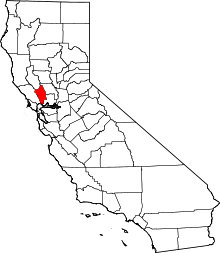 Napa County map | |
| CDPs |
| |
| Unincorporated communities |
| |
| Ghost towns | ||
| Bodies of water |
|  |
|---|---|---|
| Counties | ||
| Major cities | ||
| Cities and towns 100k–250k | ||
| Cities and towns 50k–99k | ||
| Cities and towns 25k–50k | ||
| Cities and towns 10k–25k |
| |
| Sub-regions | ||
| Authority control |
|
|---|