Balakan District
Balakan (Avar: Билкан/Bilkan ; Azerbaijani: Balakən) is a rayon of northwestern Azerbaijan, located between Georgia and Russia. It borders Kakheti of Georgia to south and west and Dagestan of Russia to east and north. There is an Azerbaijan-Georgia border crossing at Postbina in the rayon that is open to both local residents and foreigners.
Balakən | |
|---|---|
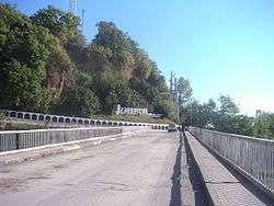 The international border crossing from Georgia to Balakan | |
.svg.png) Map of Azerbaijan showing Balakan Rayon | |
| Country | Azerbaijan |
| Established | 8 August 1930 |
| Capital | Balakən |
| Area | |
| • Total | 940 km2 (360 sq mi) |
| Population (2018)[1] | |
| • Total | 97,600 |
| • Density | 104/km2 (270/sq mi) |
| Postal code | 0800 |
| Telephone code | (+994) 24[2] |
History of the rayon
Archaeological finds including many historical monuments and kurgans in the region speak of early human habitation. Balakan was a part of Caucasian Albania. A Greek writer of the time who authored books on the battle between the Roman troops and Caucasian Albanians on the bank of Alazani (Qanıx) river in 65 AD., described the locals as calm, prideful and full of courage. In the 7th century Balakan was invaded by Arabs and Balakən settlement was destroyed. After the Arab rule was overthrown in 9th–10th centuries, Balakan established its political and economic links with Shaki. Both provinces developed sericulture as their primary industry.[3]
Etymology of names such as "Getovlar" (similar to Hettax), Hunbulanchay (similar to Huns), Ingiloy (similar to Gellah) and others confirm habitation of the region by early nomadic Turkic tribes.
In 1803 the Balakan Rayon territory was incorporated into the Russian Empire and was administratively a part of Georgia until 1842, after that it was a separate oblast. In 1844 the Char-Balakan Military Region was founded. From 1860 to the end of the Russian Empire it was a part of Georgia within the Tiflis Governorate.[4]
When Democratic Republic of Georgia was established, Balakan was a part of Zaqatala District, one of Georgia's eastern provinces. After the Soviet occupation of Georgia in 1921, Zaqatala District was handed over to Azerbaijani SSR by the Bolshevik Government.[5]
During the Great Patriotic War, 6,882 residents of Balakan fought Nazi Germany and 2,315 of them died on the front lines. During Nagorno-Karabakh War, Balakan lost 152 residents who fought in Karabakh. Balakan rayon was created on 8 August 1930. The settlement Balakən was assigned to be the administrative center of the rayon. It later grew to become a city type settlement in 1954 and received a status of a city in 1968.[6] In 1963, the rayon was abolished and joined with Zaqatala Rayon. In 1965, it was again re-established as an independent rayon.[3]
Among the historical monuments are the 9th century Albanian church 18 km away from the administrative center of Balakan, Peri castle dating to 7th–8th centuries in Qullar village, 17th-century mosque with a 45-meter minaret in Balakən city, Nokho Cave in the Qubek gorge pertaining to the Iron Age, ruins and pilgrimage site from the 5th–8th centuries located 2 km west of Mahamalar village, 1st–2nd century BC necropolis 1 km north of the same village, mosque built in 1780 and an underground water storage facilities from the 18th century in Qullar village, a 19th-century fortress and 18th-century mosque in Mahamalar, a 14th-century mosque in Katex village, 17th-century four-edged castle and two tombs, a 14th-century mausoleum in Tülü village, mosque built in 1910 in İtitala village, 14th-century temple in Hənifə village, 16th-century mosque in Xalatala and temples in Mazımçay, ruins of a settlement from Middle Ages on Maklakan mountain.[7]
Geography and economy
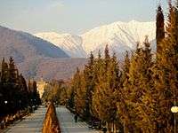
The rayon is situated at the foothills of Greater Caucasus and is very rich with flora and fauna. Balakan mountains makes up the big part of Zakatala State Reserve. The Katex waterfalls is located in the reserve. Due to existence of many mountains in the rayon, Balakan is rich with many rivers. The mountainous part of rayon is cold, the temperature in lower parts is mild. Average annual humidity reaches 41%, average monthly temperature is 13 °C (55 °F). The northern part of rayon is enriched with vegetation, among them hornbeam, alder, oak, chestnut, walnut, acacia trees, as well as raspberry, rose hip and medlar. There are over 30 plants used for medical treatment purposes.[7]
Balakan region is considered one of the most resourceful regions of Azerbaijan by its economic potential, natural resources and cultural heritage. The economy of rayon is based on agrarian sector. Main segments of the agriculture are tobacco growing, horticulture, sericulture and corn cultivation. Additionally, cattlebreeding, wheat growing, winemaking and fishery are widely practised. There are 123 agricultural farming businesses in Balakan rayon.[6]
Infrastructure
The 1970-1980s saw rapid economic reforms due to construction of Baku-Balakan Railway which connected the region with capital Baku and industrial Absheron Peninsula. There are 48 secondary schools with 16,872 (2007 census) students and 1,629 teachers and 24 kindergartens in the region. Additionally, there are 1 stadium, 29 sports facilities and 20 sports complexes. There are 6 hospitals, tuberculosis treatment center and family planning centers with 126 doctors and 497 nurses. The capital city has one central library which has 49 branches throughout the rayon. Over 370 students study at 7 musical schools.[6]
Demographics
There is one city of Balakən and 59 villages in the rayon. According to 2018 census, Balakan rayon has 97,600 residents, out of which 14,900 (15%) live in urban and 82,700 (85%) live in rural areas. Men make up 49.6%, women – 50.4% of the population. The population density is 95.7 people per 1 km2. In 2010, there were 1,238 newborns and 510 deaths in rayon. The ethnic composition of the rayon is very rich. Representatives of 27 ethnicities live in Balakan rayon. The largest group, Azeris make up 88.4% of the population (61,170 people living throughout the region), Avars – 18,4% (25,370 people living mainly in Qabaqçöl, Mahamalar and Mazımçay villages), Ingiloys (Muslim Georgians) – 2.4% (2,145 people living mainly in İtitala village) and other ethnicities such as Georgians (23 residents), Lezgins (223 residents), Russians (138 residents), Laks (23 residents), Persians (226 residents), Tatars (27 residents), Tsakhurs (13 residents), Turks (11 residents), Ukrainians (6 residents), Armenians (3 residents) and Talysh (1 resident) – 1.49%.[3][6]
Population
According to the State Statistics Committee, as of 2018, the population of city recorded 97,600 persons, which increased by 13,100 persons (about 15.5 percent) from 84,500 persons in 2000.[8] 48,400 of total population are men, 49,200 are women.[9] More than 26 percent of the population (about 25,700 persons) consists of young people and teenagers aged 14–29.[10]
| Region | 2000 | 2001 | 2002 | 2003 | 2004 | 2005 | 2006 | 2007 | 2008 | 2009 | 2010 | 2011 | 2012 | 2013 | 2014 | 2015 | 2016 | 2017 | 2018 |
|---|---|---|---|---|---|---|---|---|---|---|---|---|---|---|---|---|---|---|---|
| Balakan region | 84,5 | 85,1 | 85,7 | 86,2 | 86,7 | 87,3 | 87,9 | 88,4 | 89,0 | 89,7 | 90,5 | 91,1 | 92,1 | 93,0 | 93,8 | 94,9 | 95,9 | 96,8 | 97,6 |
| urban population | 10,0 | 10,0 | 10,1 | 10,1 | 10,2 | 10,2 | 10,2 | 10,3 | 10,3 | 10,3 | 10,4 | 10,4 | 10,4 | 10,5 | 14,3 | 14,5 | 14,7 | 14,8 | 14,9 |
| rural population | 74,5 | 75,1 | 75,6 | 76,1 | 76,5 | 77,1 | 77,7 | 78,1 | 78,7 | 79,4 | 80,1 | 80,7 | 81,7 | 82,5 | 79,5 | 80,4 | 81,2 | 82,0 | 82,7 |
Language
The majority of the population speak the Azerbaijan language with a minority of Avar and Georgian speakers.[6]
Religion
About 95% of the population of the Balakan city is Muslim.[6]
Recreation and tourism
Festivals
As the district is contributing mostly to the persimmon production in Azerbaijan, Balakan started to host annual Hazelnut Festival since 2017. The festival is organized annually in October–November when the most delicious persimmon grows. In the festival, different varieties of persimmon, culinary products and different compositions made of persimmon are displayed. It also features a field trip to the persimmon garden in the Gerekli village and planting persimmon trees.[11][12][13][14]
References
- The State Statistical Committee of the Azerbaijan Republic
- "Şəhərlərarası telefon kodları". Aztelekom MMC. Aztelekom İB. Retrieved 19 August 2015. (in Azerbaijani)
- "EP of Balakan. Balakən tarixi". Archived from the original on 30 May 2009. Retrieved 1 February 2010.
- "Ingilos – History and Cultural Relations". Retrieved 1 February 2011.
- "World Statesmen of Georgia". Retrieved 6 February 2011.
- Президентская библиотека Азербайджанской Республики. При содействии Академии Наук. Baku. 2008. pp. 47–48.
- "State library. BALAKƏN RAYONU". Archived from the original on 6 July 2011. Retrieved 1 February 2010.
- "Political division, population size and structure: Population by towns and regions of the Republic of Azerbaijan". The State Statistical Committee of the Republic of Azerbaijan. Retrieved 18 December 2018.
- "Political division, population size and structure: Population by sex, towns and regions, urban settlements of the Republic of Azerbaijan at the beginning of the 2018". The State Statistical Committee of the Republic of Azerbaijan. Retrieved 18 December 2018.
- "Political division, population size and structure: Population at age 14-29 by towns and regions of the Republic of Azerbaijan at the beginning of the 2018". The State Statistical Committee of the Republic of Azerbaijan. Retrieved 18 December 2018.
- "Balakan to host first Persimmon Festival". AzerNews.az. 25 October 2017. Retrieved 22 November 2019.
- "3rd Persimmon Festival held in Balakan". AzerNews.az. 28 October 2019. Retrieved 22 November 2019.
- "В Азербайджане проходит первый Фестиваль хурмы (ФОТО)". Trend.Az (in Russian). 4 November 2017. Retrieved 22 November 2019.
- "Narıncının sehrində: Balakən festivalından görüntülər". Sputnik Azerbaijani (in Azerbaijani). Retrieved 22 November 2019.