Kangarli District
Kangarli (Azerbaijani: Kəngərli; also known as Kengerli) is the newest raion of Azerbaijan, in the Nakhchivan Autonomous Republic. Kangarli district was established in March 19, 2004. The district of Kangarli is located between the districts of Babek and Sharur. The southern part of the district is bordered by Iran, the northern - by Armenia. The landscape of the district is predominantly mountainous; it is located on the Daralayaz Plateau. The area is 704 square km. It was split off from Sharur raion in March 2004. The administrative center of the raion is Givrakh. The name Kangarli was originally applied to a Turkic tribe who founded a regional Maku Khanate that ruled the area. On 25 May 2004, President Ilham Aliyev appointed Nazim Cafarov as the executive head of the raion.[1]
Kangarli | |
|---|---|
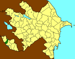 Map of Azerbaijan showing Kangarli Raion | |
| Country | |
| Autonomous republic | Nakhchivan |
| Settlement | 1 |
| Villages | 10 |
| Capital | Givrakh |
| Government | |
| • Executive power | Jafarov N. |
| Area | |
| • Total | 704,89 km2 (27,216 sq mi) |
| Population | |
| • Total | 31,000 |
| • Density | 0.44/km2 (1.1/sq mi) |
| Time zone | UTC+4 (AZT) |
| Postal code | AZ6827 |
| Telephone code | (+994) 36 |
General Information
The village of Givrakh is the administrative center of the district. It was founded only in 2004. Givrakh is located on the Nakhchivan-Sharur highway, 30 km from the capital (Nakhchivan) and 6 km from the Araz River. The climate, like in the rest of the autonomous republic, is strongly continental; it is very hot in summer and chilling in winter. On the territory of the district runs the Araz River that flows along the border between Azerbaijan and Iran. Mountainous landscape, climatic conditions and lack of small rivers underlay the features of the indigenous fauna, which is represented largely by semidesert and mountainous species (bushes, herbage and scarce trees). This is an agricultural district with advanced tobacco, cine, grain, vegetable and melon growing.
Historical Monuments
Like the rest of Nakhchivan Autonomous Republic, there are many ancient monuments, evidencing that the land was inhabited in earliest times: the Chilkhangala mounds, the Gazma Cave and the ancient settlements of Galadzhig, Govurgala, Damlama, Gulamtepe and Balatepe. There are also newer monuments - the Jami Mosque (18th century) in the village of Khok, a mosque of the 18th century and a bath of the 19th century in the village of Shakhtakhty.[2]
Population
According to the State Statistics Committee, as of 2018, the population of city recorded 32,200 persons, which increased by 6,900 persons (about 27 percent) from 25,300 persons in 2004.[3] 15,900 of total population are men, 16,300 are women.[4] More than 10,9 percent of the population (about 8,200 persons) consists of young people and teenagers aged 14–29.[5]
| Region | 2004 | 2005 | 2006 | 2007 | 2008 | 2009 | 2010 | 2011 | 2012 | 2013 | 2014 | 2015 | 2016 | 2017 | 2018 |
|---|---|---|---|---|---|---|---|---|---|---|---|---|---|---|---|
| Kengerli region | 25,3 | 25,6 | 26,1 | 26,4 | 26,9 | 27,5 | 27,9 | 28,6 | 29,2 | 29,9 | 30,6 | 31,0 | 31,4 | 31,8 | 32,2 |
| urban population | 4,2 | 4,2 | 4,3 | 4,4 | 4,5 | 4,6 | 5,1 | 5,3 | 5,4 | 5,5 | 5,7 | 5,8 | 5,9 | 6,0 | 6,1 |
| rural population | 21,1 | 21,4 | 21,8 | 22,0 | 22,4 | 22,9 | 22,8 | 23,3 | 23,8 | 24,4 | 24,9 | 25,2 | 25,5 | 25,8 | 26,1 |
References
- "Azeri leader appoints new executive heads in two districts". BBC Monitoring Central Asia. May 26, 2004. p. 1. ProQuest 450470528.
- Kəngərli raion
- "Political division, population size and structure: Population by towns and regions of the Republic of Azerbaijan". The State Statistical Committee of the Republic of Azerbaijan. Retrieved 2018-12-18.
- "Political division, population size and structure: Population by sex, towns and regions, urban settlements of the Republic of Azerbaijan at the beginning of the 2018". The State Statistical Committee of the Republic of Azerbaijan. Retrieved 2018-12-18.
- "Political division, population size and structure: Population at age 14-29 by towns and regions of the Republic of Azerbaijan at the beginning of the 2018". The State Statistical Committee of the Republic of Azerbaijan. Retrieved 2018-12-18.
- Naxçıvan Ensiklopediyası, I cild, Naxçıvan, 2005,
- Kəngərli rayonu məqaləsi. Naxçıvan Muxtar Respublikasının Kəngərli rayonu. Naxçıvan, 2008.