Easton, New Hampshire
Easton is a town in Grafton County, New Hampshire, United States. The population was 254 at the 2010 census.[1]
Easton, New Hampshire | |
|---|---|
Town | |
 Town center | |
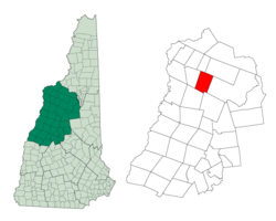 Location in Grafton County, New Hampshire | |
| Coordinates: 44°08′46″N 71°47′24″W | |
| Country | United States |
| State | New Hampshire |
| County | Grafton |
| Incorporated | 1876 |
| Government | |
| • Board of Selectmen | Zak Mei Bob Thibault Toni Woodruff |
| Area | |
| • Total | 31.2 sq mi (80.8 km2) |
| • Land | 31.2 sq mi (80.8 km2) |
| • Water | 0.0 sq mi (0.0 km2) 0.03% |
| Elevation | 1,167 ft (356 m) |
| Population (2010) | |
| • Total | 254 |
| • Density | 8.1/sq mi (3.1/km2) |
| Time zone | UTC-5 (Eastern) |
| • Summer (DST) | UTC-4 (Eastern) |
| Area code(s) | 603 |
| FIPS code | 33-22020 |
| GNIS feature ID | 0873586 |
| Website | www |
History
Formed from a part of Landaff known as East Landaff, Easton was incorporated in 1876.
Kinsman Mountain, the Kinsman Range, and Kinsman Notch are named for Nathaniel Kinsman, one of the original settlers.
Geography
According to the United States Census Bureau, the town has a total area of 31.2 square miles (81 km2), of which 0.03% is water. The highest point in Easton is 4,040 feet (1,230 m) above sea level, just west of the 4,293-foot (1,309 m) summit of the North Peak of Kinsman Mountain. The Wild Ammonoosuc River drains the southern part of town, while the Ham Branch of the Gale River drains the northern portion and passes the town's village. Easton lies fully within the Connecticut River watershed.[2]
Demographics
| Historical population | |||
|---|---|---|---|
| Census | Pop. | %± | |
| 1880 | 302 | — | |
| 1890 | 248 | −17.9% | |
| 1900 | 249 | 0.4% | |
| 1910 | 226 | −9.2% | |
| 1920 | 131 | −42.0% | |
| 1930 | 132 | 0.8% | |
| 1940 | 156 | 18.2% | |
| 1950 | 94 | −39.7% | |
| 1960 | 74 | −21.3% | |
| 1970 | 92 | 24.3% | |
| 1980 | 124 | 34.8% | |
| 1990 | 223 | 79.8% | |
| 2000 | 256 | 14.8% | |
| 2010 | 254 | −0.8% | |
| Est. 2017 | 262 | [3] | 3.1% |
| U.S. Decennial Census[4] | |||
At the 2000 census there were 256 people, 117 households, and 84 families living in the town. The population density was 8.2 people per square mile (3.2/km²). There were 187 housing units at an average density of 6.0 per square mile (2.3/km²). The racial makeup of the town was 96.48% White, 0.78% Native American, and 2.73% from two or more races. Hispanic or Latino of any race were 0.78%.[5]
Of the 117 households 23.9% had children under the age of 18 living with them, 58.1% were married couples living together, 10.3% had a female householder with no husband present, and 28.2% were non-families. 23.1% of households were one person and 6.8% were one person aged 65 or older. The average household size was 2.19 and the average family size was 2.54.
The age distribution was 19.1% under the age of 18, 3.9% from 18 to 24, 22.3% from 25 to 44, 35.2% from 45 to 64, and 19.5% 65 or older. The median age was 47 years. For every 100 females, there were 98.4 males. For every 100 females age 18 and over, there were 97.1 males.
The median household income was $49,167 and the median family income was $69,375. Males had a median income of $41,875 versus $23,750 for females. The per capita income for the town was $31,841. About 6.0% of families and 10.0% of the population were below the poverty line, including 30.6% of those under the age of eighteen and none of those sixty five or over.
Notable people
- Bode Miller, Olympic gold medalist skier; born in Easton[6]
References
- United States Census Bureau, American FactFinder, 2010 Census figures. Retrieved March 23, 2011.
- Foster, Debra H.; Batorfalvy, Tatianna N.; Medalie, Laura (1995). Water Use in New Hampshire: An Activities Guide for Teachers. U.S. Department of the Interior and U.S. Geological Survey.
- "Annual Estimates of the Resident Population: April 1, 2010 to July 1, 2017 (PEPANNRES): Minor Civil Divisions – New Hampshire". Archived from the original on February 13, 2020. Retrieved November 14, 2018.
- "Census of Population and Housing". Census.gov. Retrieved June 4, 2016.
- "U.S. Census website". United States Census Bureau. Retrieved 2008-01-31.
- Bode: Go Fast, Be Good, Have Fun by Miller, Bode (Oct 18, 2005)
External links
Places adjacent to Easton, New Hampshire | |
|---|---|
Municipalities and communities of Grafton County, New Hampshire, United States | ||
|---|---|---|
| City | 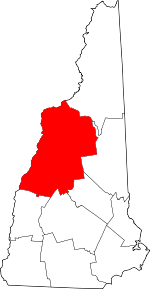 Map of New Hampshire highlighting Grafton County | |
| Towns |
| |
| Township | ||
| CDPs | ||
| Other villages | ||