Zhongzhou Reef
| Disputed island Other names: Zhōngzhōu jiāo (中洲礁), Bãi Bàn Than | |
|---|---|
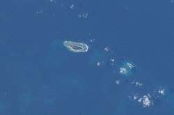 International Space Station photograph of Taiping Island (left) and Zhongzhou Reef (right) | |
| Geography | |
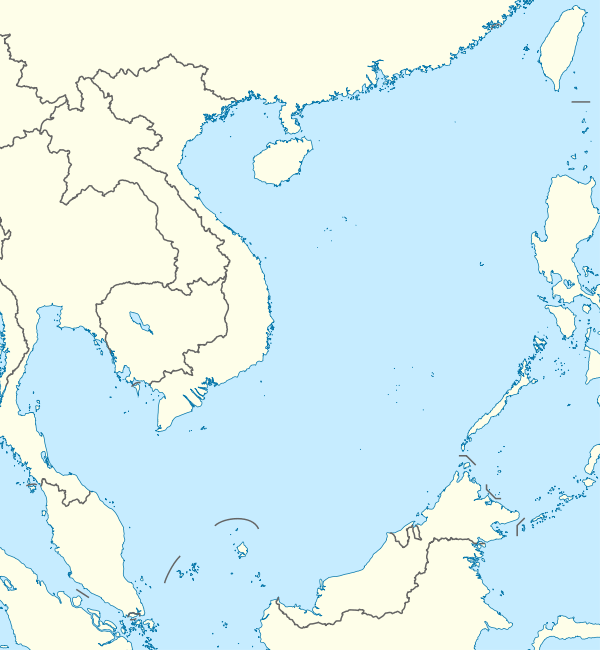 | |
| Location | South China Sea |
| Coordinates | 10°23′10″N 114°24′49″E / 10.38611°N 114.41361°ECoordinates: 10°23′10″N 114°24′49″E / 10.38611°N 114.41361°E |
| Archipelago | Spratly Islands |
| Length | 100 metres (330 ft) |
| Width | 100 metres (330 ft) |
| Administered by | |
| Republic of China (Taiwan) | |
| Municipality | Qijin, Kaohsiung |
| Claimed by | |
| People's Republic of China | |
| City | Sansha, Hainan |
| Philippines | |
| Municipality | Kalayaan, Palawan |
| Republic of China (Taiwan) | |
| Municipality | Qijin, Kaohsiung |
| Vietnam | |
| Province | Khánh Hòa |
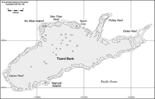
Zhongzhou Reef also known as Ban Than Reef and Centre Cay[1] (Chinese: 中洲礁; pinyin: Zhōngzhōu jiāo; Vietnamese: Bãi Bàn Than) is a small coral reef on the north edge of the Tizard Bank in the Spratly Islands, South China Sea. It lies 4.6 km (2.9 mi) east of ROC-occupied Taiping Island (Itu Aba), 7.2 km (4.5 mi) west of Vietnamese-occupied Sand Cay,[2] and has an exposed area of approximately 0.2 hectares (0.49 acres) during high tide, and 0.6 hectares (1.5 acres) during low tide. It consists of an accumulation of seashells, sand, coral reefs and debris which forms a circular coral reef plate, surrounding the reef under the water, with a diameter of approximately 1.3 km (0.8 mi).
The reef is currently controlled by Taiwan (ROC), under the administration of Qijin District, Kaohsiung. It is also claimed by the PRC, Vietnam and the Philippines.
As many as 51 species of migratory birds inhabit the reef for short stays. The surrounding waters contain a rich marine ecosystem with plentiful staghorn coral. Shellfish species such as Harpago chiragra and Cassis cornuta can be found on the reef, and the surrounding waters contain various common tropical fish and coral reef fish. The reef geology is not suitable for plant growth.
The reef has no groundwater source. Though currently uninhabited by humans, the ROC Coast Guard sends regular patrols via M8 speedboats from nearby Taiping Island. These patrols circle the reef, in addition to landing, making inspections and carrying out ecological surveys.
Recent history
The reef was included within the area claimed by Nationalist China in 1935, and this claim was reiterated in a map published in 1947.[4]
Scientists from Taiwan conducted ecological research on green turtles living on the reef from 2002 to 2003.
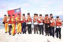
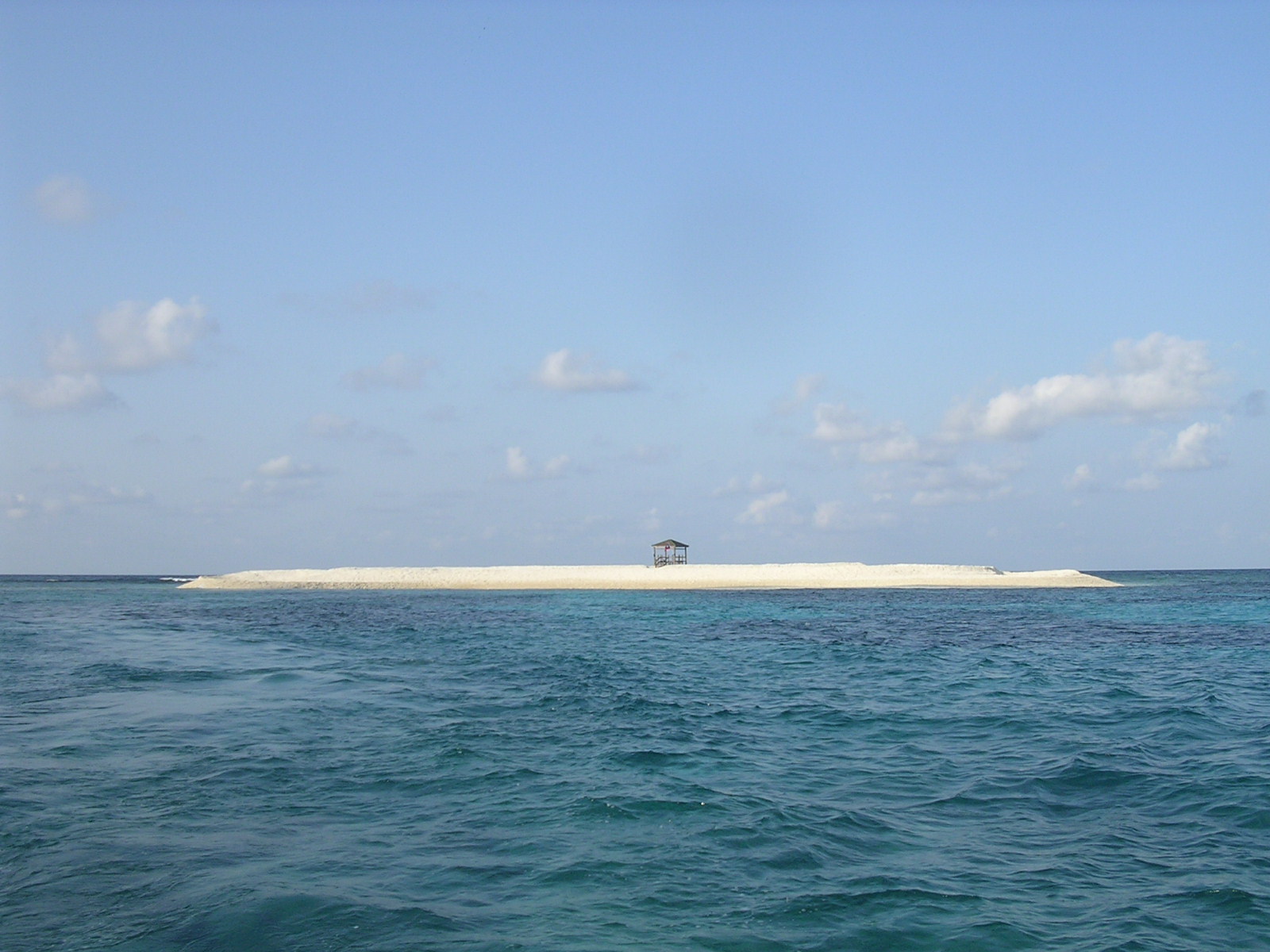
On 16 August 2003, the Taiwanese Minister of the Interior Yu Cheng-hsien visited the reef, travelling via M8 speedboat, and planted a ROC flag in a declaration of sovereignty. On 28 March 2004, the ROC Coast Guard Administration completed the construction of wooden observation kiosks on the reef. In September 2010, the ROC Environmental Protection Agency conducted environmental quality sampling intending on monitoring reef marine water quality.[5]
On 22 March 2012, a routine patrol of the ROC Coast Guard came into contact with Vietnamese patrol boats near the reef; following the incident, ROC legislators Lin Yu-fang, Chen Zhenxiang and Chen Zhankai visited the reef by M8 speedboats.[6]
The ROC government has revealed plans to construct permanent marking facilities and a lighthouse to facilitate vessel navigation.
See also
References
- ↑ Itu Aba Island (Taiping Island), Spratly Islands, globalsecurity.org
- ↑ measured at HERE Satellite Image Tiles
- ↑ Taipei Times, 01 November 2015, p. 1: ROC does not ‘recognize’ UN tribunal
- ↑ "China: Maritime Claims in the South China Sea" (PDF). Limits in the Seas No. 143. United States Department of State, Bureau of Oceans and International Environmental and Scientific Affairs, Office of Ocean and Polar Affairs. 5 December 2014.
Scholarly accounts indicate that the 1947 map, titled 'Map of South China Sea Islands', originated from an earlier one titled 'Map of Chinese Islands in the South China Sea' (Zhongguo nanhai daoyu tu) published by the Republic of China's Land and Water Maps Inspection Committee in 1935, and that Chinese maps produced after the establishment of the People's Republic of China in 1949 'appear to follow the old maps'.
- ↑ 淨灘活動(中華民國行政院海巡署), ROC Coast Guard Administration, 2010.
- ↑ "台"国安内政"高官南沙太平岛升旗宣示主权(图)_台海_环球网". taiwan.huanqiu.com (in Chinese). 环球网.
External links
- Small photo of the reef, also showing a wooden platform.
.svg.png)
| Related articles | |||||||||||
|---|---|---|---|---|---|---|---|---|---|---|---|
| Confrontations | |||||||||||
| Regions | |||||||||||
| Occupied features | |||||||||||
| Unoccupied features | |||||||||||
| Pratas Islands | |||||||||||||||||
|---|---|---|---|---|---|---|---|---|---|---|---|---|---|---|---|---|---|
| Paracel Islands |
| ||||||||||||||||
| NorthEast SCS | |||||||||||||||||
| Spratly Islands |
| ||||||||||||||||
| Southern SCS | |||||||||||||||||
| Tudjuh Archipelago | |||||||||||||||||
| History | |||||||||||||||||
| Transport |
| ||||||||||||||||
| |||||||||||||||||