Half Moon Shoal
| Disputed island Native name: Hasa Hasa Shoal Banyue Jiao 半月礁 | |
|---|---|
| Geography | |
 | |
| Location | South China Sea |
| Coordinates | 8°52′N 116°16′E / 8.867°N 116.267°ECoordinates: 8°52′N 116°16′E / 8.867°N 116.267°E |
| Archipelago | Spratly Islands |
| Administered by | |
| Philippines | |
| Municipality | Kalayaan, Palawan |
| Claimed by | |
| People's Republic of China | |
| Philippines | |
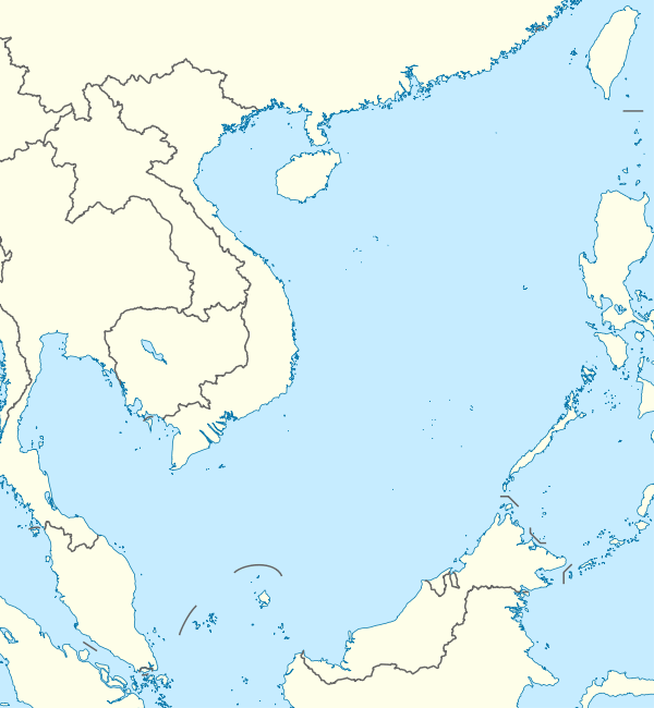
Half Moon Shoal (Chinese: 半月礁; pinyin: Banyue Jiao ; Tagalog: Hasa Hasa Shoal) is a shoal at the eastern edge of the Spratly Islands of the South China Sea. China and the Philippines have competing claims over the shoal. It is located close to Northeast Investigator Shoal and 100 km from Palawan, Philippines.[1]
Notable incidents
The Chinese frigate Dongguan ran aground on the shoal on 11 July 2012.[2][3]
On 6 May 2014, Philippine police seized 11 Chinese fishermen allegedly poaching sea turtles on board the fishing boat, Qiongqionghai, near the Half Moon Shoal.[4]
On 29 August 2018, BRP Gregorio del Pillar ran aground at the shoal in the West Philippine Sea off Palawan.[5]
References
- ↑ Admiralty Sailing Directions - South China Sea. Taunton, UK: UKHO (United Kingdom Hydrographic Office). 1 July 2013.
|access-date=requires|url=(help) - ↑ Austin Ramzy (2012-07-24). "China's Newest City Raises Threat of Conflict in South China Sea". time.com. Retrieved 2012-07-25.
- ↑ Jaime Laude (2012-07-14). "China ship runs aground near Phl". The Philippine Star. Retrieved 2012-07-25.
- ↑ Mogato, Manuel; Blanchard, Ben (7 May 2014). "Tensions surge in S. China Sea as Philippines seizes Chinese boat". Reuters. Retrieved 7 May 2014.
- ↑ "PHL Navy frigate ran aground in West Philippine Sea". GMA News. August 31, 2018. Retrieved August 31, 2018.
| Related articles | |||||||||||
|---|---|---|---|---|---|---|---|---|---|---|---|
| Confrontations | |||||||||||
| Regions | |||||||||||
| Occupied features | |||||||||||
| Unoccupied features | |||||||||||
| Pratas Islands | |||||||||||||||||
|---|---|---|---|---|---|---|---|---|---|---|---|---|---|---|---|---|---|
| Paracel Islands |
| ||||||||||||||||
| NorthEast SCS | |||||||||||||||||
| Spratly Islands |
| ||||||||||||||||
| Southern SCS | |||||||||||||||||
| Tudjuh Archipelago | |||||||||||||||||
| History | |||||||||||||||||
| Transport |
| ||||||||||||||||
| |||||||||||||||||
This article is issued from
Wikipedia.
The text is licensed under Creative Commons - Attribution - Sharealike.
Additional terms may apply for the media files.