Yatta, Hebron
| Yatta | ||
|---|---|---|
| Other transcription(s) | ||
| • Arabic | يطّا | |
| • Also spelled | Yattah (official) | |
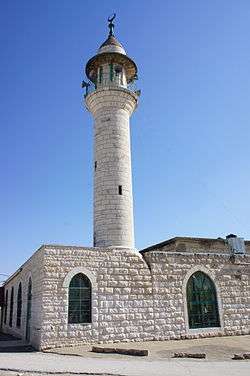 Mosque in Yatta | ||
| ||
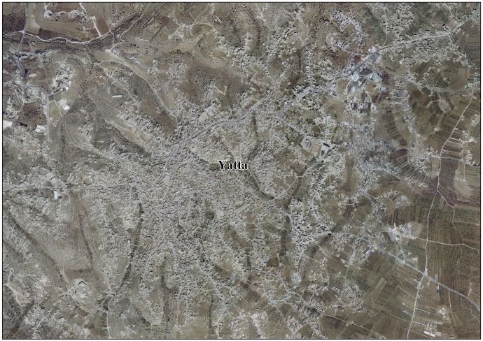
 Yatta Location of Yatta within Palestine | ||
| Coordinates: 31°26′52″N 35°05′24″E / 31.44778°N 35.09000°ECoordinates: 31°26′52″N 35°05′24″E / 31.44778°N 35.09000°E | ||
| Palestine grid | 163/094 | |
| Governorate | Hebron | |
| Government | ||
| • Type | City | |
| • Head of Municipality | Khalil Younis | |
| Area | ||
| • Jurisdiction | 133,080 dunams (133.0 km2 or 51.4 sq mi) | |
| Population (2016) | ||
| • Jurisdiction | 64,277 | |
| Name meaning | from Juttah[1] | |
| Website | www.yatta-munc.org | |
Yatta or Yattah (Arabic: يطّا) is a Palestinian city located in the Hebron Governorate in the West Bank approximately 8 km south of the city of Hebron in the West Bank.[2] According to the Palestinian Central Bureau of Statistics, it had a population of 64,277 in 2016.[3]
History
Located on a large, ancient hilltop,[4] Yatta has been identified with the site of the Biblical town of Juttah.[5] In 1931, a Jewish burial complex dating to the 2nd century CE was found in the town .[6] Eusebius (4th century) wrote that Yatta was "a very large village of Jews eighteen miles south of Beit Guvrin."[6][7] Some Palestinian residents of the town believe they originate from the Jewish kingdom of Khaybar in the south-western Arabian peninsula and are descended from the Jewish tribes of Arabia.[8] Research by Yitzhak Ben Zvi in 1928 also suggested that three out of the six extended families in Yatta belonged to the "Mehamra" group and possibly descended from an Jewish Arab tribe.[6]
Ottoman era
Yatta, like the rest of Palestine, was incorporated into the Ottoman Empire in 1517, and in the census of 1596 the village appeared to be in the Nahiya of Halil of the Liwa of Quds. It had a population of 127 families, all Muslim, and paid taxes on wheat, barley, olives, goats and bee-hives; a total of 9,872 akçe. 5/6 of the revenue went to a Waqf.[9]
In 1838, Edward Robinson and noted Yutta as a Muslim village, located southwest of el-Khulil.[10] He further noted that it had the "appearance of a large modern Mohammedan town, on low eminence, with trees around."[11]
In July 1863 Victor Guérin visited Youttha. He described it as a village of 2000 inhabitants, but at least half were living in tents, scattered in the all over, partly to finish the harvest, partly to avoid the military recruiters active in the area.[12] An Ottoman village list from about 1870 found that Jatta had a population of 226, in 66 houses, though the population count included men, only.[13][14]
In 1883, the Palestine Exploration Fund's Survey of Western Palestine described Yatta as being a "large village standing high on a ridge. It is largely built of stone. The water supply is from cisterns. On the south there are rock-cut tombs, and rock wine-presses are found all round the village. The neighborhood is extremely stony; south of the village are scattered olives, which are conspicuous objects; on the west, a little lower under a cliff, is a small olive yard in which the camp of the Survey party was pitched in 1874; to the south-west of camp were a few figs. The inhabitants are very rich in flocks; the village owned, it was said, 17,000 sheep, beside goats, cows, camels, horses, and donkeys. The Sheikh alone had 250 sheep."[15] South of the village are several tombs; one has a shallow semicircular arch cut above a small square entrance. West of the village and of el Muturrif is a very fine rock-cut wine-press. A second occurs north of the village."[16]
British Mandate era
In the 1922 census of Palestine conducted by the British Mandate authorities, Yatta had a population 3,179 inhabitants, all Muslims.[17] increasing in the 1931 census to 4,034, in 767 inhabited houses, still all Muslims.[18]
In the 1945 statistics the population of Yatta was 5,260, all Muslims,[19] and the land area was 174,172 dunams according to an official land and population survey.[20] 3,254 dunams were plantations and irrigable land, 67,498 used for cereals,[21] while 216 dunams were built-up (urban) land.[22]
Jordanian era
In the wake of the 1948 War, and after the 1949 Armistice Agreements, Yatta came under Jordanian rule.
The Jordanian census of 1961 found 6,326 inhabitants in Yatta.[23]
Post-1967
Since the 1967 war, Yatta has been under Israeli occupation, along with the rest of the West Bank. As of September 1995, Yatta and its immediate region, now known as Area A, have come under the administration of the Palestinian Authority (PA).[24]
The population in the 1967 census conducted by the Israeli authorities was 7,281.[25]
At least seven Palestinians were killed in Yatta during the Second Intifada in different incidents from 2002-04.[26] On March 8, 2012 Israeli soldiers shot dead 20-year-old Zakariya Abu Eram and injured two others during an raid in the town with the intent of arresting Abu Eram's uncle [27] Khaled Mahamra, a Hamas member, who was sentenced to life in prison and released as part of the exchange deal to free captive IDF soldier Gilad Schalit.[28] The Israeli's claimed they fired at the men only after one of them stabbed a soldier during the arrest attempt.[27]
In June 2016, two assailants from Yatta were apprehended after firing upon Israelis dining in a Tel-Aviv café, after which they were charged with killing four people and injuring 16 others.[29]
Culture
A Jillayeh dress from Yatta from around 1910 is part of the Museum of International Folk Art (MOIFA) at Museum of New Mexico at Santa Fe.[30]
See also
References
- ↑ Palmer, 1881, p. 415
- ↑ Columbia Encyclopedia: Juttah
- ↑ 'Localities in Hebron Governorate by Type of Locality and Population Estimates, 2007-2016 ,' Palestinian Central Bureau of Statistics, 2016.
- ↑ Dauphin, 1998, p. 966
- ↑ Robinson and Smith, 1841, vol 2, p. 190
- 1 2 3 Ḥevrah la-haganat ha-ṭevaʻ (1990), Israel - land and nature, Society for the Protection of Nature in Israel, p. 83, retrieved 6 June 2011
- ↑ Eusebius, Onomasticon - The Place Names of Divine Scripture, (ed.) R. Steven Notley & Ze'ev Safrai, Brill: Leiden 2005, p. 104 (§545)
- ↑ A tragic misunderstanding, The Sunday Times, January 13, 2009.
- ↑ Hütteroth and Abdulfattah, 1977, p. 123
- ↑ Robinson and Smith, 1841, vol 3, Appendix 2, p. 116
- ↑ Robinson and Smith, 1841, vol 2, p. 628
- ↑ Guérin, 1869, pp. 205-6
- ↑ Socin, 1879, p. 155 It was noted in the Hebron district
- ↑ Hartmann, 1883, p. 142, noted 166 houses
- ↑ Conder and Kitchener, 1883, SWP III, p. 310
- ↑ Conder and Kitchener, 1883, SWP III, p. 380.
- ↑ Barron, 1923, Table V, Sub-district of Hebron, p. 10
- ↑ Mills, 1932, p. 34
- ↑ Government of Palestine, Department of Statistics, 1945, p. 23
- ↑ Government of Palestine, Department of Statistics. Village Statistics, April, 1945. Quoted in Hadawi, 1970, p. 50
- ↑ Government of Palestine, Department of Statistics. Village Statistics, April, 1945. Quoted in Hadawi, 1970, p. 94
- ↑ Government of Palestine, Department of Statistics. Village Statistics, April, 1945. Quoted in Hadawi, 1970, p. 144
- ↑ Government of Jordan, 1964, p. 13
- ↑ 1995 Oslo Interim Agreement. Text of the Accord
- ↑ Perlmann, Joel (November 2011 – February 2012). "The 1967 Census of the West Bank and Gaza Strip: A Digitized Version" (PDF). Levy Economics Institute. Retrieved 24 June 2016.
- ↑ Palestinians killed by Israeli security forces in the Occupied Territories B'Tselem
- 1 2 Palestinian shot dead in West Bank. Al Jazeera English. 2012-03-08.
- ↑ Yatta: A heritage of terrorism. Israel Hayom. 2016-06-17.
- ↑ Paton, Callum (June 9, 2016). "Tel Aviv shooting: Israel pulls travel permits for 83,000 Palestinians in wake of cafe slayings". International Business Times. Retrieved June 10, 2016.
- ↑ Stillman, 1979, pp. 59 - 60
Bibliography
- Barron, J.B., ed. (1923). Palestine: Report and General Abstracts of the Census of 1922. Government of Palestine.
- Conder, C.R.; Kitchener, H.H. (1883). The Survey of Western Palestine: Memoirs of the Topography, Orography, Hydrography, and Archaeology. 3. London: Committee of the Palestine Exploration Fund.
- Dauphin, Claudine (1998). La Palestine byzantine, Peuplement et Populations. BAR International Series 726 (in French). III : Catalogue. Oxford: Archeopress. ISBN 0-860549-05-4.
- Government of Jordan, Department of Statistics (1964). First Census of Population and Housing. Volume I: Final Tables; General Characteristics of the Population (PDF).
- Government of Palestine, Department of Statistics (1945). Village Statistics, April, 1945.
- Guérin, V. (1869). Description Géographique Historique et Archéologique de la Palestine (in French). 1: Judee, pt. 3. Paris: L'Imprimerie Nationale.
- Hadawi, S. (1970). "Village Statistics of 1945: A Classification of Land and Area ownership in Palestine". Palestine Liberation Organization Research Center.
- Hartmann, M. (1883). "Die Ortschaftenliste des Liwa Jerusalem in dem türkischen Staatskalender für Syrien auf das Jahr 1288 der Flucht (1871)". Zeitschrift des Deutschen Palästina-Vereins. 6: 102–149.
- Hütteroth, Wolf-Dieter; Abdulfattah, Kamal (1977). Historical Geography of Palestine, Transjordan and Southern Syria in the Late 16th Century. Erlanger Geographische Arbeiten, Sonderband 5. Erlangen, Germany: Vorstand der Fränkischen Geographischen Gesellschaft. ISBN 3-920405-41-2.
- Mills, E., ed. (1932). Census of Palestine 1931. Population of Villages, Towns and Administrative Areas. Jerusalem: Government of Palestine.
- Palmer, E.H. (1881). The Survey of Western Palestine: Arabic and English Name Lists Collected During the Survey by Lieutenants Conder and Kitchener, R. E. Transliterated and Explained by E.H. Palmer. Committee of the Palestine Exploration Fund.
- Robinson, E.; Smith, E. (1841). Biblical Researches in Palestine, Mount Sinai and Arabia Petraea: A Journal of Travels in the year 1838. 2. Boston: Crocker & Brewster. (p. 193)
- Robinson, E.; Smith, E. (1841). Biblical Researches in Palestine, Mount Sinai and Arabia Petraea: A Journal of Travels in the year 1838. 3. Boston: Crocker & Brewster.
- Socin, A. (1879). "Alphabetisches Verzeichniss von Ortschaften des Paschalik Jerusalem". Zeitschrift des Deutschen Palästina-Vereins. 2: 135–163.
- Stillman, Yedida Kalfon (1979). Palestinian costume and jewelry. exhibition catalog of the Museum of International Folk Art (MOIFA) at Santa Fe. Albuquerque: University of New Mexico Press. ISBN 0-8263-0490-7.
External links
- yatta-munc.org
- Welcome To The City of Yatta
- Yatta, Welcome to Palestine
- Survey of Western Palestine, Map 21: IAA, Wikimedia commons
- Yatta Town (Fact Sheet), Applied Research Institute–Jerusalem (ARIJ)
- Yatta Town Profile, ARIJ
- Yatta Town aerial photo, ARIJ
- The priorities and needs for development in Yatta city based on the community and local authorities’ assessment, ARIJ
| Cities |
|  |
|---|---|---|
| Towns |
| |
| Villages |
| |
| Refugee camps | ||